
South Australia expected to see up to 1500mm of rain in some areas
IT’S now pouring in the north of South Australia as what is tipped to be the heaviest rainfall event in 30 years begins in earnest.
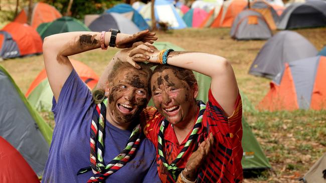
WITH some of the most ferocious bushfires since Ash Wednesday and then the potential for the heaviest rainfall event in 30 years, mother nature has taken aim at South Australia.
While tired Country Fire Service and State Emergency Service crews start to recover from the week-long Sampson Flat bushfire that has ravaged the Adelaide Hills, they prepare to cope with the heaviest rainfall event in the state since January, 1984.
With potentially 'once in 30 year' rain predicted across parts of #SA, follow @SA_SES, @PaddyPlatypus & bookmark: http://t.co/hmJaSlO0fP
— SA Metropolitan Fire (@SA_MFS) January 8, 2015
The Bureau has UPDATED the SEVERE WEATHER WARNING for HEAVY RAINFALL at 10pm info at http://t.co/FRzPDih6sP pic.twitter.com/b4mn2gpk8l
— Paddy Platypus (@PaddyPlatypus) January 8, 2015
The Bureau of Meteorology has predicted rainfall across the entire state over the next three days, with torrential rain creating a serious risk of flooding and damaging winds, with gusts in excess of 90km/h, expected to batter the state.
The northern pastoral districts and Flinders Ranges will be the areas hardest hit. It’s already rain hard in the north of the state.
Marree has had 44mm over the past 24 hours, most of that falling early this morning.
Elsewhere, Whyalla has had 39mm, Mt Crawford 13.8mm, Naracoorte 13.2mm, Snowtown 12.8mm and Woomera 10.6mm.
Adelaide has largely escaped so far with just 2.8mm.
Bureau of Meteorology SA regional director John Nairn said up to 150mm of rain would fall across parts of the state between up until Sunday, with localised higher falls of up to 200mm possible.
“In summer, there is a warmer atmosphere, which is when we tend to see heavy rainfall events,” he said.
“January 1984 is the last time we saw an event of this nature.
“There will be thunderstorms across the state over the next few days … none of the state will be missing out on rain. How much falls depends on the area.”
A Flood Watch has been issued for the Pastoral, Flinders, Mid North, Riverland, Murraylands and Upper South East districts.
But the rain could also lead to significant stream rises and possible flooding in the Mount Lofty Ranges, as Adelaide expects 25-50mm of rain over today, tomorrow and Sunday.
A tropical low over the northwest of the state, combined with an upper trough developing over western parts of South Australia, is generating the rain band.
The SES has made Port Pirie a base for its operations and yesterday stockpiled 15,000 sandbags in preparation for the north’s heavy rain.
It also sent a swift-water rescue crew to Port Pirie in case anyone is caught in flooded areas or stormwater drains, canals, rivers and creeks.
SES deputy chief officer Dermot Barry said there was a risk to travellers and campers across the state.
“We encourage people not to drive through floodwaters and monitor the weather forecasts,” he said.
“Any campers in areas identified for flooding, should think about leaving now rather than leaving it too late.
“And please don’t let children play near floodwaters because it is very dangerous.
“Although our volunteers are tired, it’s the nature of the job and we will be supported in emergency efforts by CFS and MFS.”
Coober Pedy resident Josephine Brennan-Kuss has started filling sandbags in preparation for the expected deluge that will hit the mining town.
“We are currently packing some sandbags ourselves as the council have run out; they will have more available later today,” she said.
“We will be staking them to the side until we need to put them in place across the top of the driveway.”
Hayley Nunn, manager of the Pink Roadhouse at Oodnadatta, said the town had been in a drought for four years in March.
“We don’t believe in rain until it’s on the ground now because we think it’s forgotten how to rain here,” the 28-year-old said.
Further roads opened for local residents as of 6pm 8 January. Visit this this page for more information. https://t.co/vLFVcb8Ygb
— SA Police News (@SAPoliceNews) January 8, 2015
“The rain for the region would be fantastic. The pastoralists need it desperately.
“And it will bring tourism to us during the busy season, especially if the lakes get water.”
Marree Hotel manager Andy Rawle, 30, said the business had food to last three to four weeks should the roads flood.
“The biggest problem from us in the hotel is we’re not going to see any guest if the roads shut,” he said.
CFS assistant chief officer Malim Watts said while the fire in the Hills had been completely contained and the rain was welcome relief, volunteers would remain in the field.
“There are still pockets of concern across the fireground … we still have to turn over the ground and identify hot spots,” he said.
“There is also a risk of falling trees … it’s certainly a case of extreme weather.
“There is 240km of fire edge to look after and it is a big footprint to keep an eye on.”
Primary Producers SA chairman Rob Kerin said the pastoralists in the north of the state will welcome the rain.
“Crops are 98 per cent off at this time of year, so they will not be affected and it will be good for livestock feed,” Mr Kerin said.
“It’s neutral rain at this time of year.”
Grapegrowers have been warned of the threat of downy mildew, but Wine Grape Council of South Australia chairman Simon Berry said most crops, which are close to harvest, would not be affected.
“At this time of the year the berries are largely resistant to downy mildew, unless there is fresh tips or young vines which could be infected,” he said.
“For the rest of the crop, the risk is extremely low.
“In the most part, apart from people very close to harvest who might get some splitting, the rain will be a good thing.”
State Emergency Service deputy chief officer Dermot Barry said there was a risk to travellers and campers across the state.
“We encourage people not to drive through flood waters and monitor the weather forecasts,” he said.
The SES has responded to more than 100 call-outs since 2pm on Wednesday.
Meantime, more than 6000 homes remain without power, as wind and rain continue to ravage the state.
We're keeping resources at capacity for storm outage restoration tomorrow, all non critical planned work cancelled for Friday 9 Jan
— SA Power Networks (@SAPowerNetworks) January 8, 2015
On Thursday afternoon, SA Power Networks reported around 3600 homes were without power because of storm damage.
By 8.50pm, this number had reduced to about 550 properties. Power will be restored by late Thursday to many but 152 properties in Glencoe and Glencoe West are expected to have power restored by 2.15a; another 95 properties at Alma, Giles Corner and Salter Springs should have supply back by 7.30am; and another 175 at Dalkey, Erith, Hoskin Corner, Langhorne Creek and Mulgundawa will regain power by about 8.15am.
Work will continue through the night to restore power to these homes, but SA Power Networks has warned that this could take a while.
“Apart from one safety-related job, planned work has been cancelled and we are mobilising additional crews to worst-affected areas,” the company announced on its Facebook page.
“However, given the number and spread of outages and ongoing thunderstorm activity, customers please be prepared for extended outages.”
Late on Wednesday night, more than 14,000 homes were without power.
Click here for outage details.
Gorge Road will remain closed for several days due to the risk of falling trees and rock slides in the area https://t.co/yDifSx69B1
— SA Police News (@SAPoliceNews) January 7, 2015
SA Police has advised that Gorge Rd will remain closed for several days to due to the risk of falling trees and rock slides in the area.
Fonterra steps up farmgate figure for New Zealand suppliers
New Zealand suppliers of Fonterra have received some welcome news from the Auckland-based processor — but it’s still the farmgate status quo for Australian farmers.

Top tales of survival in the bush
The miraculous discovery of missing man Robert Weber is just the latest tale of survival in the bush in Australia. These are some of the most famous and heartwarming from our history.