
‘La Nina fuelled’ drenching expected with two-thirds of Australia to see rain
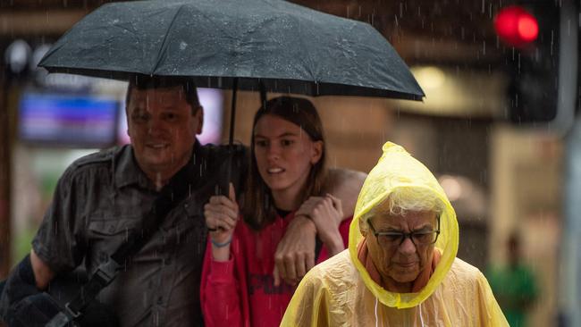
The coming days are set to cement November rain records as the just declared La Nina brings downpours to two-thirds of Australia amid fresh flood fears.

Environment
Don't miss out on the headlines from Environment. Followed categories will be added to My News.
La Nina may only have been officially declared yesterday but already its effects are being felt with a “La Nina fuelled” drenching set to sweep across much of Australia in the coming days.
As a prelude to the main event, parts of south east Queensland saw flash flooding on Tuesday with almost 140mm of rain falling in 24 hours across Brisbane suburbs.
And yet more rain is coming right behind that with Brisbane, Sydney and Canberra set to be swamped and downfalls are possible just about everywhere bar Western Australia and southern parts of the Northern Territory.
It’s bringing humid, muggy conditions and the very real risk of already swollen rivers succumbing to floods.
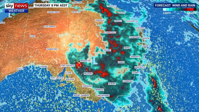
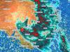
“It’s a La Nina fuelled major rain event this week with two-thirds of Australia to see rain during the next few days with heavy falls and thunderstorms,” said Sky News Weather senior meteorologist Tom Saunders.
On Tuesday, the Bureau of Meteorology moved its climate outlook to La Nina. The Pacific-based weather system usually dumps more rain on central and eastern Australia also bringing down temperatures.
In some places it was likely to be the wettest November on record, Mr Saunders added, particularly as more rain was forecast.
“We’ve got moisture coming in from the northwest and northeast feeding into an area of low pressure which will move east across the country during the next few days.”
Eastern states to be hardest hit
Currently that rain band is travelling in a line across the Northern Territory and South Australia.
Darwin will be partly cloudy today but showers can be expected for the next seven days including up to 10mm on a stormy Thursday. Hot and humid in the Top End with highs of 34C and lows in the mdi twenties.
Up to 10mm is likely to fall on Adelaide today but it should be dry heading into the weekend after the system has passed. Highs of 24C on Wednesday dropping to 20C on Friday before rising once more. It could hit 30C on Tuesday.
However, further north in the state the rain will be heavier and persist for longer.
It’s the eastern states, however, that will bear the full brunt in the coming days.
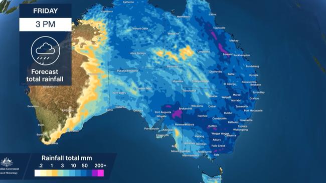
Brisbane could see another 100mm of rain between now and Sunday, maybe a touch more, as the low pressure systems lingers. Storms are a possibility on Friday with 15-35mm coming down and the mercury peaking at 27C.
The entire coast north of Brisbane will be in much the same situation with Townsville looking at a possible 100mm too. Inland areas could experience heavy falls with Charleville forecast to receive 20 to 40mm on Thursday.
Major flood warnings are in place for the lower Macintyre and Weir rivers.
Just about everywhere in NSW to see downpours
A sprinkling in Sydney on Wednesday is the entree to heavier falls on Thursday with 8-15mm coming down and then as much as 35mm on Friday with showers continuing on the weekend. Maximums in the Harbour City of 26C but it will fall to 20C on Saturday. On Friday, it might not dip below 20C even at dawn.
Just like Queensland, the NSW coast is set to be sodden with heavy falls and storms from Tweed Heads to Eden with the upper end of forecasts putting between 75mm and 100mm in the gauge.
Indeed, few parts of the state will escape a drenching particularly from Wednesday to Friday. A flood watch is in place for scores of inland NSW rivers and well as the Hunter.
Storms in Canberra on Thursday when 20-35mm is forecast and then 25-45mm on Friday before easing into scattered showers for the weekend. A high of 23C on Thursday and then down to 16C on Saturday with minimums dropping from 14C tomorrow morning to 8C early on Sunday.
Not as wet in Melbourne but you’d hardly call it dry. Up to 8mm today followed by 3-15mm on Thursday and then some more showers on Friday. But the weekend should be clear of the inclement weather.
A high of 25C on Wednesday will fall to 19C on Thursday which will set the trend for the next few days. Minimums should be in the low teens.
Inland and particularly in the east of Victoria those falls will be much heavier. Bairnsdale is forecast to have 55mm and 100mm come down by Saturday.
Flood watches are in place for Gippsland and parts of central and north eastern Victoria.
A few showers in Hobart but nothing to be too concerned about. A high of 23C today and then down to a mild 14C on Friday. Lows might also dip below 10C by the weekend.
Dry, sunny and hot in Perth with highs in the thirties to end the week and a toasty 35C on Saturday beckoning a glorious weekend of Spring Beach weather.
Originally published as ‘La Nina fuelled’ drenching expected with two-thirds of Australia to see rain

Brutal winter blast sparks warnings
A savage winter blast is sweeping across the country, bringing gale-force winds, icy temperatures and widespread weather alerts.

States told to brace for weekend cold front
Windy weather has finally subsided across Australia’s southern regions, but a cold front is bearing down on these states for the weekend.