
Evacuations imminent as low becomes Tropical Cyclone Ilsa
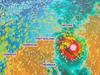
A tropical low has become Tropical Cyclone Ilsa, moving slowly off Australia’s northwest coast, before it’s expected to smash the mainland later this week.
WA News
Don't miss out on the headlines from WA News. Followed categories will be added to My News.
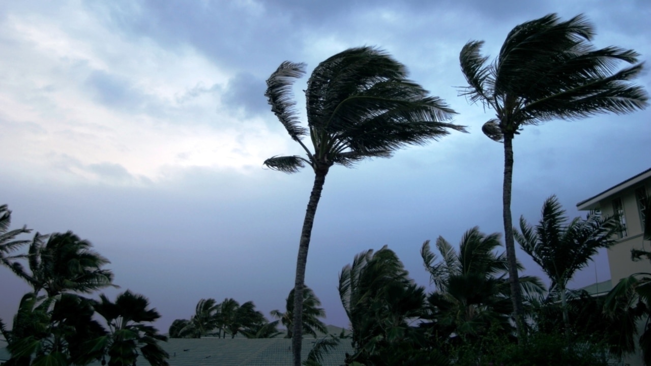
Communities in the potential path of what is now a category 1 tropical cyclone are evacuating as the storm heads closer to land.
A tropical low, moving off Australia’s northwest coast, intensified to become Tropical Cyclone Ilsa on Tuesday afternoon.
An update from the Bureau of Meteorology (BOM) and the state’s Department of Fire and Emergency Services (DFES) earlier on Tuesday afternoon confirmed the mining town of Telfer, about 250km south of where Ilsa is expected to cross the coast later this week, will evacuate.
There’s also concern for caravan parks operating at Eighty Mile Beach, between the towns of Broome and Port Headland.
“The operators of the caravan parks are clear on what their plan is,” said DFES Commissioner Darren Klemm, “once we hit yellow [alert], or even before, everyone's got to be out of there.”
Mr Klemm also urged anyone in the area with caravans to leave.
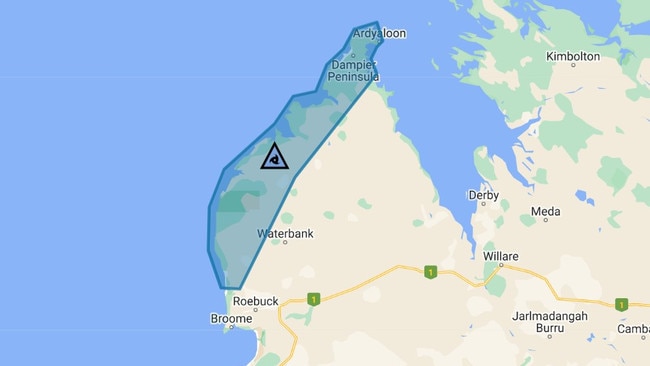
The system had been moving off the coast of Western Australia’s northern Kimberley over the weekend, with DFES issuing a cyclone blue alert for coastal communities including Cape Leveque and the Dampier Peninsula.
This means there’s no immediate danger, but those in affected areas should prepare for a cyclone.
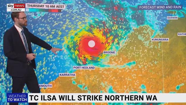
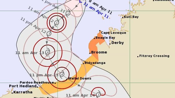
BOM’s Hazard Preparedness and Response North & West Manager Todd Smith said their latest predictions have the system rapidly intensifying to category four by the time it crosses the coast somewhere around Eighty Mile Beach.
“Tomorrow we're expecting it to take a turn towards the south, and then Thursday the southeast,” said Mr Smith.
“So any areas where that system does cross the coast are going to experience some very destructive winds … in excess of 200kmph … they’re most likely to be close to the centre, but even extending out some hundreds of kilometres from the cyclone centre you’ll get those damaging winds gusts that are up to that 100kmph wind range.
“Coastal areas are not a good place to be during a cyclone as it’s making landfall, and as it crosses the coast it’ll produce some heavy rainfall that could lead to localised flash flooding.
“The damaging winds and heavy rainfall that could lead to flooding could extend many hundreds of kilometres inland … that‘s as we go into Friday and over the weekend.
“As the system does track over land, we're expecting a lot of rain to be dumped into the Degrey River Catchment — upwards of 200mm a day.
“We’re expecting some really strong river rises in the De Grey River as a response … we've currently got a flood watch for that part of the state, we’ll transition into warnings once we start to have some confidence around the rainfall totals.”
As of 11am Tuesday, the low is tracking 410 kilometres north of Broome, heading southwest at 13kmph.
Sky Weather meteorologist Rob Sharpe described it as a “quickfire run up the category scale” with predictions the system could reach Category 3 by Thursday.
“It’s in between [Broome and Port Headland] that we’re going to see the wild conditions, with the target likely to be Eighty Mile Beach,” said Mr Sharpe.
“And therefore the Eighty Mile Beach Caravan Park is going to see the worst impacts from this system as it makes landfall.”
Commissioner Klemm said a task force of 26 personnel in six State Emergency Service (SES) vehicles is expected to reach the area on Wednesday.
“Another 10 SES volunteers will arrive Port Headland tomorrow to assist that task force,” said Commissioner Klemm on Tuesday.
“We've sent additional aircraft to Karratha, and they’ll arrive tomorrow … one of those has been retrofitted to provide medical evacuations, should that be required.
“We do implore people to ensure they‘re adequately prepared; now‘s the time to be tidying up around your property.
“If you‘re planning to go out on the water in the northwest, that’s not something we’d be encouraging anyone to do.”
The Commissioner continues to urge locals in the affected warning areas to tie down loose outdoor items, and to make sure emergency kits are up-to-date.
Up-to-date information from DFES and BOM can be found here.

Originally published as Evacuations imminent as low becomes Tropical Cyclone Ilsa

Sam Kerr’s nan ‘revived herself’, court
A driver who allegedly hit Sam Kerr’s nan with a car as she was getting off a bus told a court he “killed the lady, but she revived herself.”
Extreme heatwave warning for Aussies
A very hot air mass is sloshing around the country, causing temperatures to reach the mid-to-high 40s over several states.