
Tasmanian weather: Flooding subsiding in Huonville, warnings still active
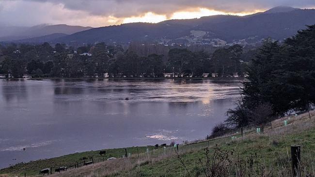
Floodwaters in the Huon Valley are subsiding after an emergency warning for parts of the town was issued overnight. LATEST WARNINGS + FORECAST >>
Weather
Don't miss out on the headlines from Weather. Followed categories will be added to My News.
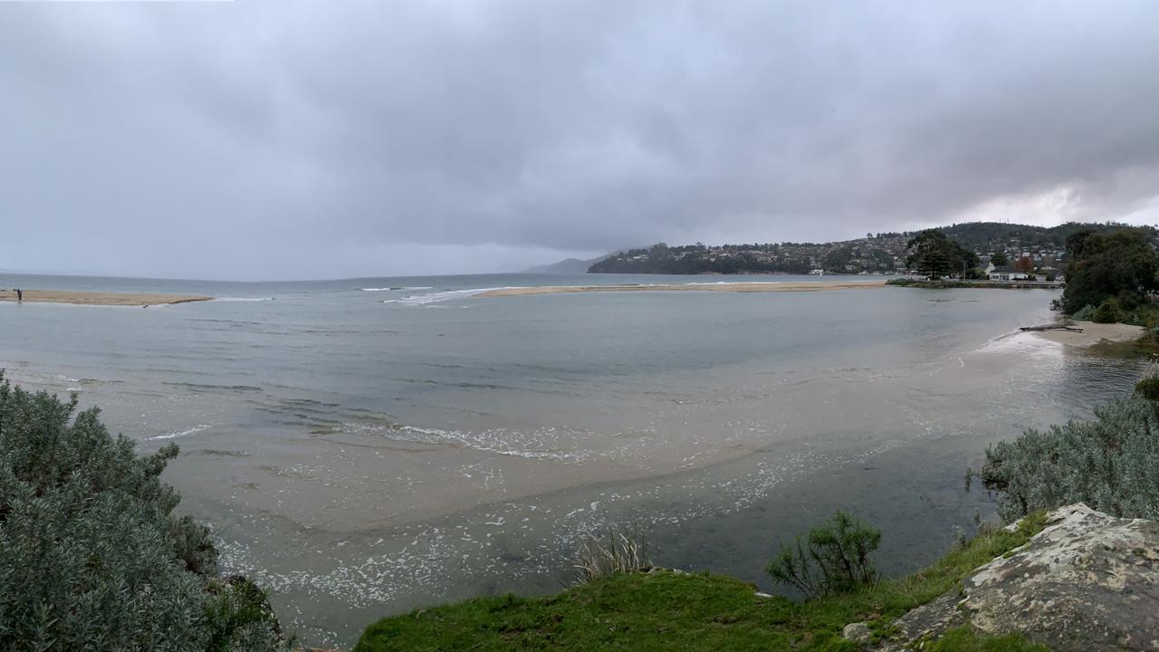
Floodwaters in the Huon Valley are subsiding after an emergency warning for parts of the town was issued overnight.
Tasmania State Emergency Services Director, Mick Lowe, said no reports of flooding of structures in Huonville were received overnight.
“Minor flooding is occurring in the Huon River with flood waters at Huonville peaking in the early hours of Thursday morning,” Mr Lowe said.
“SES, Tasmania Police and Huon Valley Council personnel doorknocked and contacted affected residents in approximately 15 homes and businesses in the expected flood impact zones to prepare for evacuation.”
He said SES Tasmania received 17 calls to their 132500 number overnight, and a total 16 requests for assistance, seven of which in the south.
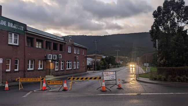
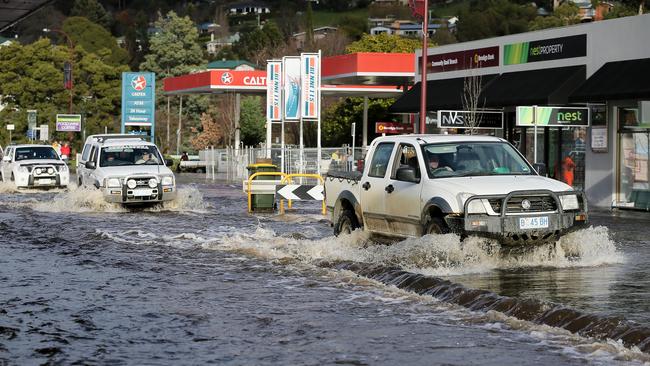
He added that widespread flooding was affecting roads in the area and people were urged to drive with extreme caution, and reminded people not to drive through floodwaters.
Mr Lowe said that affected residents were urged to monitor conditions with a flood watch and act alert still current for the Huon River in the Tahune to Judbury region.
There is also a current flood advice alert issued for the Huon River between Judbury to Huonville.
“We do urge people in the greater Huonville area to be aware of the situation and to monitor TasALERT in case the situation changes,” he said.
For flood updates go to: www.TasALERT.com
For current river levels and weather conditions go to: http://www.bom.gov.au/tas/
And for the latest road closure updates, go to: https://www.police.tas.gov.au/
Earlier – May 31, 2023:
Residents of the Huon Valley are being warned that flooding “similar to 2016” is expected overnight, with heavy falls continuing.
Just after 8.30pm, a ‘Flood Watch and Act – Prepare now’ warning was issued for Judbury to Huonville and surrounds by Tasmania SES.
“The Bureau of Meteorology has issued a major flood warning for the Huon river with major flooding similar to 2016 likely to occur,” the warning states.
Locations likely to be impacted are Huon River Flood Plains downstream of Judbury and surrounds.
Authorities warn that during the next 24 hours, flooding is likely in streams and rivers and “lives could be at risk from flood waters”.
Some properties may become isolated or inundated by flood waters and evacuation of some properties may be required.
“Property, livestock, equipment, and crops may be threatened by flood waters (and) driving conditions may be dangerous,” the warning states.
“Flood waters are a risk to safety, never walk, play, ride, or drive in floodwater.”
If you live in the alert area and/or near the Huon river, SES advises:
- If you have a flood emergency plan, use it now.
- Prepare your property (if safe to do so). This may include:
- Placing furniture and possessions up high on tables/benches
- Move livestock and equipment to higher ground
- Preparing your emergency kit and being ready to leave
- If conditions worsen and safe to do so, leave and go to the home of a family member or friend who is in a safe location away from the flood affected area.
- Contact family, friends, and neighbours to alert them of the potential for flooding.
EARLIER:
The Bureau of Meteorology and Tasmania SES are warning of the risk of flooding in a number of suburbs in Tasmania’s south as more rain is forecast today.
A moderate flood warning for the Huon river has been issued by the Bureau, with locations likely to be impacted including Judbury, Ranelagh, Huonville, Glen Huon, Woodstock, Cradoc, Glaziers Bay, Franklin, Castle Forbes Bay, Port Huon and surrounds.
During the next 24 hours, authorities say flooding in nearby streams and rivers is likely and some low-lying properties may become isolated by flood waters.
“Property, livestock, equipment, and crops in low lying areas may be at risk from flood waters (and) driving conditions may be dangerous,” the warning states.
If you live in the alert area and/or near the Huon river, SES advises:
- If you have a flood emergency plan, check it now.
- Monitor conditions and prepare now to go to a safer place if conditions become more dangerous.
- For SES Flood Warning updates, visit TasALERT.com
- For life-threatening emergencies, dial triple-0 (000)
- For emergency flood and storm assistance call the SES on 132 500.
Wind and showers are forecast for Tasmania and southern Victoria.
— Bureau of Meteorology, Tasmania (@BOM_Tas) May 29, 2023
A front passing on Wednesday night will enhance the wind and bring some showers across the south-eastern states as well.
Latest: https://t.co/02yUeWCYpNpic.twitter.com/H0m3upetgJ
Moderate Flood Warning for the Huon River and Flood Warning for the Picton River
River levels along the Huon River are elevated in response to rainfall overnight Tuesday into Wednesday. Minor flooding is likely along the Huon River at Tahune Bridge Wednesday morning, and moderate flooding may develop from Wednesday afternoon. Minor flooding likely at Judbury and possible at Huonville Wednesday afternoon with further forecast rainfall. Since 9:00am Tuesday, rainfall totals of up to 55mm have been recorded across the Huon River catchment. A further 30-40 mm is possible across the Huon River catchment for the remainder of Wednesday.
Where the rain fell
In the 24 hours to 9am Wednesday, the following rainfall totals were recorded in the South:
- Strathgordon: 65mm
- North Boomerang: 60mm
- Scotts Peak: 29mm
- Warra: 31mm
- Razorback (McKays Track): 32mm
In the 24 hours to 9am Wednesday, the following rainfall totals were recorded in the West:
- Mount Read: 75mm
- Darwin Dam: 70mm
- South Queenstown: 64mm
- Lake Margaret: 60mm
More cold, windy weather on the way
Monday, May 29:
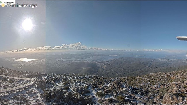
Tasmanians are being warned to brace for more wild weather this week, with rain, strong wind and even more snow on the way.
Icaro Pronsate dressed his one-year-old son Sol in a bright yellow winter suit and travelled from Blackmans Bay to Hobart for a boys day out on Monday, with a dusting of snow falling on kunanyi overnight.
“It was very windy this morning,” he said.
Mr Pronsate, who is originally from Brazil, has been living in Hobart for the past four years with his wife.
“It was really tough the first two winters to get through it, but we love Tasmania, we love Hobart, we love the place so the weather is just a thing we figured out how to get comfortable and warm,” he said.
“This is Sol’s second winter, and I think we’re doing pretty well.”
A strong wind warning is in place for Tuesday for Central Plateau Lakes, South West Lakes, Far North West Coast, Central North Coast, Banks Strait and Franklin Sound, Upper East Coast and Lower East Coast, with a gale warning for East of Flinders Island, South East Coast, South West Coast and Central West Coast.
Hobart is expected to have showers all week with a top of 17C on Tuesday and Wednesday before cooling down to 13C on Thursday. Showers will continue into the weekend with a top of 15C on Friday, Saturday and Sunday.
More high-level snow is expected across the state Wednesday and Thursday.
To the north of the state, Launceston will have showers and a maximum of 17C on Tuesday and Wednesday, partly cloudy and top of 14C on Thursday before a shower or two developing and maximum of 14C on Friday. Saturday and Sunday will have a shower or two and top of 16C.
In the state’s west, Strahan will have showers and wind and top of 15C on Tuesday and Wednesday, before showers ease and top of 12C on Thursday. Showers will continue to develop into the weekend with a top of 15C on Friday, Saturday and Sunday.
Coles Bay will have a mostly cloudy week, with a maximum of 18C on Tuesday and Wednesday before dropping to a cooler 14C on Thursday. Showers will start developing on Friday before setting in for the weekend. Temperatures will reach a top of 15C on Friday, Saturday and Sunday.


Join the conversation
Pictures: King tide rolls in as low-lying coastal community braces
An abnormally high tide has begun to roll in across the state’s South East after a coastal hazard warning was issued. Pictures >>
Read more

Christmas Day weather could hit the sweet spot for Tassie
The holiday could serve up an extra sweet with above average temperatures expected during the day in Tasmania. Here’s what to expect on Christmas Day.
Read more