
Tasmanian weather: Spring set to soar after one of warmest winters on record
Tasmania experienced one of the warmest winters on record. As we head into spring, here’s what to expect.
Weather
Don't miss out on the headlines from Weather. Followed categories will be added to My News.
Spring had sprung a month earlier than normal, as Tasmania possibly experienced the warmest winter on record. But as we head into the coming months, the temperatures are set to soar higher than normal.
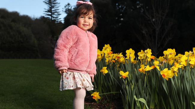
On the last day of winter, Nora and Alan Davidson took their two-year-old daughter Sophia to the Botanic Garden to see the flowers blooming.
“We decided to come in and have a look at the gardens here which are very pretty and very bright – nice flowers and it was good to have a nice little walk around,” Mr Davidson said.
“We’re staying in Richmond at a little farm cottage and we’re talking to the owner, and he said, he’s only had about 6ml of rain for the month, which isn’t very good.”
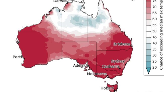
The Bureau of Meteorology’s spring outlook for September to November has forecasted less rain and high temperatures than normal across Tasmania and Australia.
“It’s been more warmer than usual for August 2023 which is likely to rank in one of the top 10 warmest August on record for Tasmania overall for maximum temperatures,” Bom senior climatologist Jonathan Pollock said.
“For Tasmania overall, winter 2023 is likely to rank in the top five warmest winters on record for both maximum and minimum temperatures.”
Mr Pollock said they are expecting below average rainfall across Tasmania during spring, from September to November.

“There’s more than double the normal likelihood of unusually low rainfall across the state rising to more than triple the normal likelihood for parts of the North and North West,” he said.
“Hobart only has a 23 per cent chance of above median rainfall and at the same time, temperatures are likely to remain higher than average is more than triple the normal likelihood of unusually high mean maximum temperatures for most of the state, and more than double the normal likelihood of unusually high mean minimum temperatures.”
While the temperatures are warming, Mr Pollock said fire authorities, including the Bom, will have a better idea of bushfire risk towards the end of spring.
“With the sort of drier and warmer conditions that we’re forecasting here, there is a reasonable amount of fuel around, we’ll probably see a bushfire risk increase towards summer,” he said.
“Until we’ve seen what happens in spring, It’s a bit too early to say for summer.”


Pictures: King tide rolls in as low-lying coastal community braces
An abnormally high tide has begun to roll in across the state’s South East after a coastal hazard warning was issued. Pictures >>

Christmas Day weather could hit the sweet spot for Tassie
The holiday could serve up an extra sweet with above average temperatures expected during the day in Tasmania. Here’s what to expect on Christmas Day.