
‘Antarctic origins’: Week-long cold blast to bring snow, ice and frost
Statewide frost and “well below average” minimum temperatures will continue until Friday, with two car crashes forcing Tasmania Police to plea with the public. WARNINGS >>
Weather
Don't miss out on the headlines from Weather. Followed categories will be added to My News.
Statewide frost and “well below average” minimum temperatures will persist until Friday, with two car crashes in the state’s centre forcing Tasmania Police to plea with the public.
Inspector Jim Semmens said motorists need to slow down and drive with caution as the state grapples with a polar blast.
“With ice on our roads on Tuesday morning, which is predicted to continue for the coming days, it’s timely for police to remind all motorists of the importance of driving to the conditions and being alert for ice on our roads,” he said.
Tasmania Police responded to crashes at Arthurs Lake and Miena on Tuesday, with early investigations indicating icy road conditions contributed to both.
A car also cleared a fence and ended up upside-down a Glenorchy rivulet.
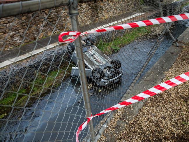
Luckily, no serious injuries have been reported across the three crashes.
“Winter brings adverse road conditions such as ice, rain and snow, which make road surfaces slippery, and it’s imperative motorists drive to the conditions to prevent crashes,” Inspector Semmens said.
Tasmania Police recommends drivers leave plenty of space between them and the car ahead, pay attention to road warning signs and ensure their tyres are in good condition.
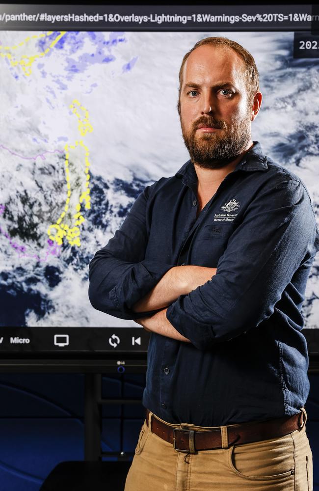
Metrologist Michael Conway said Tasmanians would be “a lot colder than normal” up until the weekend.
“The minimum temperatures will be well below average and it will be quite frosty,” he said.
“We’re expecting pretty much statewide frost for many days.
“You can get some really bad conditions at the end of a string of frosty days.”
ROAD WEATHER ALERT AS OF 5PM:
Icy roads will make driving conditions dangerous during Wednesday morning in parts of the North West Coast, Central North, North East, Western, Central Plateau, Midlands, East Coast, Upper Derwent Valley and South East.
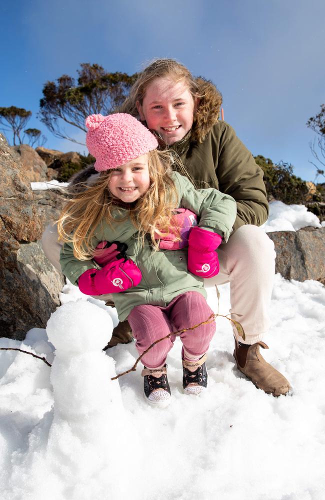
Snow delight as icy week begins
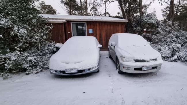
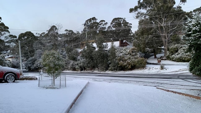
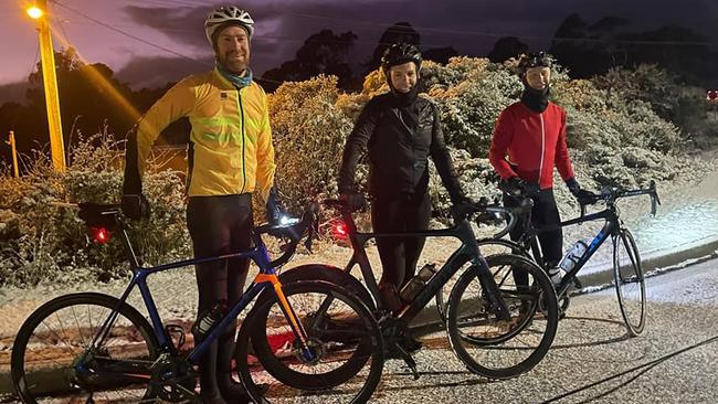
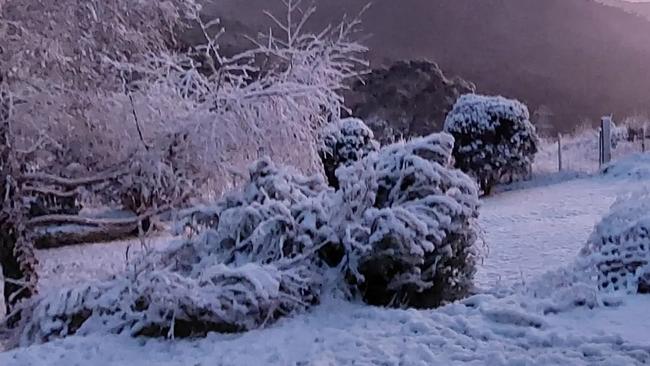
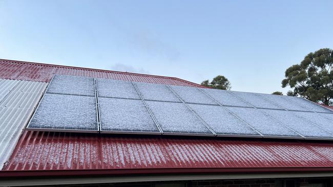
Hobart residents woke on Monday to snow in the suburbs as a polar blast struck the state.
Snow mainly settled in the western suburbs, across areas like Mount Nelson, West Hobart, Tolmans Hill and Fern Tree, delighting families who were able to enjoy some school holiday snow in their own backyards.
Residents were right to make the most of the suburban snowfall, with the Bureau of Meteorology saying snow will not fall that close to sea level again this week.
“Snow down to as low as it got to on Monday morning is a bit of a one-off for the next little while,” meteorologist Luke Johnston said.
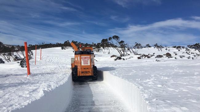
“But there’ll be plenty of snow on the mountain top for the coming days.”
Mr Johnston said while the BOM had forecast snow to fall as low as 250m on Monday, it settled at 150m in some areas.
Snow flurries even made an appearance at 20m.
“We saw plenty of snow settling on the hills around Hobart, particularly in the western suburbs,” he said.
“Further south from the city, we have seen reports of snow down to as low as 150m, give or take, which is quite low.”
Mr Johnston said snow could fall lower than expected during a cold blast, with the temperature of the ground crucial to whether snow settled.
“If the ground is too warm, any snow falling on it will just melt away,” he said.
Fern Tree resident Patrick Newland said snow only fell like it did on Monday “once every couple of years”.
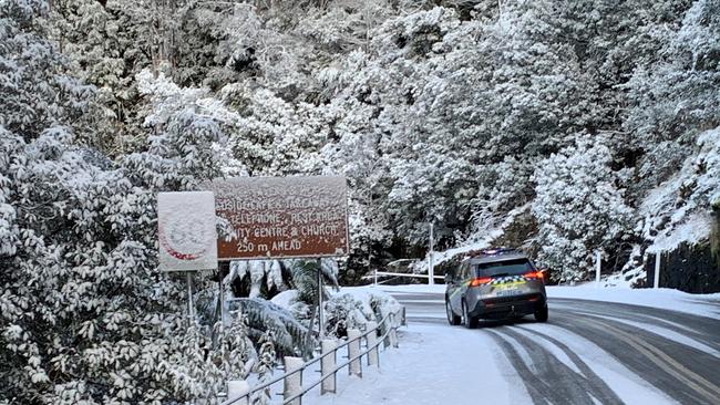
The conditions forced Tasmania Police to close the Lyell Highway between Queenstown and Derwent Bridge, and the Cradle Mountain Rd.
“Tasmania Police advise all motorists intending to use elevated roads during the evening to consider an alternate route or use with caution,” they said.
“Roads at elevation throughout the state can be subject to ice and snow. Conditions may deteriorate rapidly.”
The RACT warns that in the coming days motorists should be “especially careful” on shaded or tree-covered roads, on bridges and on overpasses, as they can all freeze more quickly.
If your car slides on black ice, the advice is to let your car pass over it.
“Don’t hit the brakes or oversteer,” the RACT said.
“Keep your steering wheel steady and lift your foot off the accelerator.”
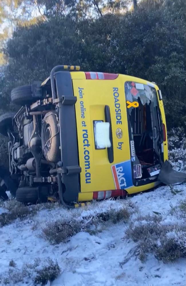
However, even roadside assistance vehicles can fall victim to dangerous driving conditions, with one RACT vehicle veering off the road and coming to rest on its side, according to a photo on social media on Monday.
Mercury readers have shared the snowfall at their place this morning:
‘Cold blast’: Sub-zero temps on the way for much of Tassie
A snowy blast closed in on Tassie on Sunday, bringing a bitterly cold morning, snow flurries and black ice to large parts of the state.
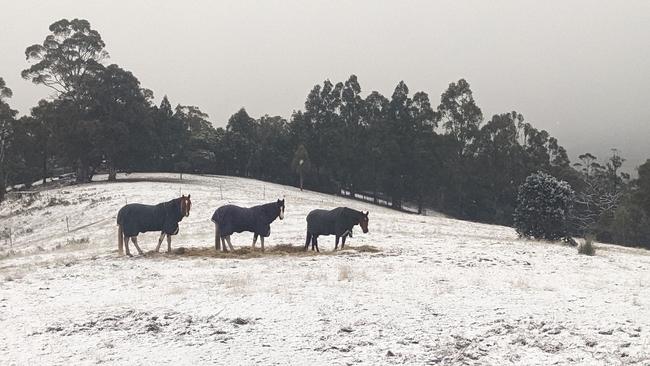
The cold conditions are set to linger for a week, with the Bureau of Meteorology predicting temperatures below zero for much of Tasmania.
“At this stage, it looks like the coldest mornings are going to be Tuesday, Wednesday and even Thursday where we are forecasting widespread minimum temperatures of -2C to -4C across many inland areas,” meteorologist Alex Melitsis said.
“And some of the northern suburbs (of Hobart) like Glenorchy and Brighton could see minimum temperatures of 0C or even below on Wednesday, Thursday and Friday morning.”
But Mr Melitsis said those in town will feel slightly warmer.
“We’re expecting minimum temperatures of around 1C to 2C … in Hobart CBD.”
Mr Melitsis added that snow would be as low as 250m in the state’s South but said “high accumulations of snow” were not likely.
“You’ll probably see kunanyi/Mt Wellington look quite pretty tomorrow morning, but we’re not expecting a magnificent snow-capped mountain,” he said.
“I doubt that many, if any, Hobart suburbs will get any snowfall, but maybe some snow flurries.”
Warnings
- Minor Flood Warning for the North Esk River,
- Warning to Sheep Graziers for Midlands, East Coast, Upper Derwent Valley and South East forecast districts,
- Road Weather Alertfor Tasmania for North West Coast, Western, Central Plateau, Midlands, East Coast, Upper Derwent Valley and South East forecast districts,
- Bush Walkers Weather Alert for Western and Central Plateau forecast districts.
Mr Melitsis said motorists should also expect dangerous driving conditions throughout the week.
“With those persistent, cold temperatures … we’re expecting widespread black ice across much of the state, particularly on Tuesday, Wednesday and Thursday.”
‘Antarctic origins’: Week-long cold blast to bring snow, ice and frost
A surprise week-long cold blast will bear down on Tasmania from Sunday which will bring low setting snow, frosty mornings and even black ice to much of the state.
The snow blast expected to start on Sunday evening is expected to bring snowfalls as low as 250m for parts of southern Tasmania overnight, with snow down to 400 metres expected elsewhere.
Tasmanian meteorologist Alex Melitsis said cold weather and snow modelling took a plunge on Saturday morning.
“All the models are suggesting the snow is going to be a little bit lower than what we were thinking (on Friday),” he said.
“Around the south east and the Hobart area, I can expect to see that kunanyi/ Mt Wellington would look fairly snowy (on Monday morning).”
Mr Melitsis said snow could settle on Hobart’s higher suburbs and warned motorists to expect snow on higher roads, particularly Vincent’s Saddle between Huonville and Hobart.
The cold snap has also triggered numerous warnings for the state.
“With the cold weather, snow, gusty winds and lots of showers around the state, we’ve got a warning for sheep Graziers for Sunday in most districts,” Mr Melitsis said.
“We’ve also got a warning for bushwalkers for low level snow.”
“Very cold” mornings, widespread frost and black ice are also expected from Monday until next weekend.
The snap is a result of a significant cold front on Sunday which will be followed by “really cold” and gusty south westerly winds with Antarctic origins.
But the outlook isn’t totally bleak.
“From Monday we’re actually looking at fairly settled nice winter weather but it will be very cold,” Mr Melitsis said.
“It’s going to be one of those weeks where you’ve got very cold mornings, widespread morning frost followed by a nice winters day with a bit of sun in the afternoon.”
Southern Tasmanian surfers might also get the chance to relish in the six metre south west swells expected to peak on Monday morning.
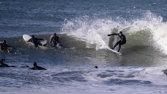
“There would be a nice big southerly swell of two to three metres getting into the South Arm area … so maybe some nice surfing around,” Mr Melitsis said.
Join the conversation

Floods, snow and sun: A week in Tasmanian weather
The weather is keeping Tasmanians on its toes with a few changes on the way, including promising signs for a slightly warmer weekend before another wintry blast brings snow. FORECAST >>
Read more
Pictures: King tide rolls in as low-lying coastal community braces
An abnormally high tide has begun to roll in across the state’s South East after a coastal hazard warning was issued. Pictures >>
Read more