
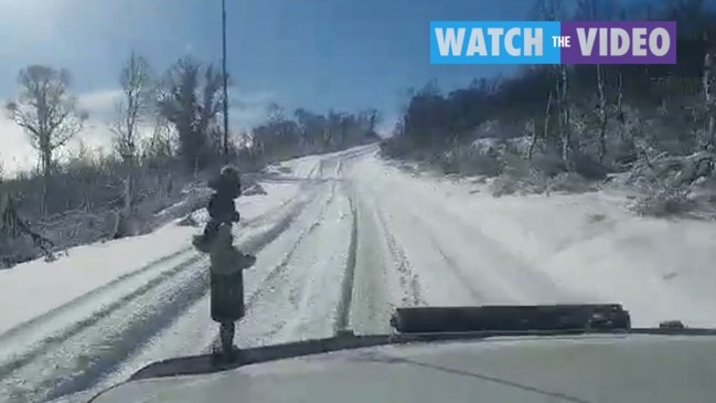
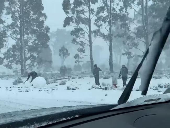
Highway closed after snowy blast hits West Coast and Cradle Mountain
A number of roads are closed across the state due to icy conditions, after yesterday’s snow fall saw motorists stranded and roads cut. LATEST ROAD CONDITIONS + FORECAST >>
Tasmania
Don't miss out on the headlines from Tasmania. Followed categories will be added to My News.
- Highlands cop cold blast, snow and hail
- Tassie flight cancellations imposed by lockdowns causes travel chaos
A number of roads are closed across the state due to icy conditions, after yesterday’s snow fall saw motorists stranded and roads cut.
Tasmania Police advise motorists of the following road weather alerts;
ROADS CLOSED
- Lyell Highway – Road Closed between Wayatinah and the Queenstown.
- Lake Dobson Tourist Road
- Lake St Clair Tourist Road
- Pinnacle Road Mt Wellington – Gate Closure at Bracken Lane
- Poatina Road between Poatina Village and Highland Lakes Road is CLOSED due to ice and snow.
- Mt Barrow Road, Nunamara.
4WD ONLY
- Highland Lakes Road – extreme caution for slippery conditions Hunterston to Miena
- 14 Mile Road, Tarraleah to Tungatina – 4×4 with chains only.
- Marlborough Road – extreme caution for slippery conditions throughout
- Strathgordon Road – black ice patches.
- Lake Secondary Road and Poatina Main Road
- Great Lake Road – Bothwell to Miena
- Anthony Road between Murchison Highway and Zeehan Highway
- Belvior Road between the Murchison Highway and Cradle Mountain
- Pelverata Road, between Halls Track and Vinces Road
CAUTION:
- Huon Highway – Vinces Saddle
James Johns from the Great Lakes Hotel told ABC Radio a number of people had to be rescued by Volunteer SES members about 1.30am this morning.
Mr Johns said emergency accommodation was organised for the rescued motorists.
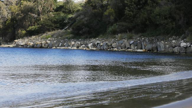
Meanwhile, abnormally high tides left the Kingston Golf Club’s lush greens a bit soggier than usual on Sunday – but that didn’t deter keen linksman Charlie Lane from enjoying a swing.
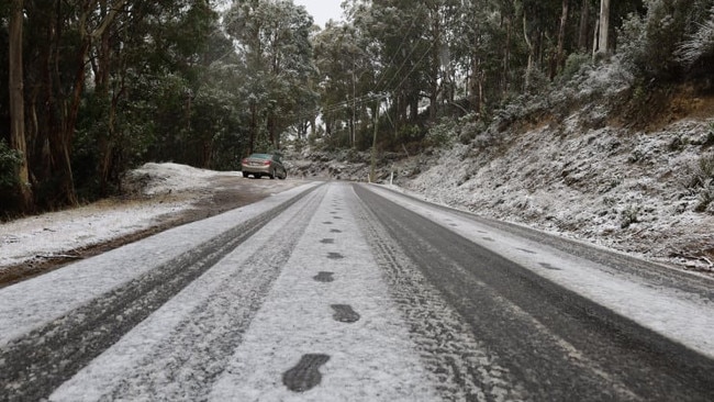
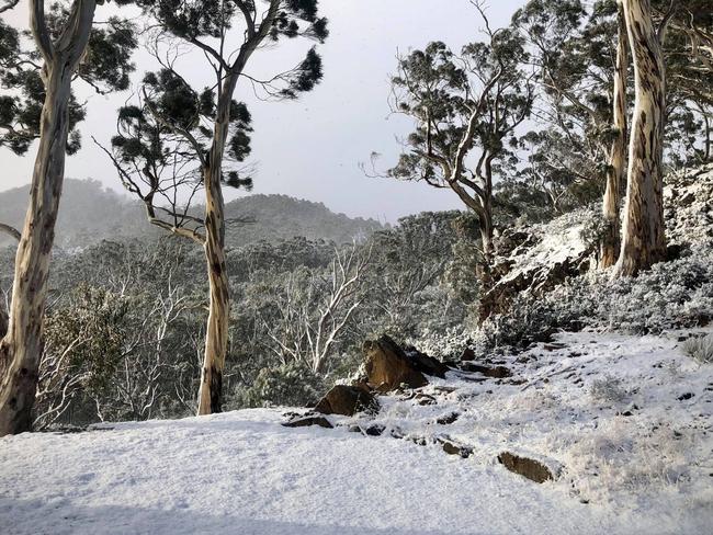
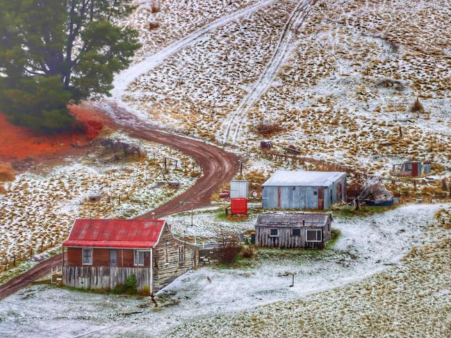
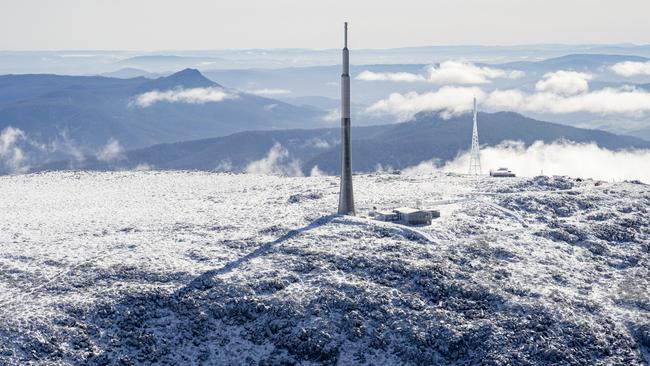
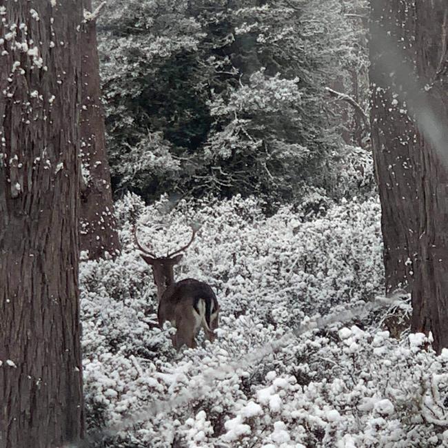
Elsewhere, Tasmanians were treated to a winter wonderland, with snow falling to about 300m on Sunday morning. Places including Fern Tree, Collinsvale, Cradle Mountain and Elizabeth Town all experienced a dusting of snow.
The conditions were the result of cold fronts passing across the state on Saturday and Sunday. However, snow levels are expected to rise to above 1000m by Monday morning.
While the 18-hole course at Kingston wasn’t hit with any snow, it did feel the effect of the high tides.
The course has experienced drainage issues in the past, but an ongoing works program has sought to address the problem.
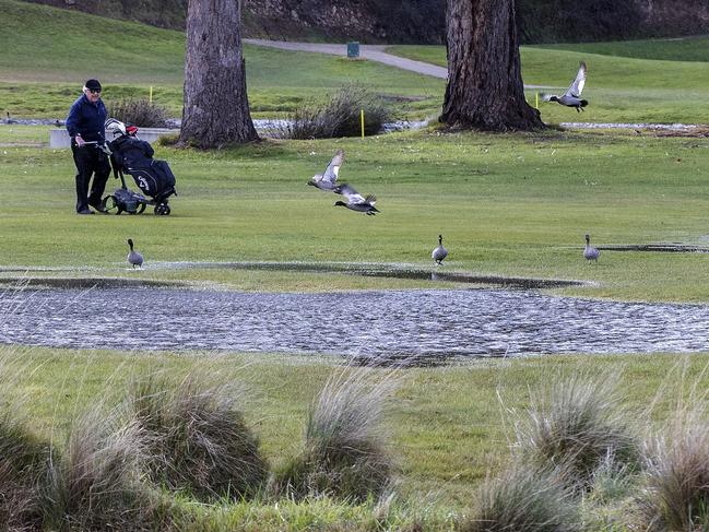
“The drainage has gotten a lot better over the last year or so,” Mr Lane said. “I actually don’t mind it, just because some bits overflow but it kind of changes up the course a little bit, makes it a bit different.
“It gets a bit repetitive playing the same course.”

Tony Lorkin, a member of the club who volunteers in the pro shop, said progress had been made in the past 18 months to improve the drainage system.
“There’s a drain that crosses the 11th and the 12th fairways and that feeds a bit more of the water back into Browns River,” he said.
“The water used to lie around (affected) areas because of high tides (but those areas) are not as affected anymore.”
According to the Bureau of Meteorology, tides were expected to be about 30-40cm higher than the standard astronomical tides on Sunday.
The Battery Point Jetty reached at least two metres about 7.30pm on Saturday, the BoM said, while the Huon River reached 2.7m about 30 minutes earlier.
BoM meteorologist Glen Perrin said another high tide was expected on Sunday afternoon and into the evening.
“We’ve still got the severe weather warning current for western, southern and lower eastern waters associated with that abnormally high tide,” he said.
“So after the high tide this evening, we expect those to drop off, so that warning will most likely be cancelled either late this evening or in the early hours of Monday.”
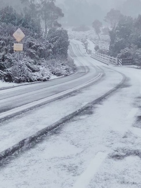
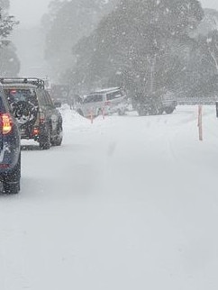
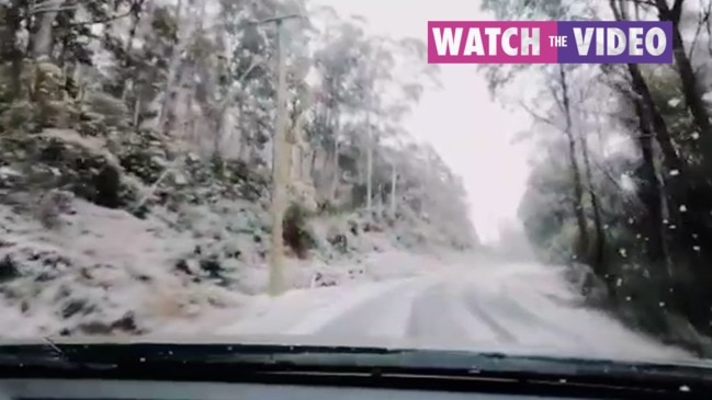
EARLIER: Snow has closed roads as an icy winter blast hits the state.
Tasmania Police has been called to crashes at Lake St Clair and Tarraleah on the Lyell Highway.
The road between Wayatinah and Queensatown is shut to all traffic except 4WDs with chains.
“Motorists without 4WDs will be unable to travel through to Derwent Bridge,” police said.
Updates will be provided on the Tasmania Police web page.
Meanwhile motorists are posting snow scenes on the West Coast and at Cradle Mountain.
Tassie bracing for low snow and high tides
TIDES as high as 2m are on their way to Tasmanian shores, with snow expected to fall to its lowest level so far this winter.
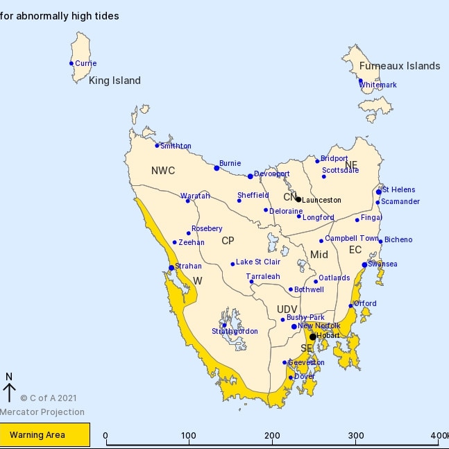
Bureau of Meteorology forecaster Deb Tabor said a severe weather warning for “abnormally high tides” was in effect for Saturday night and Sunday for the West, South-East and East Coast forecast districts.
She said tides of about 2m were expected around Battery Point on Saturday night, after 1.9m tides were recorded at Spring Bay and Battery Point overnight on Friday.
“The rise in seawater could cause flooding in low-lying areas through western and southern and low-eastern Tasmania,” Ms Tabor said.
The weather event has been predicted to create the state’s highest tides since May 1994.
Areas most likely to be affected include Strahan, Hobart, Orford and Dover.
Ms Tabor said a “strong and vigorous westerly change” would bring strong winds from 50-60km/h and gusts reaching 80km/h on Sunday.
“Snow levels are expected to drop to around 400m from early (Sunday) and that will cover western, central and southern Tasmania,” Ms Tabor said.
As much as 20mm of rain is expected in the West and up to 40mm about the Western Tiers.
Ms Tabor said road weather, bushwalking and sheep graziers alerts were in place to remind people to take care driving and stay safe in the approaching “wet, windy and cold” weather.
Hobart will reach a wintry high of 9C on Sunday with a shower or two and westerly winds up to 40km/h, 13C on Monday with possible showers, and 16C on Tuesday with partly cloudy conditions.
Get the latest weather and warning updates here.
Highest tides in decades expected to hit Tassie
The South East coast of Tasmania is on high alert with some of the highest tides in decades forecast to hit our shores.
The Bureau of Meteorology has issued a severe weather warning for abnormally high tides between Strahan to Swansea with beaches expected to ‘disappear’ and low-lying roads to become ‘unpassable’.
“At this stage it looks like the tides could be the highest tides we have seen in quite a few years potentially since May 1994.” said Meteorologist Alex Melitsis.
Due to low air pressure moving over Tasmania ocean heights will rise and tides 40 to 50cm higher than usual are expected to occur Friday, Saturday and Sunday night with the highest peak expected early Saturday evening.
âš ï¸People in parts of the Western, South East & East Coast forecast districts in #Tasmania need to prepare for impacts around abnormally high tides that may cause sea water flooding of low lying areas. Read more for exact timings & emergency services advice https://t.co/EBqhmHOZ54pic.twitter.com/zX47RWbNrr
— Bureau of Meteorology, Tasmania (@BOM_Tas) July 23, 2021
“Susceptible low-lying roads around Lauderdale and Huonville are expected to be inundated briefly so people need to prepare for possible disruptions there.” said Meteorologist Alex Melitsis.
“If you’ve got any tinnies on the beach please make sure they’re secured, otherwise they will wash out into the ocean.”
“I certainly wouldn’t be parking my car near the beach over the coming few evenings.”

Hobart will see its highest tide peak at 1.7m on Friday evening at 6:54pm while tides will come in at 2.6 metres high at Bicheno on the East Coast at 7:21pm on Saturday night.
Off the coast swells could reach 8m in the Far North West between Sandy Cape to Stanley while waves in the South East are due to reach 4m.
Tasmanians are being urged to also brace for blustery conditions as a ‘significant weather system’ passes through the state on Saturday night.
The Bureau of Meteorology (BOM) said wind and rain is expected throughout Saturday and Sunday with snowfalls lowering to 400m on Sunday afternoon.
Tasmanians can expect to see the conditions hanging around after a cold front brought a winter wonderland to parts of the state earlier this week.
“It will be a bit longer lasting and snow will be a bit lower than what we received on Tuesday.” said BOM forecaster Michael Conway.
“Snow will fall mainly in the west and it will come over into the south of the state especially on Sunday afternoon.”
“If that snow falls in those areas we’re looking at about 2cm.”
The wet and gusty conditions are due to continue into next week as frequent cold fronts pass through the state.
To keep up to date with the latest warnings visit the BOM’s website.

Tip fire triggers smoke warning
A fire at Brighton Waste Transfer Station is billowing smoke into the area, forcing authorities to issue a smoke alert for the area.

Hurry up and hire new EPA boss, Libs told
The state opposition has implored the government to appoint a new director of the environmental watchdog, five months after its former boss advised the Premier of his intention to retire.