
Snow, -0 temps, heavy rainfall as two cold fronts head for Tassie
Tasmanians are being warned to brace for snow, subzero temps and heavy rainfall beginning today as two cold fronts head for Tasmania. FULL STATE FORECAST + CLOSURES >>

Tasmania
Don't miss out on the headlines from Tasmania. Followed categories will be added to My News.
Tasmanians are being warned to brace for snow, subzero temps and heavy rainfall over the coming days as two cold fronts hit Tasmania.
A cold front is expected to bring below average temperatures, snow to 700 metres and hail over the state on Tuesday backed up by another expected to hit on Wednesday night.
The Bureau of Meteorology has issued a Road Weather Alert for snow and warns a Bushwalkers Weather Alert is imminent.
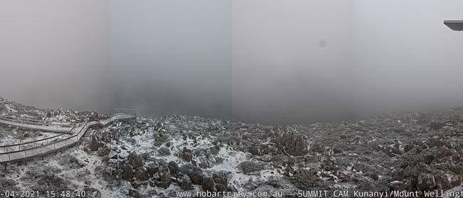
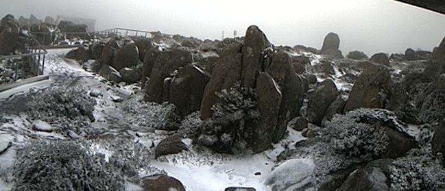
The City of Hobart this morning closed the Pinnacle Road at the Springs due to forecast snow on kunanyi/ Mt Wellington.
As of 4.01pm Tuesday, the Mt Wellington summit webcam is showing snow is already falling.
Subzero minimum temperatures are forecast for much of the north and northeast of the state, with morning frost likely and a subsequent Frost Warning likely on Wednesday.
Another cold front is forecast to cross the state overnight Wednesday, that the weather bureau expects will deliver statewide showers and snow above 1100 metres.
Time to switch over to the winter doona with frosty mornings on the forecast for southeast Australia and more wintery weather on the way. A series of cold fronts forecast to bring strong winds, showers, possible hail & snow to elevated areas this week. https://t.co/f03ErweBvZpic.twitter.com/zonf00aTsE
— Bureau of Meteorology, Australia (@BOM_au) April 18, 2021
Northwest to south-westerly winds impact Tasmania this week, with fresh and gusty conditions expected in most areas as fronts move over the state.
“Given the sustained period of westerlies, rainfall totals for the five days to Friday night are forecast to be 40-80 mm into the west, with higher falls at elevation, 5-15 mm of rain is forecast elsewhere, with isolated falls to 20-30 mm into the northeast,” Meteorologist Anna Forrest said. .
Coming up this week in #Tasmania:
— Bureau of Meteorology, Tasmania (@BOM_Tas) April 18, 2021
â˜‚ï¸ A couple of decent cold fronts Tuesday morn, and Wednesday night, bringing rain statewide.
ðŸŒ¨ï¸ Snow to around 700m on Tuesday.
â„ï¸ Frosty start (particularly the in the N) on Wednesday.
⛆ Brief periods where it stops raining in #Strahan. pic.twitter.com/j0tkWRs6rl
A high pressure system moving slowly into the Great Australian Bight during the later part of the week, and helping produce the westerly winds, is expected to cross Tasmania over the weekend bringing with it lighter winds.

It’s snow joke, Tasmania: winter’s blast is here!
Tasmania, get ready for a real chill! A severe weather warning is active as wild winds are forecast to lash the state, bringing plummeting temperatures and snow to new lows. The forecast.

Police investigate bike crash where teen airlifted for injuries
Police are reminding Tasmanians on road rules for fire trails after a motorbike crash resulted in a teen being airlifted to hospital. THE LATEST>>>>