
Interstate big guns fly in for Tasmanian fire battle
UPDATED, 11.30am: Firefighters will be given some respite today with cooler conditions expected across much of Tasmania — but the battle is far from over as Friday shapes up as “the worst day of the season”. SEE THE VIDEO
Tasmania
Don't miss out on the headlines from Tasmania. Followed categories will be added to My News.
UPDATED, 11.30am: Firefighters will be given some respite today with cooler conditions expected across much of Tasmania — but the battle is far from over as Friday shapes up as “the worst day of the season”.
One home has been lost at Miena and watch and act warnings remain in place at five locations in Tasmania’s Central Highlands, with the nation’s biggest firefighting aircraft joining the fight against wildfires raging across island state.
An emergency warning remains in place for Shannon, which is part of the Central Highlands fire.
But a welcome change in the weather has today brought some relief for firefighters.
Following a cold front that crossed overnight, maximum temperatures are today expected to be about 20C in the South and low to mid 20s in the North.
A Bureau of Meteorology bulletin today said southerly winds were directing smoke across northern Tasmania.
“Showers are expected over the North during the afternoon and evening, but rainfall totals are likely only to be a couple of millimetres,” it reads.
“Conditions are expected to warm up again during Thursday to mid to high 20s across much of Tasmania, reaching low 30s inland in the Southeast.
“A mild night is expected Thursday night before temperatures peak on Friday, reaching high 20s to low 30s across most of the state and up to mid to high 30s about the Southeast.”
Strong and gusty northwesterly winds are expected to develop on Friday which, combined with the hot temperatures, will see very high to severe fire dangers develop about southern, central and eastern parts of Tasmania.
Dry thunderstorms are also possible across Tasmania during Friday. A cold front is expected late, with westerly winds and cooler temperatures expected for the weekend.
All Tasmania warnings are updated regularly at: www.bom.gov.au/tas/warnings/
Bureau of Meteorology senior forecaster Simon McCulloch yesterday said the impact of Friday’s weather would be down to the timing of a front.
“Friday will be the worst day of the season and, given the fire in the landscape already, that adds to it,” he said.
“The three drivers of the fire danger index are temperature, wind and humidity. So while the humidity might be up fractionally — and that’s a good thing — the winds are higher than what we’ve seen.
“Friday is shaping as a bad day — the timing will be critical. If the front goes through in the morning, southeastern Tasmania might see temperatures in the high 20s or 30s, but if it doesn’t go through until later in the afternoon, mid to high 30s are possible.”
UPDATED, 7am: One home has been lost and emergency warnings remain in place at six locations in Tasmania’s Central Highlands this morning, with the nation’s biggest firefighting aircraft joining the fight against wildfires raging across Tasmania.
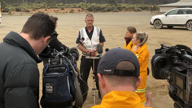
Tasmania Fire Service state public information officer Peter Middleton confirmed one property was destroyed near Miena yesterday.
“There was ... one property that was lost, a homestead, and we will be going in to assess that further today in terms of the extent of the damage to that property,” he said.
Emergency warnings are in place for Miena, Barren Tier, Tods Corner, Penstock Lagoon, Shannon and Liawenee, while watch and act alerts apply to Morass Bay, Flintsone, and Wilburville.
Mr Middleton said weather conditions began to abate late last night.
“We still have those emergency warnings in place because those areas that are listed [on the TFS website] in the Central Plateau are potentially under threat, or could be impacted at some point, particularly as we start to shift towards later in the week as well,” Mr Middleton said.
“The conditions on Friday are very unfavourable for firefighters, and we’ve got very high fire danger and pushing into severe and beyond on Friday particularly, so it will be the worst fire weather for the season.”
Mr Middleton said the plan today was to “maximise the weather conditions”.
“The weather conditions today are much more benign than yesterday and some previous days, and [we will] basically throw as much at these fires as we can today as we then head into some warmer conditions Thursday and heating up even more on Friday,” he said.
“[We will be] trying to work as much on protecting communities, protecting infrastructure, and protecting community assets as well, so that will be the priority.”
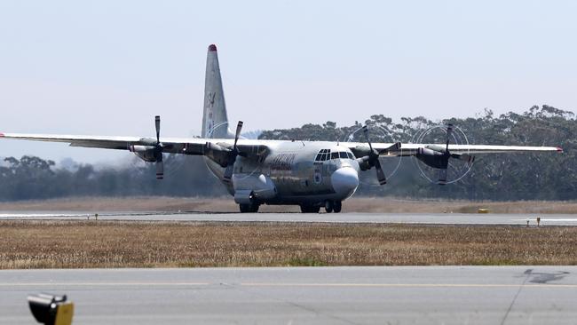
B737 airtanker “Gaia” flew into Hobart on Tuesday to join the C130 airtanker which has already been flying sorties over the fires threatening Miena.
As emergency services brace for deteriorating weather conditions across the state, local career and volunteer firefighters have been bolstered by even more reinforcements from three states and national bodies.
MORE FIRES:
FIREYS PRAISED AS BLAZE THREATENS TAHUNE AIRWALK
THICK SMOKE HAMPERS FIRE FIGHT
GALLERY: THE FIREFIGHTING EFFORT IN PICTURES
Two dozen aircraft are now working to contain and control 49 fires — the largest a 19,000 hectare fire which began near Gell River and the 10,000 hectare blaze in the Central Highlands which has menaced Miena in recent days.
A fire at Tahune has burned to within metres of the carpark of the popular Tahune Airwalk.
There have been no reports of property damage or injuries.
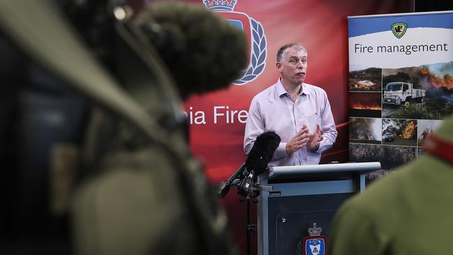
TFS deputy chief officer Bruce Byatt said everything was being done to prepare for the worst fire weather of the season, which is predicted for Friday.
“We’ve had significant resources join us from interstate,” he said. “We’ve had people from NSW, Victoria, South Australia and even representatives from Emergency Management Australia join us in our time of need.”
He said of the fires currently listed, 32 were categorised as “going”.
There were seven emergency warnings current on Tuesday night: six for communities affected by the Miena fire on Central Plateau and one for the fire which reached the carpark of the Tahune Airwalk.
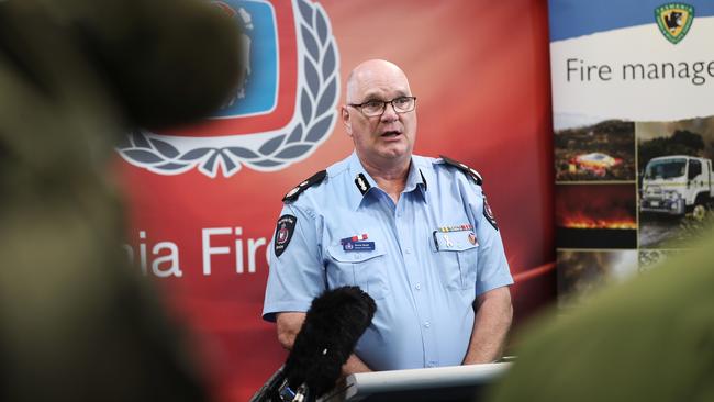
Deputy Commissioner Byatt said no new fires had been reported and resources were in place for the fight ahead.
“We currently have over 24 aerial appliances and NSW have been very kind to give us for the next three days another large air tanker, one of the larger of those assets, a 737 that carries 43,000 litres.
“So we’ve got quite a bit of hitting power in terms of what we’ll be able to do with fires, and the good news is that we’ve had no new starts today.
“It’s a combination of containment and being ready to hit it hard and fast.”
A total fire ban is in place until 2am on Wednesday, with a second total fire ban in place from Thursday to Monday.
“We cannot see any more fires in the landscape, particularly with the predicted conditions for Thursday and Friday,” Mr Byatt said.

Bureau of Meteorology senior forecaster Simon McCulloch said the impact of Friday’s weather would be down to the timing of a front.
“Friday will be the worst day of the season and, given the fire in the landscape already, that adds to it,” he said.
“The three drivers of the fire danger index are temperature, wind and humidity. So while the humidity might be up fractionally — and that’s a good thing — the winds are higher than what we’ve seen.
“Friday is shaping as a bad day — the timing will be critical. If the front goes through in the morning, southeastern Tasmania might see temperatures in the high 20s or 30s, but if it doesn’t go through until later in the afternoon, mid to high 30s are possible.”
Mark Bryce from the Tasmanian Parks and Wildlife Service said a number of tracks had been closed on Tuesday and more would be closed as conditions dictated.
“Due to the changing fire conditions a number of additional track closures have been put in place. That includes the Labyrinth and Pine Valley near Lake St Clair and tracks to the west of Lake St Clair, Lake Petrarch, the Cuvier Valley, Mount Olympus and Gould Plateau, the Eildon Range, Billy Brown Falls, Southport Lagoon four wheel drive track, Snug Tiers Four wheel drive track and the Mystery Creek tracks.
“PWS is asking that people put off extended trips into remote areas.”

Libs lead, but minority likely: poll
The Liberal Party are on track to win the most seats, but Tasmanian voters look set to deliver neither major party a majority in Saturday’s election, according to the latest opinion polling.

Cash boost to secure Party in Paddock’s future
Tassie’s most popular music festival has landed some serious political backing, with the Liberals announcing millions in funding if re-elected over the next three years to secure its future.