
Qld weather: Update shows tropical low has ‘high’ chance of forming into cyclone
A tropical low that has a high chance of forming into a cyclone in coming days. SEE THE FORECAST
QLD News
Don't miss out on the headlines from QLD News. Followed categories will be added to My News.
Queensland’s cyclone threat continues to grow as a tropical low moves closer to the coastline, bringing with it strong winds and heavy rain.
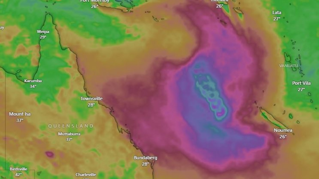
Bureau of Meteorology modelling at 4pm on February 21 showed the weather pattern was moving closer to the state.
It is expected that by 10pm on Thursday the tropical low will be about 300km from Hamilton Island.
But by 10am on Friday, February 28 it is predicted to have moved within 30km of Hamilton Island, around 70km from Bowen, and 200km from Mackay.
It is forecast that the tropical low is expected to span at least 500km across its shortest side.
Earlier on Friday, BOM modelling showed the tropical low sitting off the northeast coast of Cairns was expected to develop over the coming days, with a high chance it will form into a tropical cyclone by Monday.
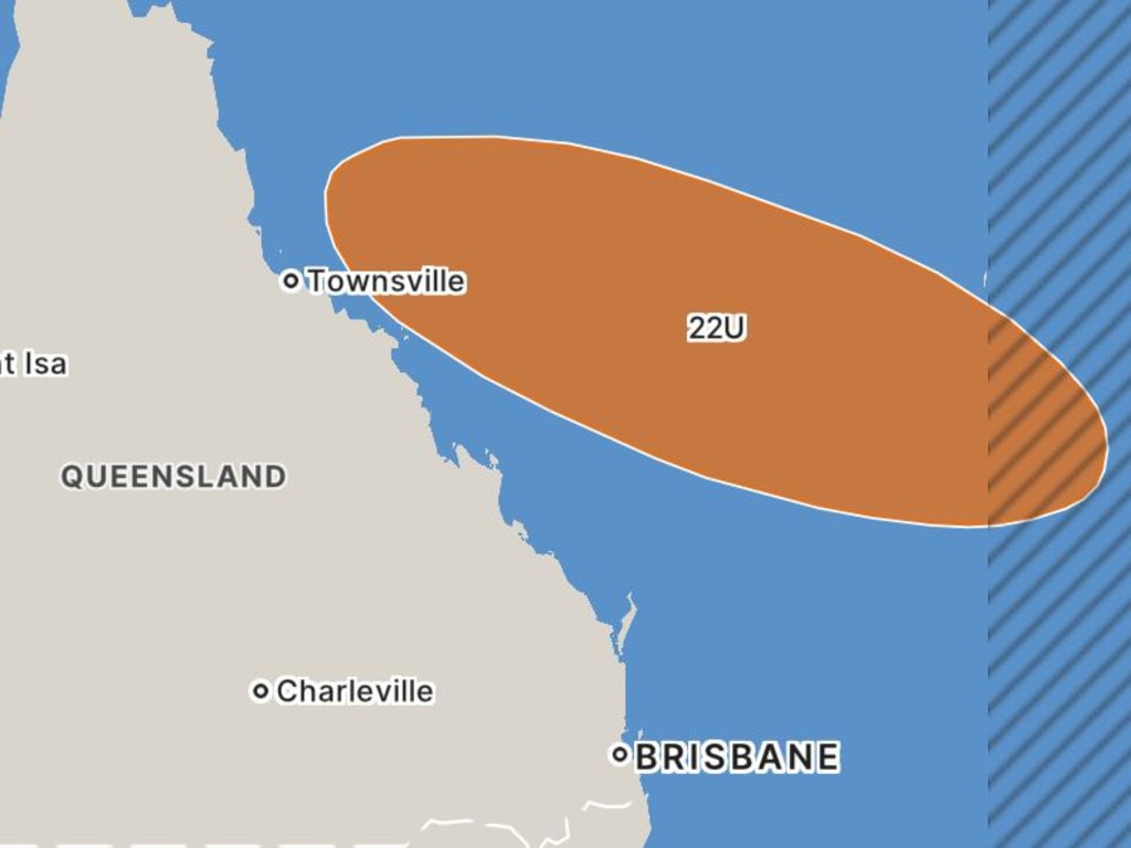
Senior Meteorologist Jonathan How said the tropical low – dubbed 22U – had developed over the northern Coral Sea and by Friday morning was about 400km off the Queensland coast.
“It is well off the Queensland coast, this tropical low is expected to develop further in the following days over the northern coral sea,” Mr How said.
“But it will remain well offshore and move slowly east and southeast over the next seven days.
“So there is no immediate threat to Queensland communities.”
Mr How said as of Friday there was a low chance that the tropical low could form into a tropical cyclone, however this is expected to change to a moderate chance from Saturday and a high chance from Monday.
“But then from the middle of next week there is a range of possible scenarios in the movement and development of this tropical low or cyclone,” Mr How said.
“This includes moving east and away from Australia towards places like New Caledonia and Vanuatu or the system could drift further south over the coral sea.”
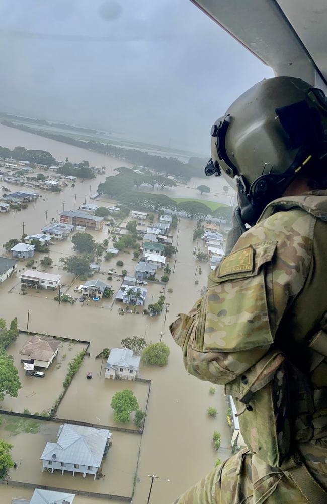
If the low formed into a tropical cyclone and were to track closer to the Queensland coast, it could cause a major headache for North Queenslanders as they continue the clean-up from the major flooding event earlier in the month.
One of the flood victims, Nerina from Ingham, Queensland told Today show on Friday morning how the whole town has been inundated with rain and the damage has been severe.
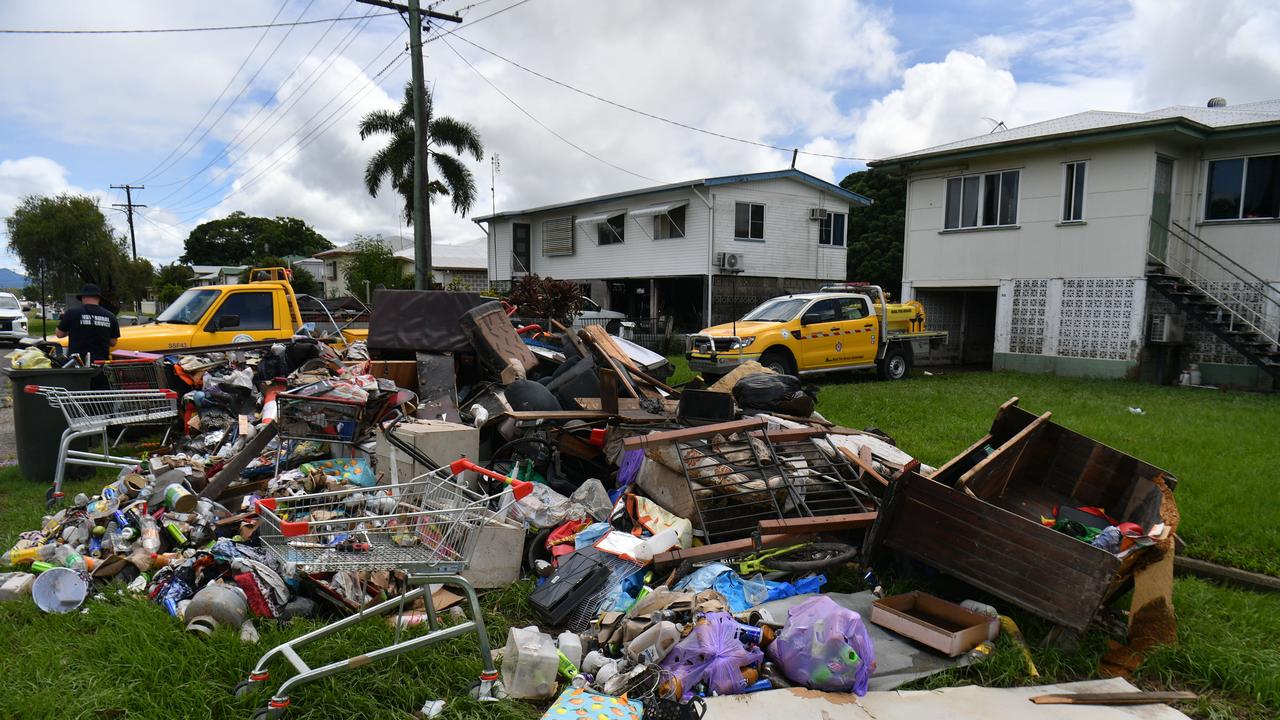
“We don’t need any more disasters. Our town, the whole district has been inundated with rain and lots of us have lost,” she said.
“They’re unable to go back to our homes until they are fully cleaned out and restored.”
Nerina, who has now become homeless and has been residing at her neighbour’s house for weeks, said how the flood water had pushed her and her family out of their own home.
“My house, it came up through the floorboards. It was only a small amount of water, but it was enough to now lock us out of our home.
“We aren’t able to go back and to find accommodation is next to impossible.
“So we have to pack up all our gear and put it into a container and yeah, try and find accommodation.”
Mr How said the Bureau’s tropical cyclone team was monitoring 22U very closely and urged Queenslanders to stay up to date with tropical cyclone warnings moving into next week.

Originally published as Qld weather: Update shows tropical low has ‘high’ chance of forming into cyclone
$2.7bn war chest to save outback Qld town from oblivion
An outback Queensland town is making a bold, $2.7bn bid to reinvent itself and avoid economic oblivion. Go inside the plan, complete with “flying whales”.

Man fights for life after shock motorcycle crash
A young motorcyclist has been left with life-threatening injuries after a collision with a vehicle on the Sunshine Coast.