
Low pressure system set to deliver severe storms, rain and steamy conditions this weekend
PARTS of Australia’s south and eastern seaboard are set for a few days of soaring temperatures, thunderstorms and mad humidity.
National
Don't miss out on the headlines from National. Followed categories will be added to My News.
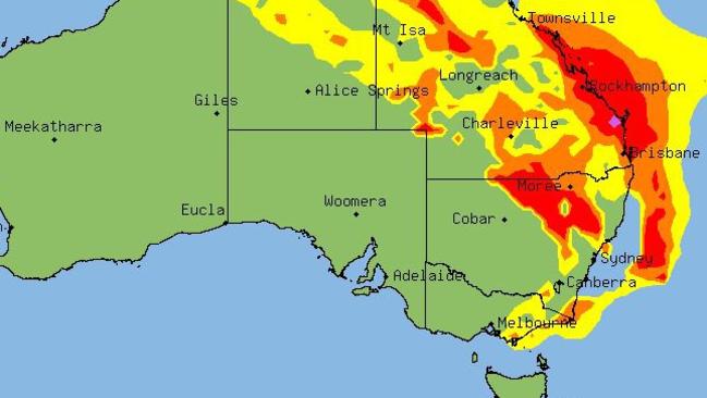
A NUMBER of low pressure systems are expected to deliver some interesting weather — with stormy, humid conditions on the forecast for much of the nation.
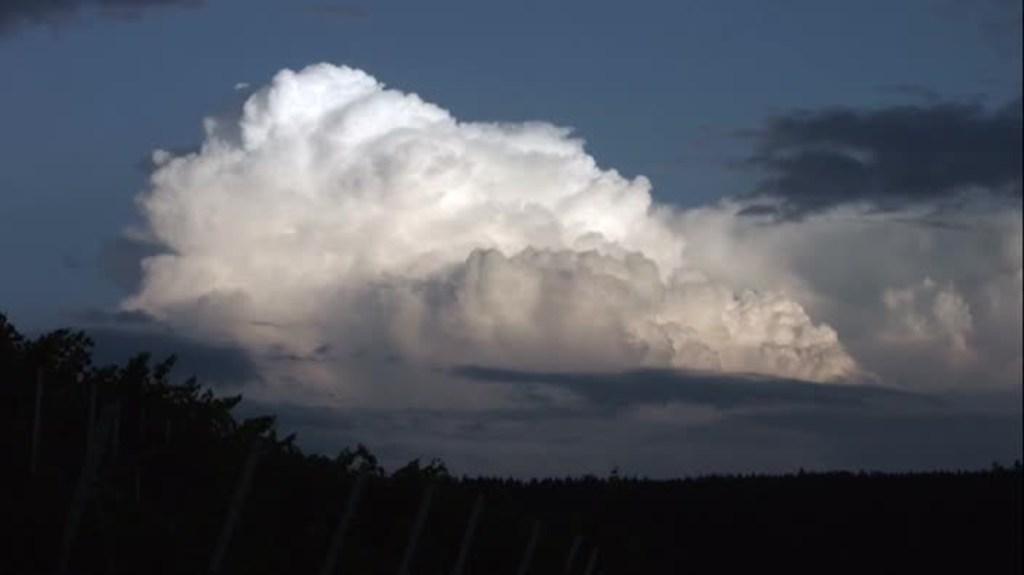
Thunderstorms are likely to spread across NSW, VIC, ACT, SA, QLD and TAS during today and on Saturday as a new trough moves over eastern Australia.
Severe storms and heavy downpours are likely to develop in some areas including Brisbane.
Here’s what you need to know.
NEW SOUTH WALES AND THE ACT
A trough of low pressure over Central Australia is moving southeast and deepening.
This trough will move through the state today and tomorrow, bringing showers and thunderstorms, possibly severe in the Lower Western and Upper Western forecast districts.
By tomorrow morning the weather system should be covering almost the entire state, with rain and storms forecast in all districts, including Sydney.
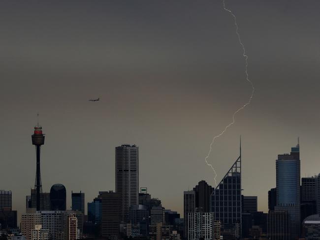
Sydney is forecast to cop 20mm of rain tomorrow with possible storms, most likely in the morning and afternoon.
Maximums temperatures in the city should be around 30C, while western suburbs can expect tops in the mid 30s.
The rain is likely to make it extremely humid.
There is some good news for NSW though, with most of the wet weather clearing for a sunny and warm Sunday.
Canberra is heading into similar conditions with storms developing later today and continuing tomorrow. Tops will be in the high 20s.
VICTORIA
A low pressure system near Adelaide is expected to deepen and approach the western Victorian border this evening before drifting south-eastwards towards western Bass Strait on Saturday.
This mass of unstable air will deliver showers and thunderstorm across much of the state later today and into tomorrow morning.
At this stage, thunderstorms are unlikely to be severe.
Warm and humid conditions will develop in the wake of the change with temperatures remaining in the high 20s and low 30s for many western and northern areas.
Melbourne can expect a sunny day today with showers developing later.
Tomorrow will be more humid with showers and thunderstorms likely, and a top of 24C.
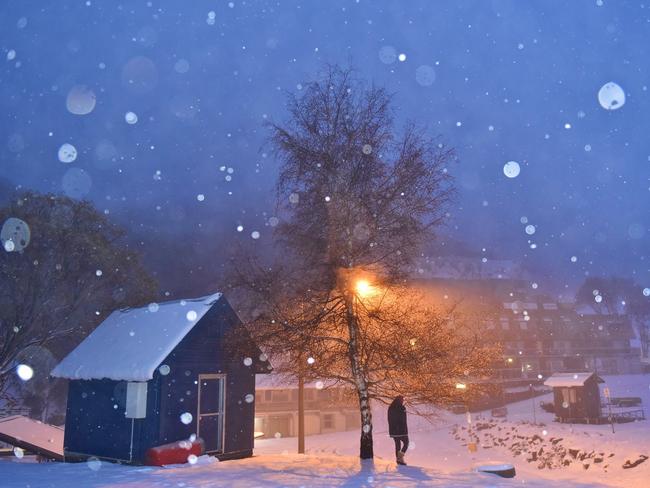
Condition across the state will cool down late on Sunday with the arrival of a cold front, delivering November snow to alpine areas.
SOUTH AUSTRALIA
A low pressure system over western parts of South Australia is expected to move south of Kangaroo Island by late Friday night and west of Tasmania during Saturday.
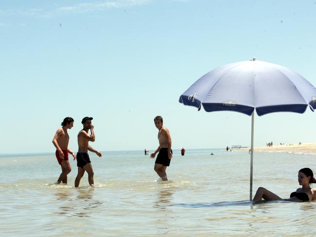
This system will bring summer-like conditions to the entire state today, with hot temperatures and high winds.
Some areas in the north of South Australia will reach 42C with dust storms possible.
A severe thunderstorm warning was issued early this morning but has since been cancelled. Further storms are likely throughout the day and the Bureau of Meteorology will issue further warnings if needed.
Adelaide is heading for a hot top of 35C today and there’s the chance of a storm.
Conditions will ease tomorrow with the arrival of a cool change.
QUEENSLAND
A broad area of low pressure extends through parts of Central Australia and into the Queensland interior.
A number of upper troughs will move eastwards over Queensland from today onwards bringing a period of unstable conditions.
The entire state can expect to see possible thunderstorms today and conditions will remain warm.
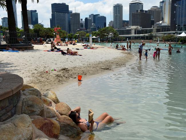
Brisbane sweltered through its hottest day of spring so far this year yesterday, with temperatures in some suburbs reaching 38C.
Storm activity is forecast to increase on Saturday, with severe thunderstorms possible in the North West, Channel Country, Maranoa and Warrego, Central West, Central Highlands and Coalfields, Darling Downs and Granite Belt, Southeast Coast and Capricornia forecast districts.
These storms could produce damaging winds, large hail and very heavy rainfall.
Brisbane can expect storms from later today through till Sunday.
Some of there are expected to be severe.
Temperatures will remain in the low to mid 30s.
TASMANIA
A ridge of high pressure over Tasmania will move to the south of the state during Friday as a low passes over South Australia.
The deepening low will approach the island state on Saturday, moving to near the west coast by evening, bringing heavy rain.
Much of the state can expect up to 70mm of rain across Saturday and Sunday as the weather system sweeps in.

Thunderstorms are likely in northern parts of Tasmania over the weekend.
Showers should develop in Hobart later today with rain increasing tomorrow.
30mm is forecast in the capital on Saturday and Sunday with temperatures in the mid to high teens.
The weather should gradually clear out by Monday.
Originally published as Low pressure system set to deliver severe storms, rain and steamy conditions this weekend
Man dies after horror lawnmower incident
A man has died after he became trapped underneath a lawnmower on a rural property.

Let me have a crack at Sam Kerr’s reputation management
Reputation management in the digital era is a whole new ball game, writes Angela Mollard, who reckons she’s a shoo-in for the gig.