
Jon Knott explores options for city planners as Barron River mouth moves north
A Cairns geoscientist has put forward two options for city planners grappling with the creation of a long-predicted new Barron River mouth that was fast-tracked recently when the flooded river gouged a destructive new path to the sea.

Cairns
Don't miss out on the headlines from Cairns. Followed categories will be added to My News.
A leading natural disaster expert has issued a renewed warning about the creation of a new Barron River mouth which was first predicted in the 1980s but took a giant surge toward reality recently when the river gouged out a destructive new path to the ocean.
A research paper published in 1980 predicted that Thomatis Creek would eventually become the main mouth of the Barron River in a natural process known as river channel migration.
Before 1932, according to the Barron River Delta Investigation, Thomatis channel carried Barron River water only when the waterway flooded.
Ninety years on and the creek is only marginally smaller than the main channel.
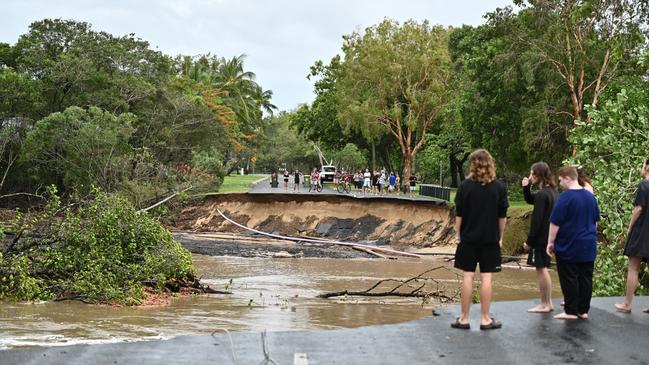
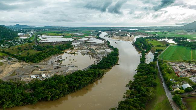
During the latest Barron River flood event Thomatis Creek cut a new path to the sea through a mangroved depression. Flood water was temporarily contained by a man-made bank built up to allow the construction of Casuarina St but eventually the weight of water was too great and the river smashed through taking a 100m section of Casuarina St along for the ride.
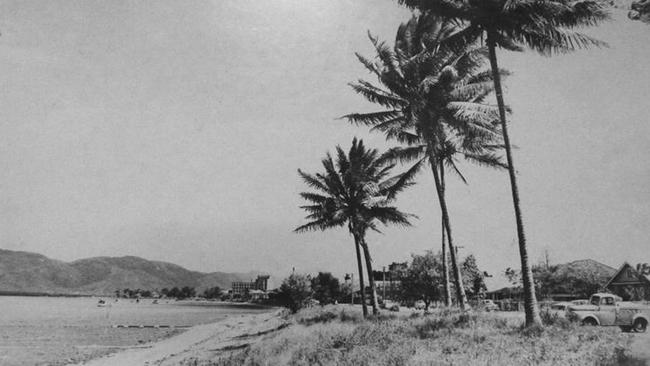
Geoscientist and James Cook University adjunct professor Jon Nott had long predicted the northern migration of the river mouth based on historical accounts of the Barron meeting the sea at Ellie Point on the southern side of the airport to feed water and sand into Trinity Bay. He said the shifting river mouth was the reason a once sandy Cairns Esplanade at the turn of the last century was now a mudflat and the same process would eventually strip sand from the foreshore at Holloways and Machans.
However he never claims to have predicted the shortcut Thomatis Creek took to reach the sea two weeks ago.
“I didn’t think that entrance was going to occur there and now looking back at Google images it was obvious it was going to happen,” he said.
“The whole purpose of rivers is to shorten their distance to the sea, they are constantly trying to do this.”
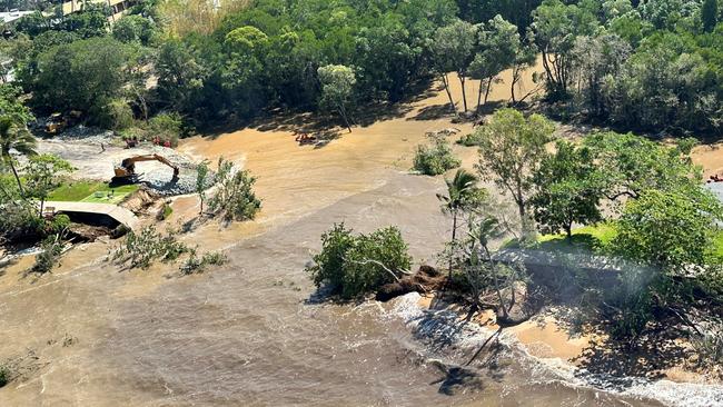
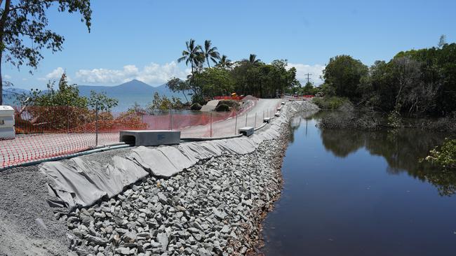
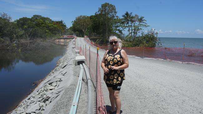
Cairns Regional Council has completed filling of the Casuarina St cut with tonnes of rock and road base has been laid on top to allow single lane access to about 50 houses on Poinsettia and Acacia streets.
In an impressive effort to restore access to residents living on the northern side of the chasm, council invested about 500 work hours to build a road in just four days.
However no drainage pipes to allow egress of water from the river have been laid.
In terms of a long-term solution Dr Knott said council had two options.
“They can let it go and allow the river to shift north or they can use heavy engineering to try and stop it,” he said.
“I don’t think they have any option but to use hard engineering work to stop it going out there.
“They could build a bridge, but that is very expensive and council is probably not keen to do that.
“But it’s hard to predict when it will occur and what to do about it.”
A council spokesman responding to Cairns Post inquiries stated further technical studies and assessments will be required before arriving at a long-term solution to the Casuarina St situation.
“The temporary structure was constructed with course grade rock which allows for some transverse water flow, however, the primary objective of the interim structure is to provide road access for traffic until a fully considered design solution is complete,” the spokesman said.
Whatever the solution Dr Knott said we had a responsibility to action any long term solution rather than leave it to future generations to contend with.
“It’s very obvious (the fix) needs to be factored into our planning and council needs to be thinking about that and plan for it,” he said.
“It’s not fair to leave it for the next generation to sort out.”
How the remediation of the washout and future flood mitigation will be tackled and whether the expert advice of professional planners will be overruled by councillors remains to be seen.
“It’s often not the planners that are at fault, it is our consenting authority, it’s the councillors who are the consent authorities,” he said.
“What we have not looked at is the economic (gain from development) versus the cost of those impacted by a disaster.
“A lot of the time we have complete disregard for the consequences of extreme weather events.
“These events cost people dearly, and I have spoken to people who are truly traumatised and the rest of the people are impacted through increased insurance premiums.
“All ratepayers are paying for these developments, economic growth is important but the issue is we are paying for it every year with our insurance premiums.
“Our insurance premiums have been going up for all of us (which) in part is due to building in flood prone areas.
“The more properties that are exposed, the higher our insurance premiums will be.”
The 1980 Barron River Delta study stated the main channel accounted for 65 per cent of the river’s flow while Thomatis Creek carried 35 per cent.
Studies of the Mississippi Delta have shown once flow of a second stream becomes greater than 40 per cent of the main channel the migration process becomes “very difficult to reverse.”
More Coverage


Originally published as Jon Knott explores options for city planners as Barron River mouth moves north

Ergon reveals timeline on power restoration to 3356 homes
Thousands of Ergon Energy customers have been left without power after large trees fell on transmission lines north west of Port Douglas.

Named: The Qlders busted for street-level drug dealing
Street level drug dealers continue to be a burden on communities, as these cases prove. SEE THE LIST