
North Queensland warned as water rises over Bruce Highway south of Ayr, more storms to come
Residents have been warned to be prepared for more severe weather as storms continue to hit the region. LATEST WEATHER NEWS.
Townsville
Don't miss out on the headlines from Townsville. Followed categories will be added to My News.
A Bureau of Meteorology spokeswoman has said conditions across North Queensland will begin to ease in the coming days, with heavy rainfall totals that are hammering the region starting to head elsewhere on Friday.
“As we go through the day, that heavy rainfall will start to move eastwards and start to impact south-east Queensland,” she said.
Despite the rain slackening off somewhat, it is still expected to linger for some days, with potential for further flood warnings to be put in place due to the consistent inundation.
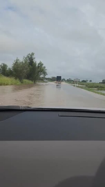
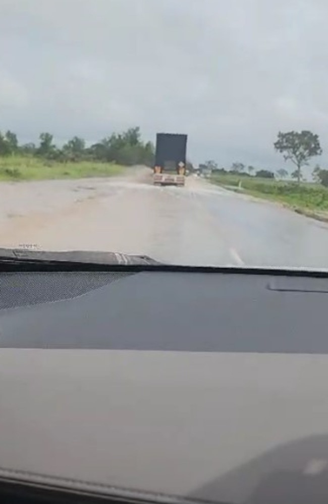
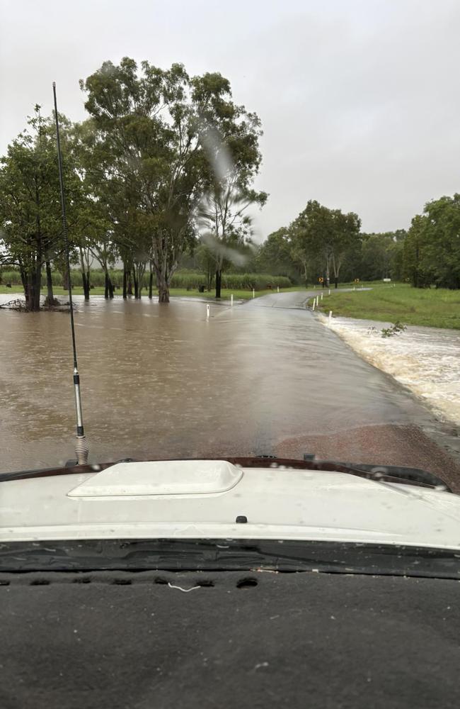
Water is flowing over the Bruce Highway south of Ayr, but the major route is yet to close.
Footage from a driver shows water over the road about 30km outside the town.
This comes as heavy rain hits Townsville and the disaster management group warns residents to stay prepared ahead of more storms to come.
Townsville Local Disaster Management Group chairman Andrew Robinson said localised flooding would impact roads across the region.
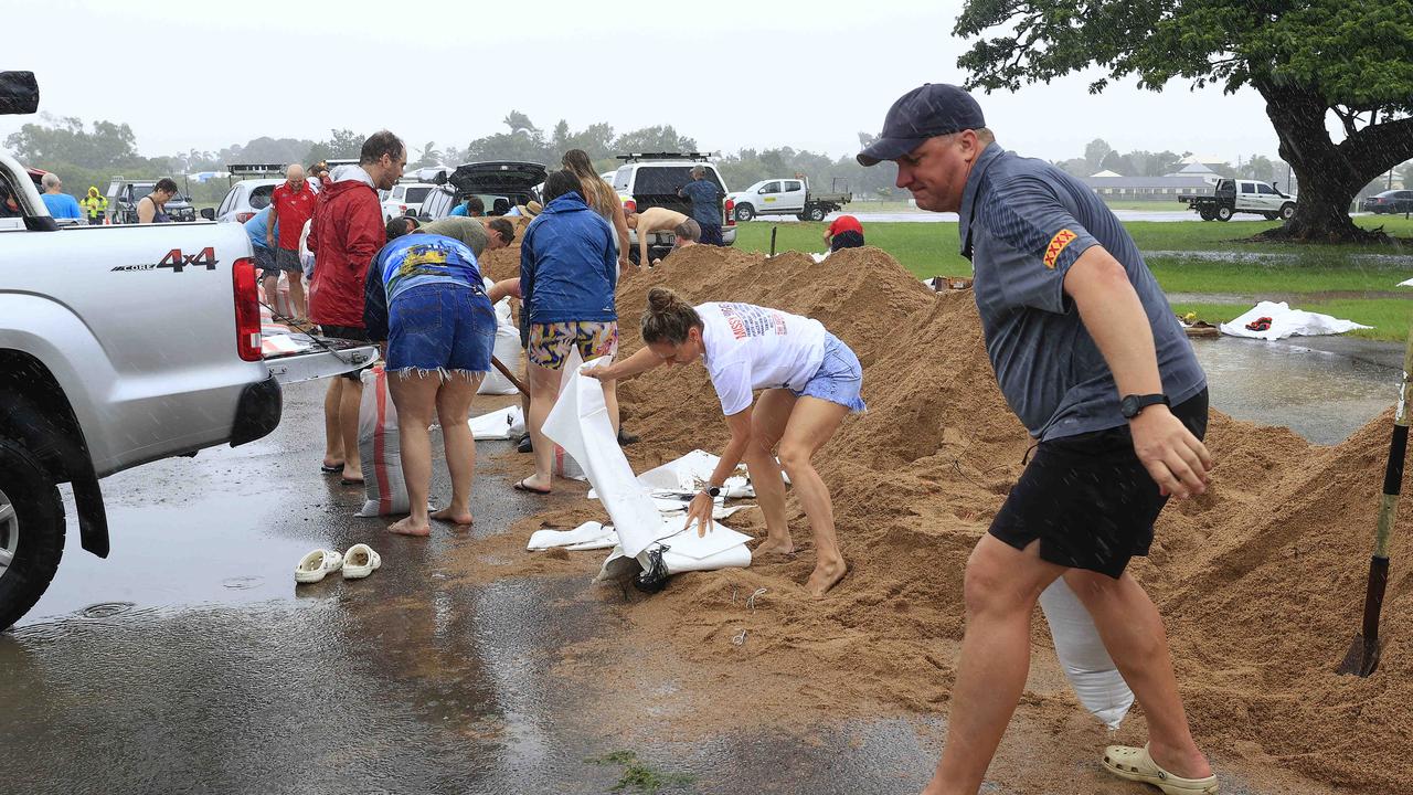
“We are seeing continued heavy rain across Townsville as well as the start of a king tide, so we are expecting to see localised flooding and road closures,” Cr Robinson said.
“It’s important that residents stay informed of the weather and be aware of the risk of localised flooding. If your home needs to be sandbagged, there are sand and bags available at four sites across the city.
“Also be aware of the environmental impacts of heavy rain if you are walking outside. Avoid coming into contact with floodwater as it can carry harmful bacteria and be careful walking on concrete as it may be slippery.”
Ross River Dam is continuing a controlled release in accordance with the approved Emergency Action Plan. The dam is currently at 135 per cent capacity.
The Ross River is closed to sport and recreation users for the length of the river between Ross River Dam and Aplin’s Weir, including the ponded areas of Black’s, Gleeson’s and Aplin’s weirs.
Beaches at The Strand, including the Rockpool, Pallarenda, Rowes Bay and Five Mile Beach are closed to the public.
Townsville’s sewerage network is currently at capacity due to rainwater intake. Residents are asked to only wash clothes when their washing machine is full, take shorter showers and only flush their toilet when necessary to minimise pressure on the sewerage system.
Sand and bags are available at:
Lou Litster Park – 30 Boundary St, Railway Estate
Council Depot Ross Dam Access, Ross Dam Access, Kelso
Corner Bruce Highway & Mount Low Parkway, Mount Low
Bluewater Community Centre, 14 Forestry Rd, Bluewater
For non-life threatening emergencies, call SES on 132 500.
More Townsville roads close as Giru faces major flooding
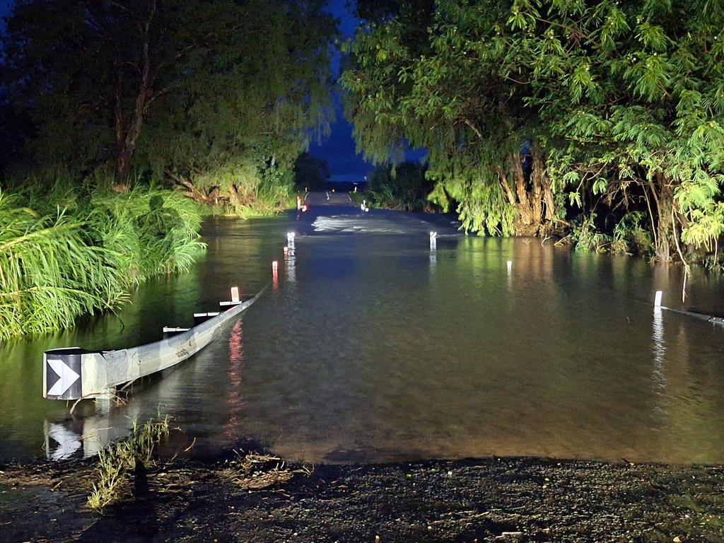
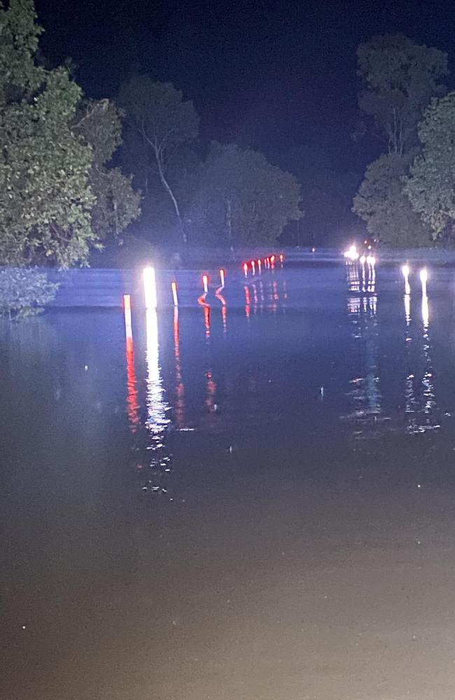
North Queenslanders are facing more weather-related challenges on Thursday after heavy rain forced the closure of several roads in the region, while a major flood warning was renewed for the Haughton River, impacting Giru.
The Queensland Traffic website warned at 6.30am that heavy rain had led to the closure of Stuart Drive to traffic in both directions between Fairfield Waters Drive and the Bruce Highway, which reopened to traffic in both directions at 8.10am.
Roads remain blocked at Charters Towers Rd, Townsend St, Glendale Drive, and Allambie Lane, while there was also water over the road at West St, Armit St, Wellington St, Kings Rd, and Railway Ave had one lane open.
To the south, Woodstock Giru Rd is closed at Mount Surround/Woodstock, to the west Hervey Range Rd is closed at Dotswood, and there is water over the Bruce Highway at Clemant/Rollingstone with lanes reduced.
There were also numerous road closures and flooding throughout the Ingham area.
The Bureau of Meteorology has numerous flood warnings in place including a major flood warning for the Haughton River Catchment, moderate flood warning for the Bohle River, and
minor flood warnings for the Herbert River, Ross River, and Burdekin River.
In its major flood warning for the Haughton River Catchment issued at 5.35am, the BOM said there major flooding occurring at Giru, with further rises expected with forecast rainfall.
“Moderate to heavy rainfall since Tuesday evening has caused renewed river and creek level rises across the Haughton River catchment. River levels at Mt Piccaninny and Major Creek have peaked, while river levels along the Haughton River at Powerline continue to rise. Major flooding is occurring along the Haughton River at Giru,” a BOM statement said.
“Further showers and storms are forecast across the catchment for the next several days, which may cause further river level rises. This situation is being closely monitored, and this warning will be updated as required.”
Major Creek: Major Creek peaked above major flood level Wednesday evening and water levels are easing. Renewed creek rises are possible with forecast rainfall.
Haughton River: Major flooding is occurring along the Haughton River.
The Haughton River at Giru is currently at 2.63m and rising, above the major flood level. The Haughton River at Giru may reach around 2.8m on Thursday morning. The river level is expected to remain above the major flood level (2.5m) Thursday morning. Further rises are possible with forecast rainfall.
Who got the rain until 9am on Thursday
• Rollingstone 93mm
• Alligator Creek Rd 88mm
• Alligator Creek 66mm
• Horseshoe Bay 56mm
• Upper Black River 52mm
• Upper Major Creek 46mm
• Townsville Airport 39mm
• Whites Creek 32mm
• Calcium 31mm
• Stony Creek 25mm
• Stuart 24mm
• Deeragun 23mm
• Saunders Creek 23mm
• Gordon Creek 20mm
• Woodlands 19mm
• Bushland Beach 17mm
• Haughton Bridge 16mm
• South Townsville 15mm
• Annandale 13mm
More to follow.
More Coverage


Originally published as North Queensland warned as water rises over Bruce Highway south of Ayr, more storms to come
Join the conversation

In pictures: Townsville art scene thrives at Umbrella Studio
Umbrella Studio Contemporary Arts ignited Townsville’s arts scene last Friday, drawing over 80 art enthusiasts to its vibrant new exhibitions.
Read more
‘We have to feed our nation’: Farmers get heated over Buffel grass
Farmers say buffel grass feeds our nation and any attempt to classify it a ‘weed of national significance’ - following in the footsteps of the NT and SA - are foolhardy.
Read more
GALLERY: Artillery kickstart the year with action packed exercise
There wasn’t a dry uniform in sight as soldiers pushed through record-breaking rainfall to brush up on their skills and test out new capabilities. SEE THE PHOTOS.
Read more

Teen motorcyclist injured in Bruce Highway crash
A male in his late teens has been injured in a motorcycle accident on the Bruce Highway between Townsville and Ingham.
Read more

Townsville artists capture wet season wonders
The “Bugs and Buds” exhibition showcases Townsville artists’ vibrant watercolours, inspired by the lush transformations of the wet season.
Read more

Local talents shine in ‘Amadeus’ debut
TheatreiNQ celebrates its 15th anniversary with “Amadeus,” featuring local talents and orchestras, marking the play’s Townsville debut at the Civic Theatre.
Read more