
Strongest winds since Tropical Cyclone Tracy recorded in Darwin
A Darwin weather station recorded the strongest winds since Cyclone Tracy, while the Top End’s rainfall is almost double the monthly average. See the photos.
News
Don't miss out on the headlines from News. Followed categories will be added to My News.
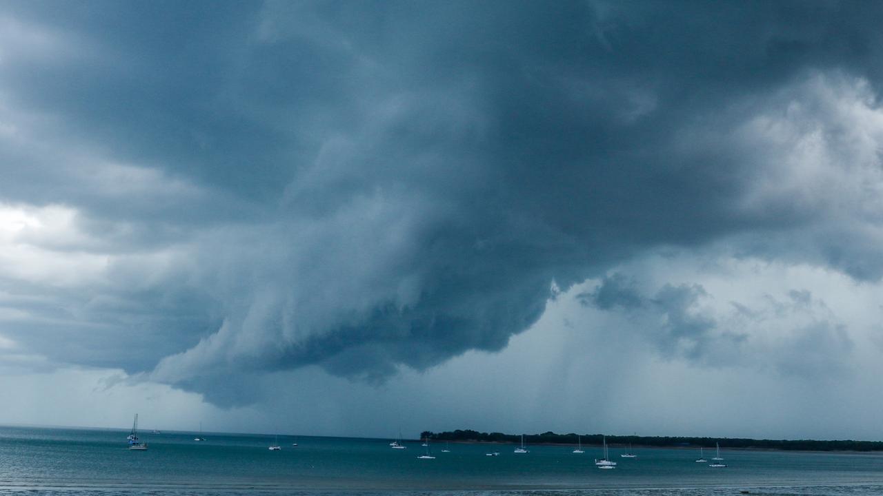
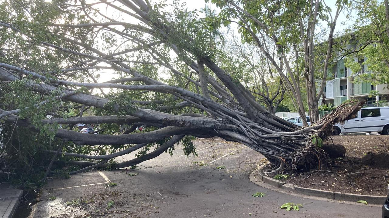
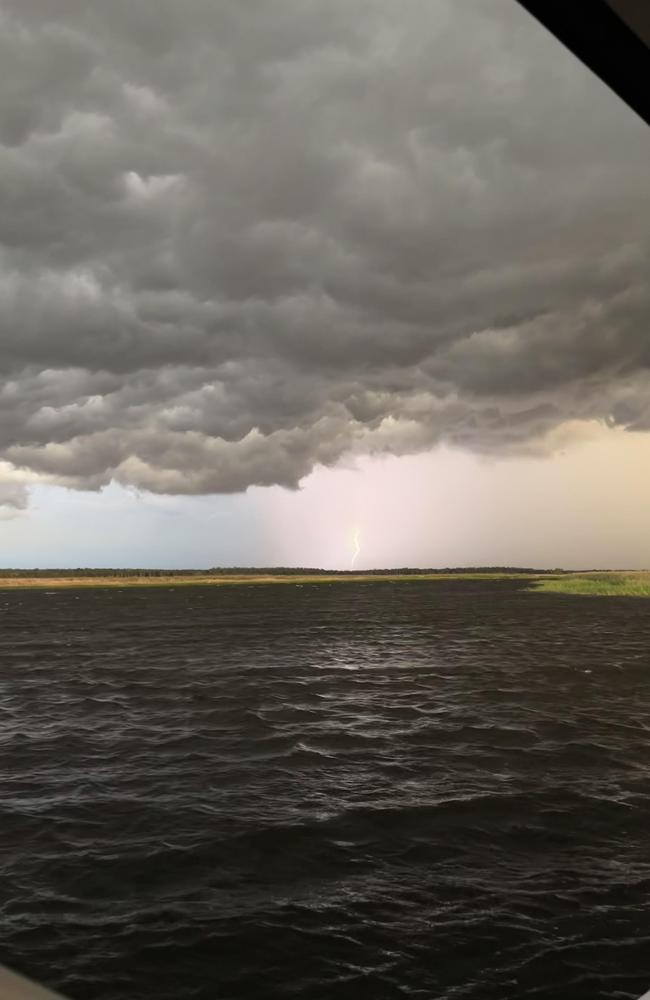
One Darwin weather station was hit with its strongest winds on record since Tropical Cyclone Tracy over the weekend, with a “monster” storm causing trees to fall and power outages across the city.
Meteorologist Anthony Cornelius from Weatherwatch, who has been a severe weather forecaster for two decades, said the storm that came through Darwin about 9pm on Saturday was “unusual”.
“Darwin (Airport) AP recorded a 137km/h wind gust (on Saturday) from destructive thunderstorm activity,” he said.
“Going through the Darwin AP records, this is the strongest wind gust since TC Tracy slammed into the city back in 1974, bringing a 217km/h gust.
What a storm that rolled through Darwin this evening! #lightning#darwinstorm#bomdarwin#weathergirl#wetseason#darwin#nt#skynewsweather#abcdarwinpic.twitter.com/IX7JqRmJHR
— Caroline Brooksby (@Caro_brooksby78) October 8, 2022
“This is also the strongest to occur in any month, excluding December.
“The Top End’s strongest storms usually occur further inland, so it’s a little bit rarer to see a storm of that intensity impact Darwin
“It was also unexpected as it wasn’t necessarily a day you would forecast a storm like that to occur.
“It’s a good reminder to always be careful of any thunderstorm that comes through the Top End.”
Tropical Cyclone Tracy, which led to 66 fatalities and destroyed most of Darwin, had a profound impact on how Australians perceived the threat of cyclones.
While the official recorded wind speed was 217km/h the measuring equipment at Darwin Airport broke during the storm so the real ferocity will never be known.
A PowerWater spokeswoman said the storm on Saturday night saw multiple lightning strikes and debris including tree branches and palm fronds impact the power supply network.
Power outages stretched from as far south as Darwin River to Palmerston, as well as most suburbs across Darwin.
All affected areas had power restored by 11.20pm.
One resident said the weather event was an “awful” thing to drive though.
“Couldn’t see a damn thing and so much debris being blown into my car,” Tori Starr said on Facebook.
“The rain was horizontal at my place, I’m shocked all the trees are still there,” Caren Beazley said.
“It was a monster storm.”

“Lived here all my life and never seen the sky flash green with the lightning as much as it did,” Jen Eric said.
Mr Cornelius also said the storm brought a significant bout of rain.
“The storm also dumped another 33mm in the city, bringing the October total to 125mm (on October 9),” he said.
“(That’s) nearly double the 70mm October average.
“This is still well off the wettest total of 338.7mm set in 1954.
“No coincidence, another strong La Nina year, as La Nina’s often result in earlier than normal wet seasons.”
“2022 continues to provide us with no shortage of significant weather events.
“No doubt there will be, unfortunately, many more before this La Nina is over.”
The Top End’s wet season officially started on October 1.
The Bureau of Meteorology is predicting a greater risk of an above average number of tropical cyclones and tropical lows this season.
It is also predicted that the weather systems could form from November, earlier than usual.
Australia has an average of nine to 11 tropical cyclones each year, with around four crossing the coast in an average season.
The PINT v Palmerston match has been called off due to a monster storm smashing TIO Stadium (and the rest of Darwin), game was tied up at 61 each. Both teams awarded two points. pic.twitter.com/66fVW6irhA
— Ben Cameron (@BenCameron4) October 8, 2022
The weather in Darwin on Monday is forecasted to reach 36 degrees with a shower or two, and a possible storm.
In the Red Centre, tops of 30 degrees are expected along with sunny skies and no rain.
Tennant Creek is forecasted to reach 32 degrees in similar conditions.
More Coverage

Originally published as Strongest winds since Tropical Cyclone Tracy recorded in Darwin

30+ photos: All the faces at 2025 Chief Minister’s Cup
Whether it was the racing action, fashion or the plentiful kid’s activities there was plenty to enjoy at the 2025 Chief Minister’s Cup. Check out all the photos.

NT fashion brand founder hit with domestic violence order
An ex-AFL player who set up an internationally acclaimed ‘social enterprise’ clothing brand has been placed under a domestic violence restraining order.

Blockbuster Top End festival aiming to bridge sport and culture
An upcoming Top End festival has the potential to become a ‘nationally significant event’, due to the combination of two blockbuster events and a $150k funding injection.

World acclaimed tourism spot is ‘launch pad for Indigenous success’
A world famous NT tourism destination has also been recognised as a leading trainer of Indigenous students. Read the details.

Teaching STEM with Aboriginal culture can change lives
In Darwin, young people learnt about STEM subjects through totem movements, dancing and storytelling to help encourage cultural pride.

Teenage running sensation dreams of athletics and AFLW success
A year on from becoming the first Warlpiri woman to compete at the Paralympics teenager Telaya Blacksmith is continuing her dream of competing at the top level with her sights now on the World Champs.