
Heavy rainfall warnings remain for Sunshine Coast
Despite Alfred being declared an ex-tropical cyclone, the Sunshine Coast mayor and police are urging residents to stay vigilant with potential flash flooding.

Sunshine Coast
Don't miss out on the headlines from Sunshine Coast. Followed categories will be added to My News.
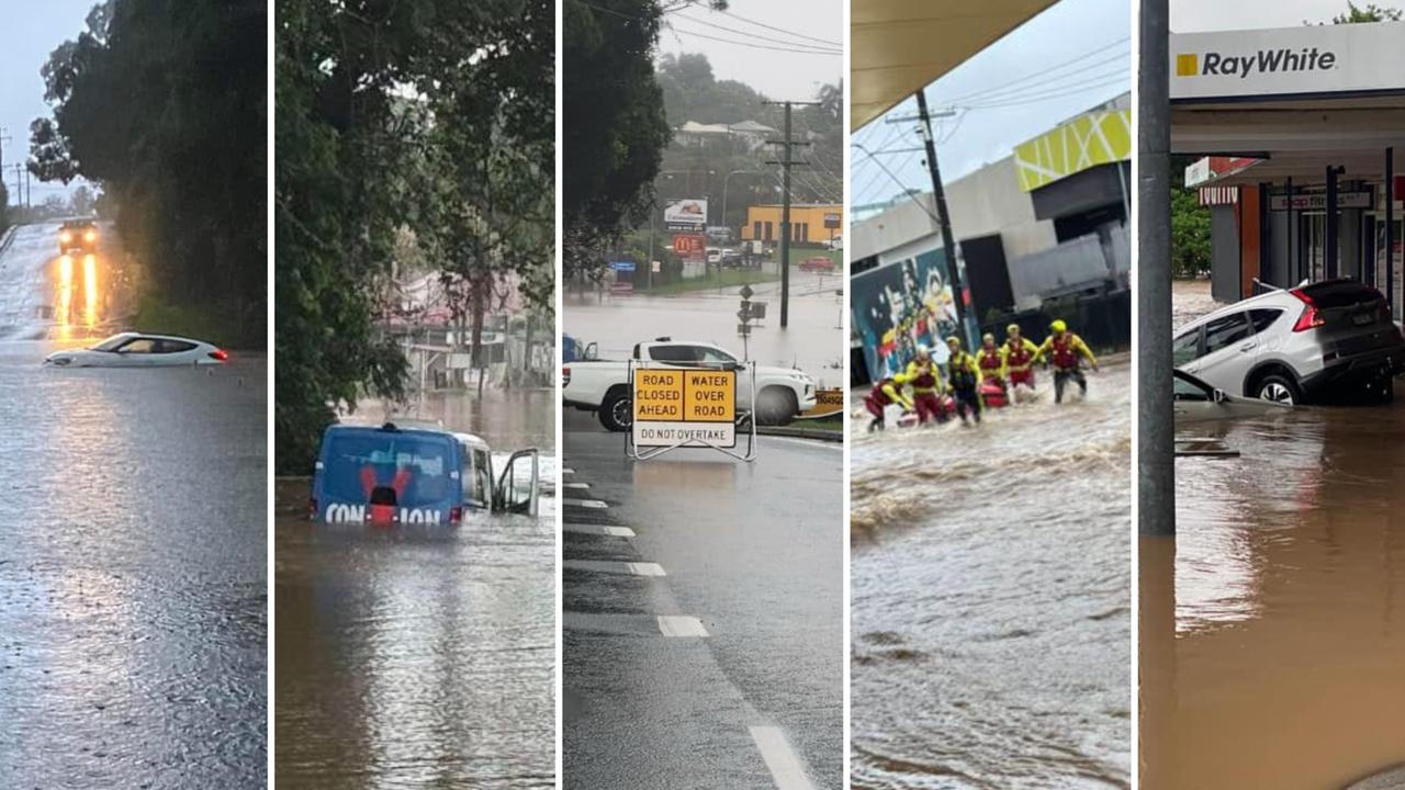
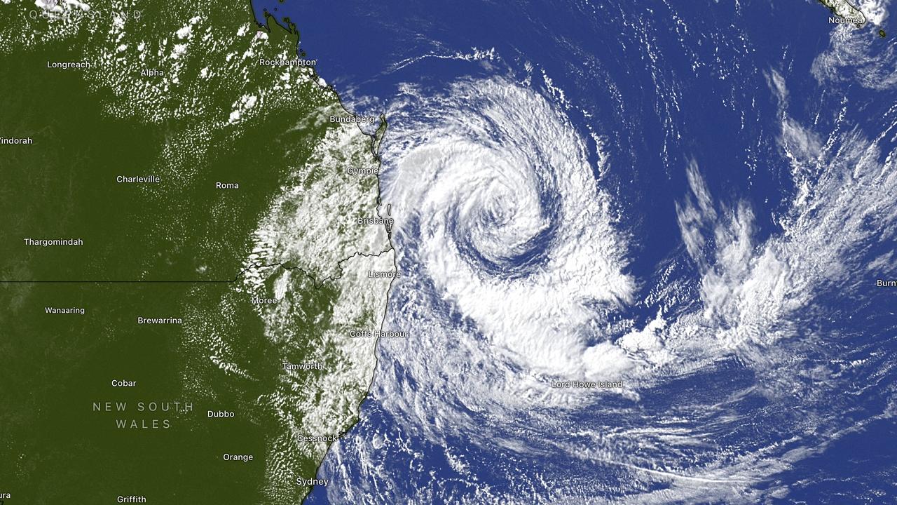
Heavy rainfall lashed the Sunshine Coast overnight and into Monday morning, with ex-Tropical Cyclone Alfred continuing to bring flash flooding risks to the region.
The system was downgraded to a tropical low on Saturday, but the Bureau of Meteorology has warned that intense rain and potential flash flooding remain a serious concern.
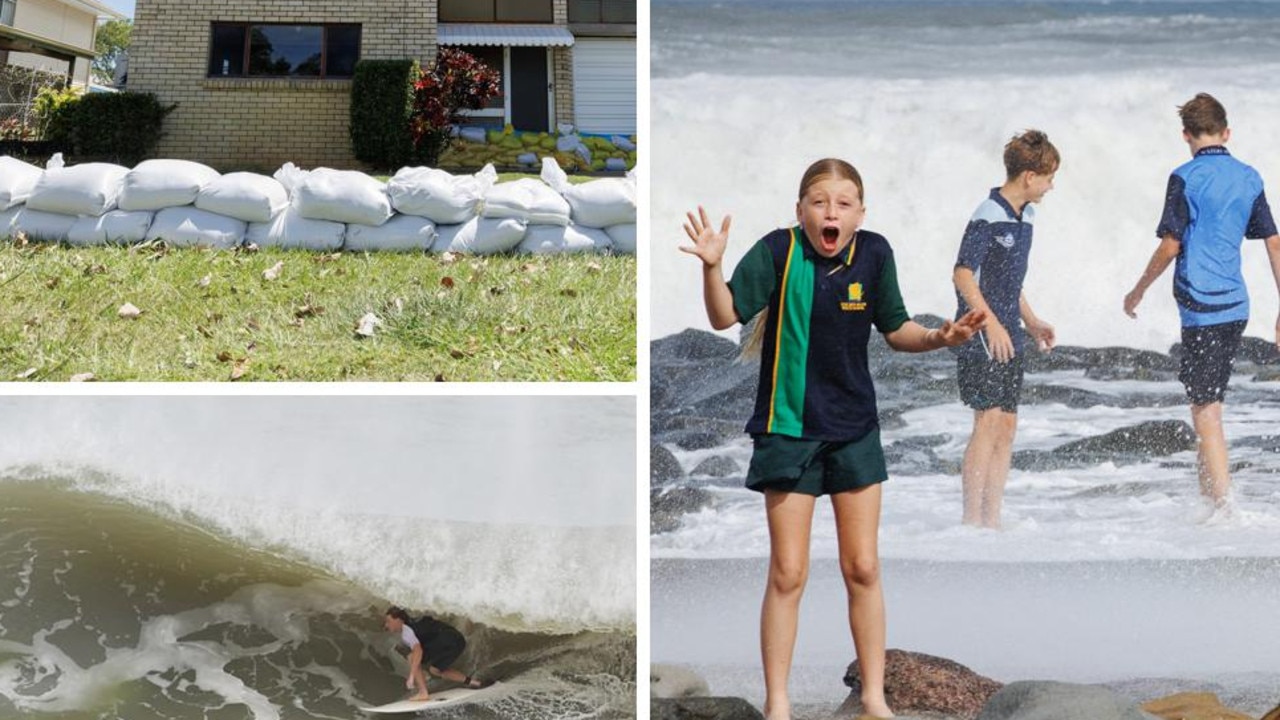
Significant flooding has been recorded across Palmwoods, the Mooloolah Valley, and other Sunshine Coast towns.
Residents have shared videos of submerged roads and swamped cars, with some comparing the flood levels to those seen in 2011.
Heavy rainfall has drenched the region, with Palmwoods Sports Ground recording 352mm by early this morning, followed by Eudlo with 346mm, Nambour with 344mm, Poona Dam with 248mm, Landsborough with 228mm, Tewantin with 117mm, and Beerburrum with 111mm.
A minor flood warning remains in place for the Maroochy and Noosa Rivers, and in Maroochydore, floodwaters were lapping at the footpath along Bradman Avenue around 8am today.
Locally intense rainfall, which could lead to dangerous and life-threatening flash flooding, may continue throughout Sunday in bands of showers and thunderstorms.
The risk of intense rainfall is expected to ease by Monday afternoon, but residents are urged to remain alert, with further warnings possible if conditions worsen.
Mayor Rosanna Natoli told media at a press conference on Sunday and warned residents to remain vigilant as heavy rainfall could still impact the region overnight.
“This is no time for complacency,” she said.
She urged residents to keep their sandbags in place and highlighted that the Mary River remains on flood watch.
Ms Natoli referenced the unfolding flooding crisis in Hervey Bay and highlighted the system’s unpredictability.

Refuse tips will open for free until March 16, and bin collection will resume on Monday.
Meanwhile, Noosa Mayor Frank Wilkie said kerbside bin collection will also return to normal from Monday, with Cleanaway working to clear more than 40,000 missed bins after the disruption caused by ex-Tropical Cyclone Alfred.
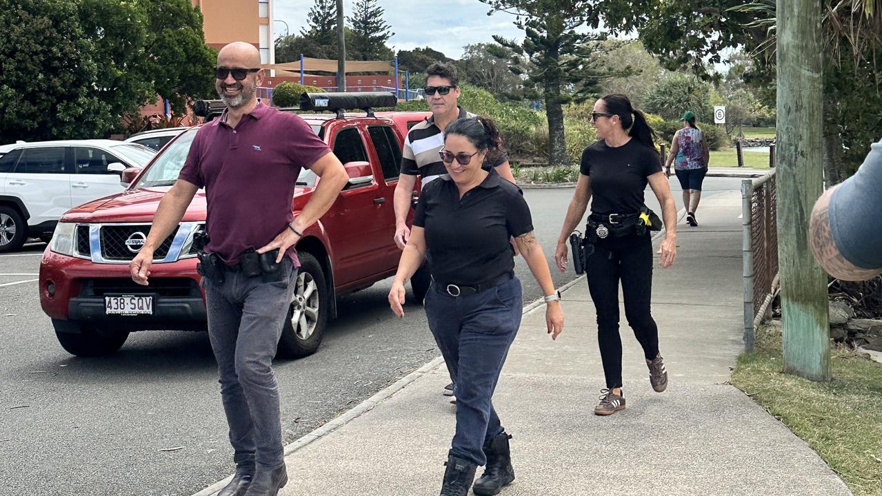
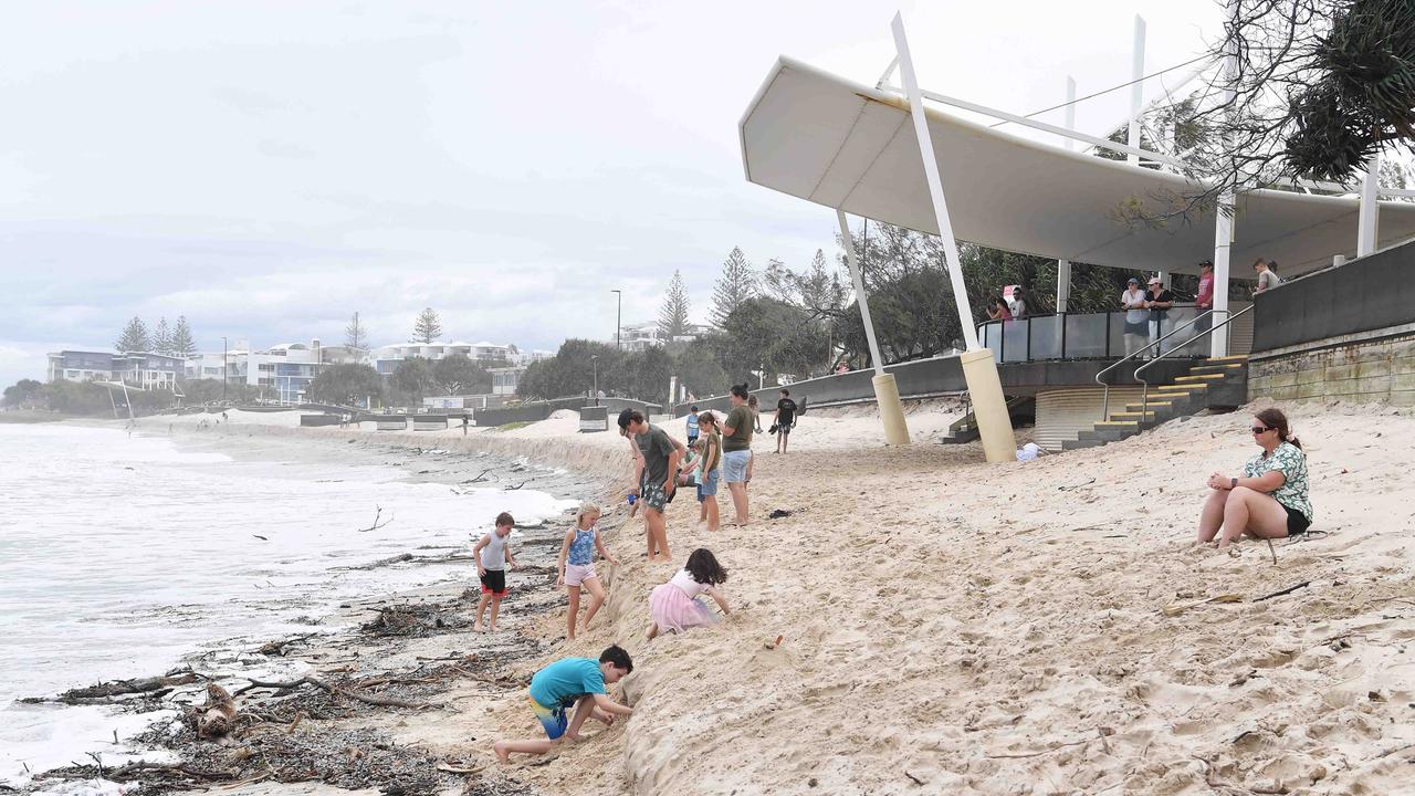
On Saturday, Natoli and Sunshine Coast Police Superintendent Craig Hawkins warned residents to stay away from the sand dunes which has led to some dunes being about 3m high due to coastal erosion.
Noosa Mayor Frank Wilkie said his council area was very fortunate in the impacts from the weather system.
Mr Wilkie said they expected less rainfall than the Sunshine Coast, estimating to be about 30ml to 100ml, with the catchment being “very dry” currently.
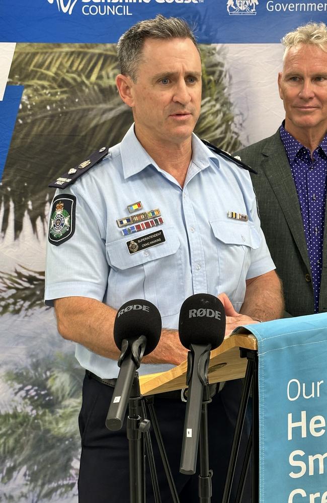
Superintendent Hawkins confirmed there was no opportunistic criminals casing vacant homes or businesses during the weather event, as well as boaties staying off the water following their stern warnings.
“We are not quite through what ex-Tropical Cyclone Alfred is yet to deliver,” he said.
“Over the next 24 to 48 hours we are expecting to see that significant rain.”
The top cop said the area was fortunate it was not suffering from the “catastrophic events” occurring in Brisbane and at the Gold Coast due to the storm cell.
“We on the Sunshine Coast could’ve just as easily been in that situation right now,” Superintendent Hawkins said, thanking residents for heeding their warnings.
“We still have 24 hours to go.”
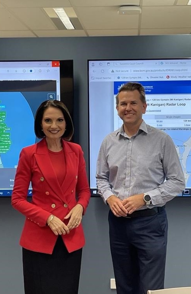
Miriam Bradbury from the Bureau of Meteorology explained that a cyclone’s category is determined by wind speed, not rainfall.
“The rainfall has been significant and is expected to continue significant through the rest of today and into tomorrow,” Ms Bradbury said.
She said most of the expected rainfall over the weekend will be concentrated in the Gold Coast, Brisbane, and areas just north of Brisbane.
Torrential rain is currently smashing parts of Brisbane, while the Gold Coast has been hit by dangerous flash flooding overnight. More than 290,000 homes are without power.
Abnormally high tides are no longer occurring but are expected to be higher than normal over the weekend.
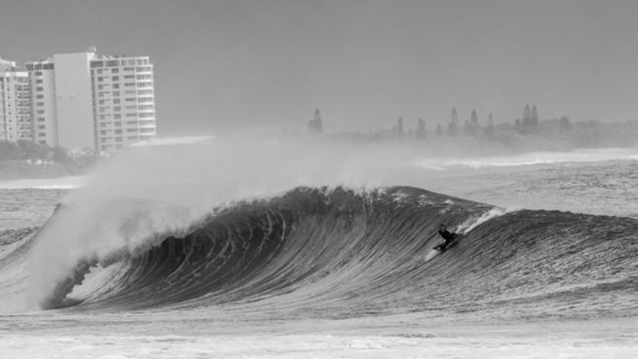
However, damaging surf may continue with significant beach erosion for the open beaches between Noosa and Ballina during the weekend.
The Sunshine Coast region is still forecast to get 30 to 200mm of rain on Saturday and flooding is still possible.
On Friday, police were out in force in parts of the southern Sunshine Coast to support residents in the firing line of Tropical Cyclone Alfred as millions of Queenslanders were warned to stay indoors.
Dozens of plain clothes detectives and uniformed police will conduct patrols along the Caloundra coastline and visit properties in preparation for the imminent arrival of the severe weather system.
Sunshine Coast Mayor Rosanna Natoli said residents were requested to stay inside and off the roads from 6pm on March 7.
“That is for your safety and the safety of our emergency services personnel who may have to risk themselves to come rescue you,” she said.
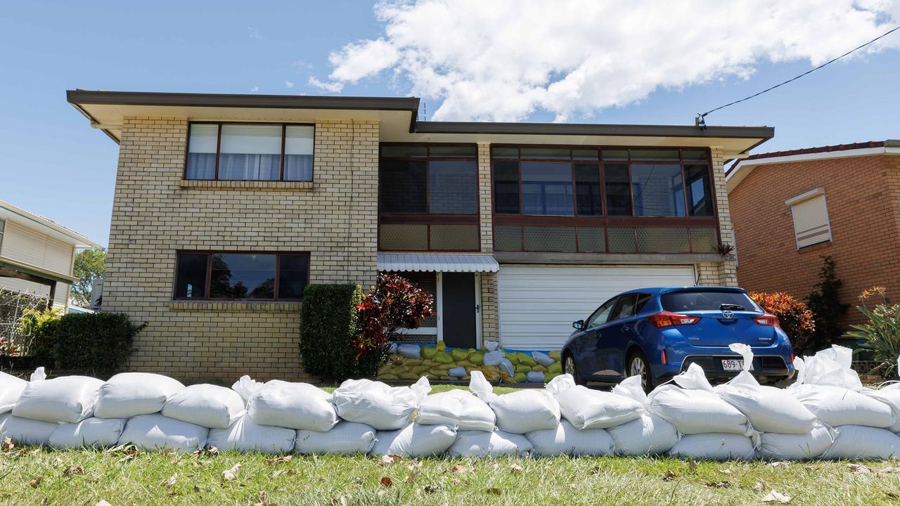
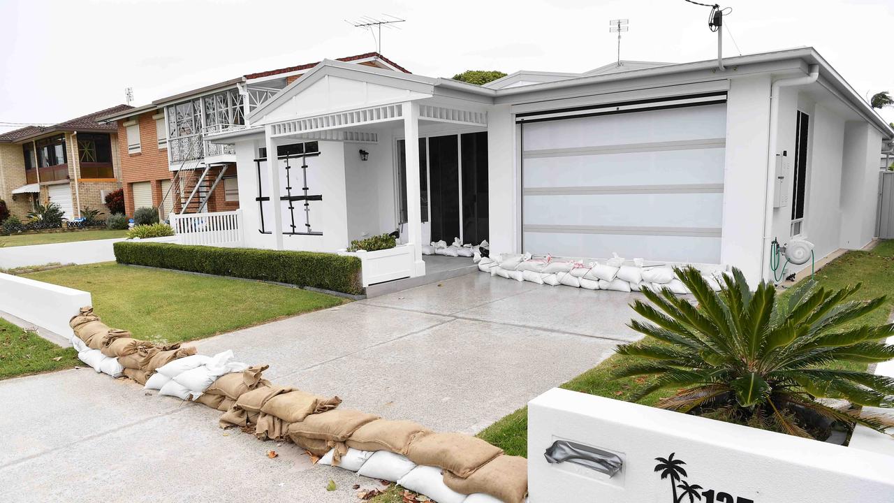
The mayor said 200,000 sandbags had been filled across the coast.
“It’s really an extraordinary effort from individuals,” Ms Natoli said.
The police warning comes as millions of Gold Coast residents were warned to stay indoors and off the roads from 4pm Friday.
Sunshine Coast Police Acting Superintendent Chris Toohey told media at Golden Beach on Friday they were going to areas they’ve previously door knocked to make sure residents were informed, if they feel safe, and to assess vacant homes of those who have left the area.
“The most important message today is we are still in a time of uncertainty,” he said.
“We are looking at now it’s going to be in the early hours of tomorrow morning, even into mid morning.
“The cyclone has changed and continues to change, so with that uncertainty we want people to be prepared.”
Acting Superintendent Toohey said officers were patrolling “24/7” to ensure they were ready to respond to any emergency.
He said they’ve door knocked more than 1600 homes over the last three days to know where vulnerable residents are.
The seasoned cop said officers spoke to a 104-year-old woman who has decided to stay put at Golden Beach.
“She’s feeling pretty good at this stage and pretty confident in her knowledge of the area, but we’re going to make sure because of her age we’ll make sure that we drop in everyday to say hello and make sure she’s feeling okay and feeling safe,” Acting Superintendent Toohey said.
There have also been unplanned power outages around Beerwah, while Kuluin residents reported losing power overnight before it was restored.
Following Bribie Island’s breakthrough, Golden Beach has become a “major area of concern”.
“We recommend you stay with family but if that is not possible, evacuate to one of our centres if you feel your home is at risk,” she said.
“Don’t get complacent as the situation can still be serious.”
She noted any waste taken to the tip will be free in clean-up efforts following the cyclone.
Residents have also been warned by the Sunshine Coast Council to stay away from unstable sand dunes and seawalls.
The Moffat Beach Seawall has shown signs of movements as it cops large swell and falling rocks are likely.
Refuge locations
Three refuge centres were open on the Sunshine Coast as of Thursday morning.
The Nambour Showgrounds opened on Wednesday, with a further two centres opened on Thursday at the Caloundra Indoor Stadium, North Street Caloundra and Landsborough Sportsground at 15 Tunnel Ridge Road, Landsborough.
Sunshine Coast Council Local Recovery Coordinator Greg Laverty spoke at a press conference at the Nambour Showground on Friday morning.
“These facilities are a place of last resort for our residents and our visitors who don’t have any other accommodation that they can rely on at this time,” Mr Laverty said.
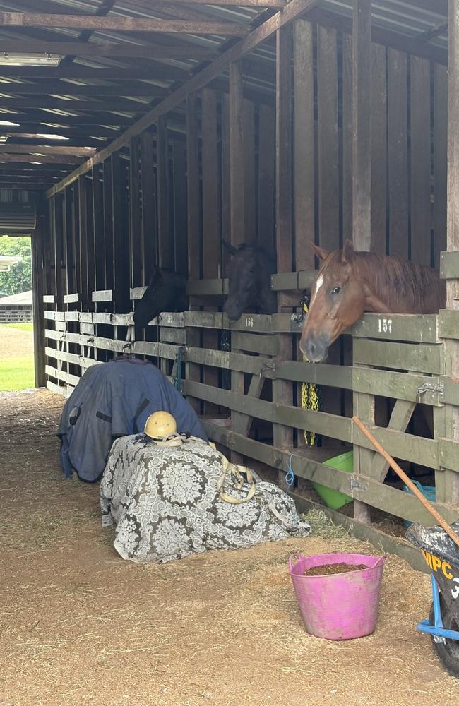
“At the Nambour Showground, there are currently 56 people and just over 50 animals of varying breeds being sheltered.”
He added that the Nambour facility is the only one offering accommodation for people with animals.
“We have 14 people at the Caloundra facility at this time,” he said.
In Noosa, the leisure centre at 9 Wallace Drive Noosaville is open as place of refuge 24/7.
A leisure centre refuge spokeswoman said the centre is prepped and ready, and about 250 people can sit inside.
A Lions Club trailer will be parked outside from 12pm offering hot food to people indeed, regardless of whether they are using the refuge, the spokeswoman said.
Sandbag locations
SES sandbagging locations are closed across the Sunshine Coast for the weekend.
Public transport
The Department of Transport and Main Roads confirmed on Wednesday all public transport would not operate from Thursday until further notice.
Sunshine Coast schools and day care centres closed from Thursday.
The Sunshine Coast Council has released its storm tide mapping that reveals the region’s most at-risk homes.
Flood mapping
The Sunshine Coast Council’s storm tide mapping has revealed where the region’s most at risk properties are ahead of the cyclone’s predicted landfall.
The maps show how high storm surges may get above the highest astronomical tide.
At half a metre above the highest astronomical tide about 1600 homes could be impacted, with 200 of those facing inundation of more than 300mm.
A metre high storm surge would likely impact 4600 homes, with 670 possibly facing more than 300mm of water inundation.
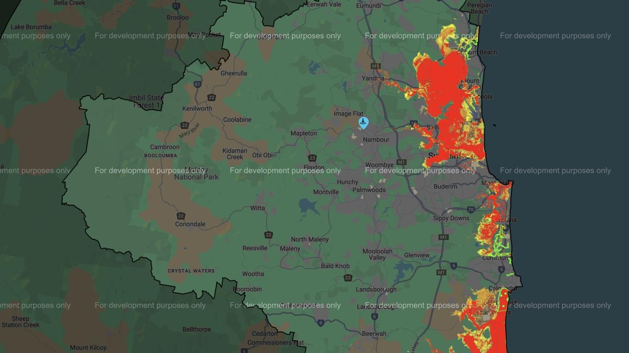
The Noosa Council also released information regarding the storm tide, stating the inundation was expected to be shallow.
“Storm surge caused by Tropical Cyclone Alfred coinciding with high tides around 12.41am Thursday, and 1pm Thursday, may cause some inundation of low-lying areas of Noosaville, Tewantin, Noosa North Shore and Boreen Point – areas that often experience inundation during lower-level river floods,” the report stated.
Time to prepare
Earlier this week, Sunshine Coast Mayor and Local Disaster Management Group chairwoman Rosanna Natoli said the time for residents to prepare themselves, their families and their properties was now.
“Please review our flood mapping on council’s website to understand the potential impacts on your property,” she said.
Closures and cancellations
Courthouses from Gympie to the Gold Coast, including the Maroochydore, Caloundra, Noosa and Nambour courthouses, were closed on Thursday and Friday.
In a direction sent out by Chief Magistrate Janelle Brassington on Wednesday, all courts stretching from Gympie to the Gold Coast were directed to close Thursday and Friday due to warnings issued by The Bureau on TC Alfred.
The Sunshine Coast Cricket Association has also cancelled men’s fixtures for Saturday, March 8 and women’s and junior finals for Sunday, March 9.
Australia Zoo released a statement on Wednesday afternoon, reassuring people the 24 hour wildlife hospital remained open as the zoo monitored the cyclone to determine whether closure of the site would be necessary.
Sunshine Coast Health
Sunshine Coast Health Chief Executive Dr Peter Gillies said the emergency department and emergency surgeries would remain open throughout the cyclone.
Vulnerable members of the community, including those on dialysis, requiring oxygen and pregnant people nearing term will either be brought into the hospital or provided with nearby accommodation.
Dr Gillies said Sunshine Coast Health was working to identify non-urgent appointments to arrange telehealth options.
Inpatients who are able to be safely discharged will be able to return to their homes.
Disaster hub warnings
The Sunshine Coast Council Disaster Hub was available for residents to keep up to date with the latest weather warnings.
Noosa Council also has a number of warnings on its Noosa Emergency Dashboard.
More Coverage


Originally published as Heavy rainfall warnings remain for Sunshine Coast

Tenant’s $25k compo claim from flatmate over eviction ‘humiliation’
A tenant in a South East Queensland share house has tried to claim $25,000 compensation from his flatmate for the emotional trauma of eviction.
Read more

Wises Farm in heart of Sunshine Coast sells for $93.5m
Maroochydore’s famed last farm has been sold to a development company, but the Wises’ legacy will live on following the deal.
Read more

Wedding venue proposed in rescue animals’ sanctuary
A Sunshine Coast campground cared for by a nature-loving couple could undergo an expansion to offer a wedding venue in a peaceful hinterland backdrop.
Read more

Lawyer’s ‘dildo’ Facebook posts bring career to crashing halt
A NSW lawyer who once challenged a Qld seat in a federal election for Pauline Hanson’s One Nation Party has been found guilty of misconduct over a series of anti-vax social media posts and fundraisers.
Read more

‘A real climax’: Ex-Labor MP celebrates national orgasm day
Former Labor MP Jason Hunt has taken community service to the next level by celebrating, wait for it... national orgasm day. THIS IS GEORGE ST BEAT
Read more

Cop accused of stealing car while off duty
A police officer will appear in a Queensland court charged with an off-duty car theft and has been suspended for the alleged act.
Read more