What monsoon weather means for Rockhampton region
One of the region’s most experienced meteorologists says the next six weeks across Central Queensland are usually the most volatile for weather patterns. See his thoughts on a potential flood for the region.

Rockhampton
Don't miss out on the headlines from Rockhampton. Followed categories will be added to My News.
While some rain fell over Rockhampton this week, it could be just a taste of things to come with the weather bureau predicting an increase of tropical activity across the next fortnight.
However, a big question mark still hangs over what will actually happen in the next few weeks - a period which is traditionally the ‘most volatile’ for Central Queensland.
According to a tropical climate update, released earlier this week by the Bureau of Meteorology, a monsoon trough that developed over Northern Australia is expected to deepen and become more active.
According to BoM, monsoon troughs are typically a focus region for heavy rainfall as well as a favoured zone for the development of tropical low-pressure systems.
Modelling currently indicates multiple tropical lows may develop in the broader Australian region in the coming fortnight.
“As the monsoon trough over Northern Australia strengthens from late this week, further tropical lows may develop over land,” the update says.
“These could draw deep tropical moisture further south, potentially leading to significant rainfall over parts of inland Northern Australia next week.
“It is too early to be confident of the location and movement of any lows that may form, but some inland regions could see high rainfall totals and possible flooding.”
So far the trough has already dumped more than 200mm on the far north, with flooding cutting the Bruce Highway north of Bowen and causing flash flooding to the Bowen Hospital.
What monsoon prediction means for CQ
While the northern part of the state has received a deluge from the current monsoon activity just how much, if any, rainfall for the Rockhampton region remains a bit of a mystery.
A spokeswoman for the BoM said the current monsoon activity was tracking further north, leaving the Capricorn Coast reasonably unscathed.
However, a big question mark hangs over what the weather will be doing late next week.
“Things are looking a little bit iffy over the next week,” she said.
“From one point of view, there is a broad low pressure system hanging over New Caledonia and its current general forecast is it will be moving south, but could even move southwest, but there’s not a lot of consensus about what will develop.
“It could move a bit more west and bring a few more showers along the coast, but as it moves south it will probably just affect NSW.
“However, there is a second thing going on where one model wants to ramp something up in Coral Sea from Monday, but the other models don’t, so there is quite a bit of discrepancy over where the monsoon trough and where lows are sitting.”
She explained that once modelling became more consistent, the more clear the extremities, if any, would be.
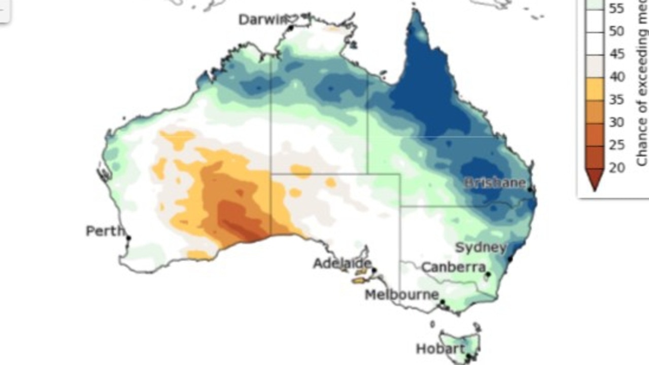
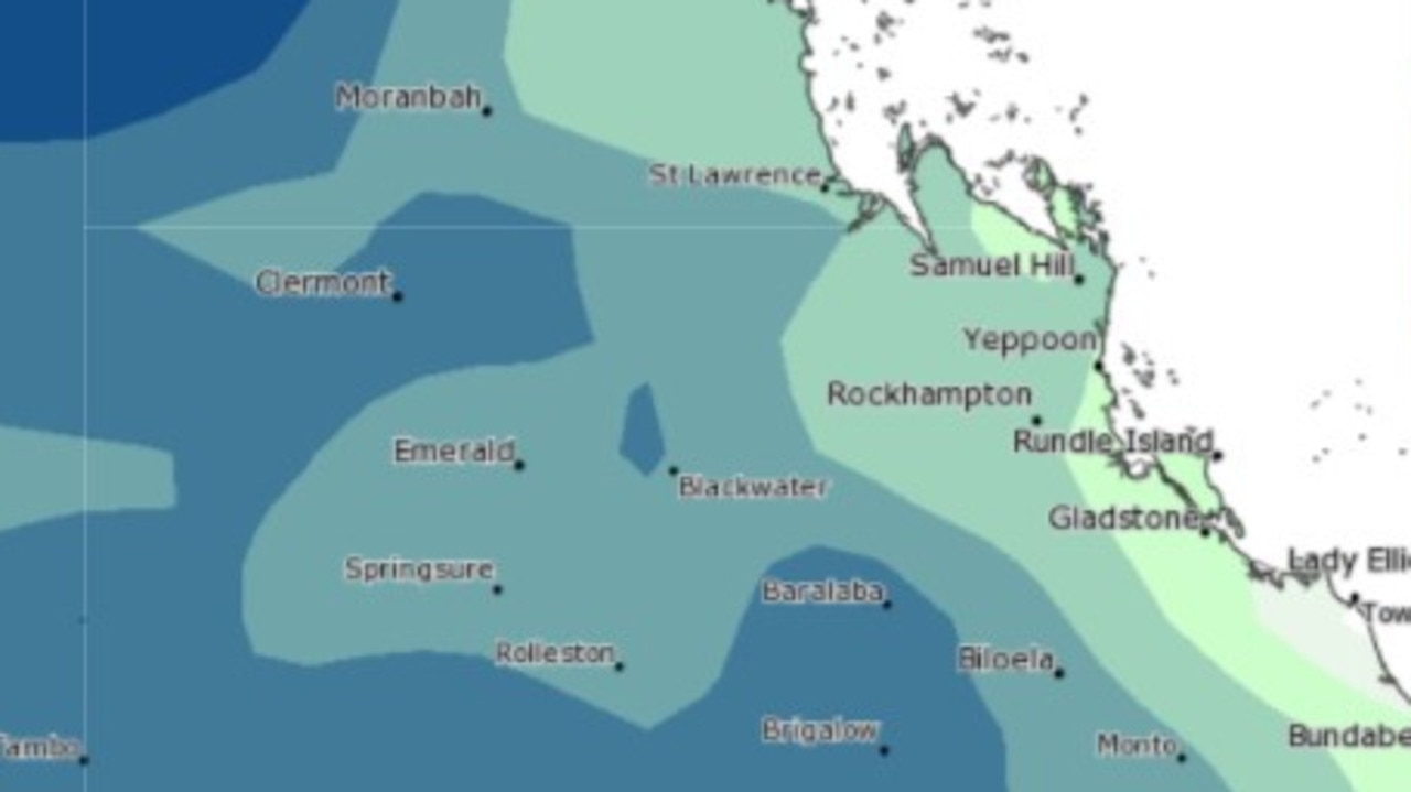
Climate outlook modelling, also released this week, shows some areas of the Rockhampton region have a more than 50 per cent chance of rainfall above the median for this time of year.
There are also areas which have a 20 per cent chance of “unusually wet” weather.
“La Niña conditions continue. Climate models indicate the current La Niña event is likely at or near its peak, with a return to neutral likely in early autumn 2022,” the outlook said.
“This pattern is likely to be contributing to the wetter than median outlooks for parts of eastern Australia.”
Experienced weatherman shares his thoughts
One of the region’s most experienced weatherminds and former Win News weatherman Peter Byrne said the next six weeks were traditionally the most volatile for Central Queensland’s weather pattern.
Mr Byrne said while he wasn’t expecting anything of significance over the next week, a potential flood of the Fitzroy River shouldn’t be totally struck out of the equation in the coming weeks.
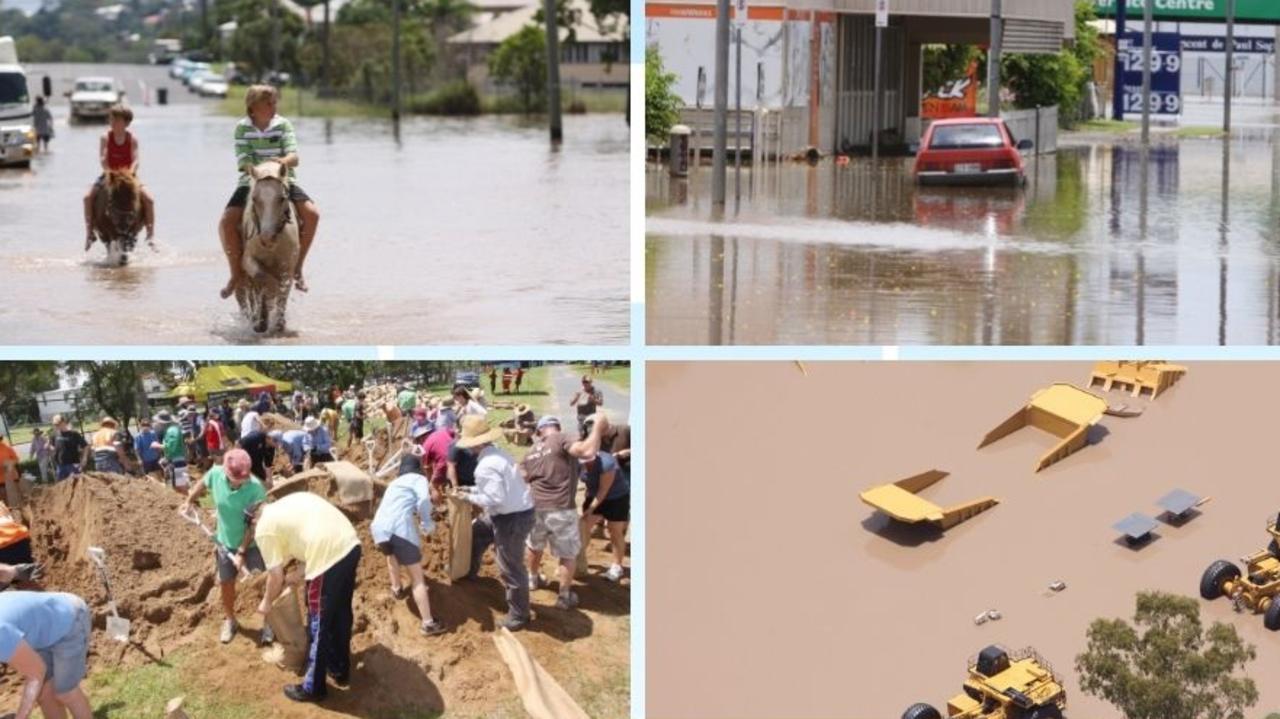
The Fitzroy River at Rockhampton has a long and well documented history of flooding with flood records dating back to 1859, according to the B0M.
The Fitzroy River’s highest recorded flood occurred in January 1918 and reached 10.11 metres in Rockhampton.
In recent times, Rockhampton has exceeded the major flood level three times - in 2011, 2013, 2017 - with the most significant of these three being 2011 when the Fitzroy River reached 9.20 metres.

“Currently looking at the monsoon trough retreating further north, it’s currently south of Cairns,” he said.
“We will probably witness a low over the eastern Coral Sea in the next two or three days, should that eventuate it will probably move further away from coast with no significant impact on Queensland.
“However the next six weeks, between now and the first half of March, are generally the most volatile for CQ.
“I still think the current La Nina can bring home the bacon but I can’t see anything significant locally here for at least the next week.
“Without speculating too much, the next six weeks are generally most volatile so there’s potential (for flood), there’s already been a flush of the Fitzroy. So it remains a possibility over the next six or seven weeks.”
Mr Byrne has been critical of the decision to close the BoM offices that used to be in Rockhampton, saying forecasting could now be “way off the mark without local knowledge”.
He said so far the start to the wet season had been “quite disappointing” with Yeppoon seeing one of the driest starts to the rain period in 15 years.
“For Yeppoon, and this probably translates to a lot of other areas, it’s been one of the driest starts to any year in 15 years and it’s among the driest in a third of the century,” he said.
“We’re looking at a pronounced ongoing rainfall deficiency in the area despite all media hype and BoM talking about La Nina.”
More Coverage
Originally published as What monsoon weather means for Rockhampton region

