
Queensland weather: Hail, severe thunderstorms forecast for southeast, Darling Downs and Wide Bay
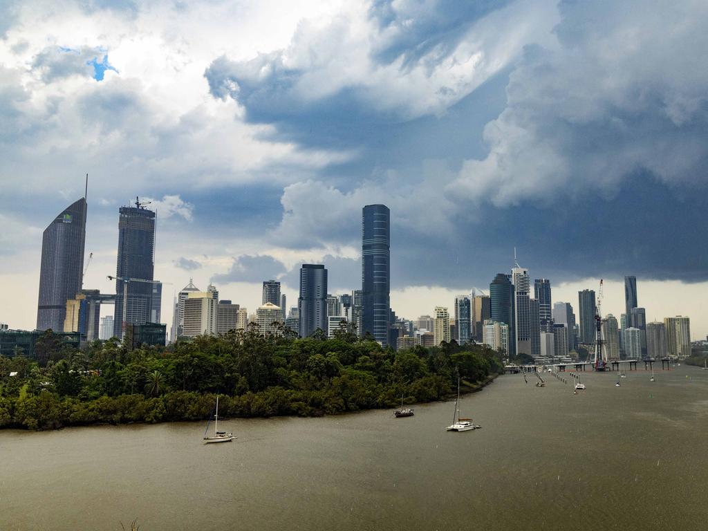
Areas from Brisbane north to Bundaberg are on high alert over coming days with hot conditions and instability triggering an elevated thunderstorm risk.
QLD News
Don't miss out on the headlines from QLD News. Followed categories will be added to My News.
Severe thunderstorms bringing destructive winds of more than 90km/h and large hail are forecast for South East Queensland in coming days, with the “peak” of storm activity arriving Tuesday.
A stalled trough in central Queensland is drawing northerly winds from the tropics, generating an elevated thunderstorm risk.
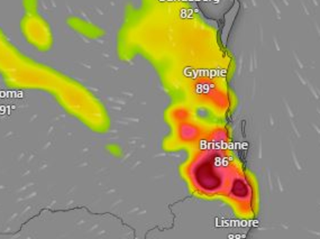
The Bureau of Meteorology’s Steve Hadley said storms had already occurred across the western interior in the past 36 hours, with wind gusts of 120km/h detected at The Monument, west of Longreach, at 106km/h at Mt Isa.
“Heat and instability up north is going to be similar today. We could see some isolated thunderstorms with damaging wind gusts this afternoon,” Mr Hadley said.
“We’re also expected some thunderstorms in parts of central and southern Queensland.”
Mr Hadley said a north-easterly sea breeze meant storm activity would be minimal along the coastline today, but inland areas could be in the firing line.
“We will most likely see those thunderstorms through inland parts of the east on Sunday afternoon, including the Esk and Somerset region, the Sunshine Coast and Fraser Coast hinterlands and up into parts of the Central Highlands.
“Where those thunderstorms occur we could see some hail and gusty winds,” he said.
Mr Hadley said storms were possible on Monday from Brisbane to Bundaberg, and inland to the Central Highlands.
“This will really peak on Tuesday. The picture is severe thunderstorm activity possible through central and South East Queensland looking at anywhere south of Emerald and Rockhampton and east to Tambo,” Mr Hadley said.
“It’s a big area but the activity is more likely through the southeast coast, Wide Bay and Burnett regions and the eastern Darling Downs.”
Mr Hadley said heavy rain and localised flash flooding was possible, but due to many of the catchments remaining dry, the risk of flooding is not as severe.
However, there is a large hail and damaging wind risk.
“It could be an eventful few days as we see this storm activity culminate in the southeast on Tuesday, but we will see this receding northwards and westwards on Wednesday as the cooler air makes its way from the south,” he said.
Temperatures are expected to remain in the mid to high 30s for much of the southeast with Ipswich recording a sweltering 36C on Sunday.
Mr Hadley said maximum temperatures were expected to remain 5-7C above average, but would not be record-breaking.
He warned the hot, stormy conditions would be dangerous for firefighters currently battling fires in central and western Queensland.
“We’re hopeful to get a burst of rainfall today in those places, but with the thunderstorms and gusty winds its going to be really trick for firefighters on ground with no massive dumps of rainfall unfortunately.”
Originally published as Queensland weather: Hail, severe thunderstorms forecast for southeast, Darling Downs and Wide Bay
Police launch investigation after armed raid at tobacco store overnight
An armed raid was carried out overnight at a shopping centre in Brisbane’s south, in which two armed men allegedly escaped with cash and cigarettes.
Crisafulli backs coal royalties amid Labor scare campaign
David Crisafulli has rejected a Labor “scare campaign” while Steven Miles has spruiked cost of living measures as they responded to a reader question on coal royalties.

‘Scrap it’: Qld politician seeks to dethrone King’s Birthday holiday
Queensland’s longest-serving politician, Paul Tully, deems the King’s Birthday holiday a royal jest, urging it be replaced by Environment Day for a greener future. CAST YOUR VOTE

Vote now: Which reader question should our leaders face?
Steven Miles and David Crisafulli are being put under the pump by Courier Mail subscribers this election. Help decide which question they will be grilled over.
Premier demands Gabba truth from Crisafulli
Steven Miles has called on David Crisafulli to be honest about his plans for the 2032 Games as the Opposition leader once again rejects QSAC and dismisses the need for a new stadium.
Man dies in boating tragedy on popular Qld waterway
A man has died after the boat he was skippering with a passenger on board overturned in a popular Queensland waterway.