
Queensland weather: 110mm downpours, 5C minimum as massive rainband sweeps across the country
Torrential rain and dramatic temperature drops are forecast for large parts of Queensland as a 3000km rainband sweeps across Australia.
QLD News
Don't miss out on the headlines from QLD News. Followed categories will be added to My News.
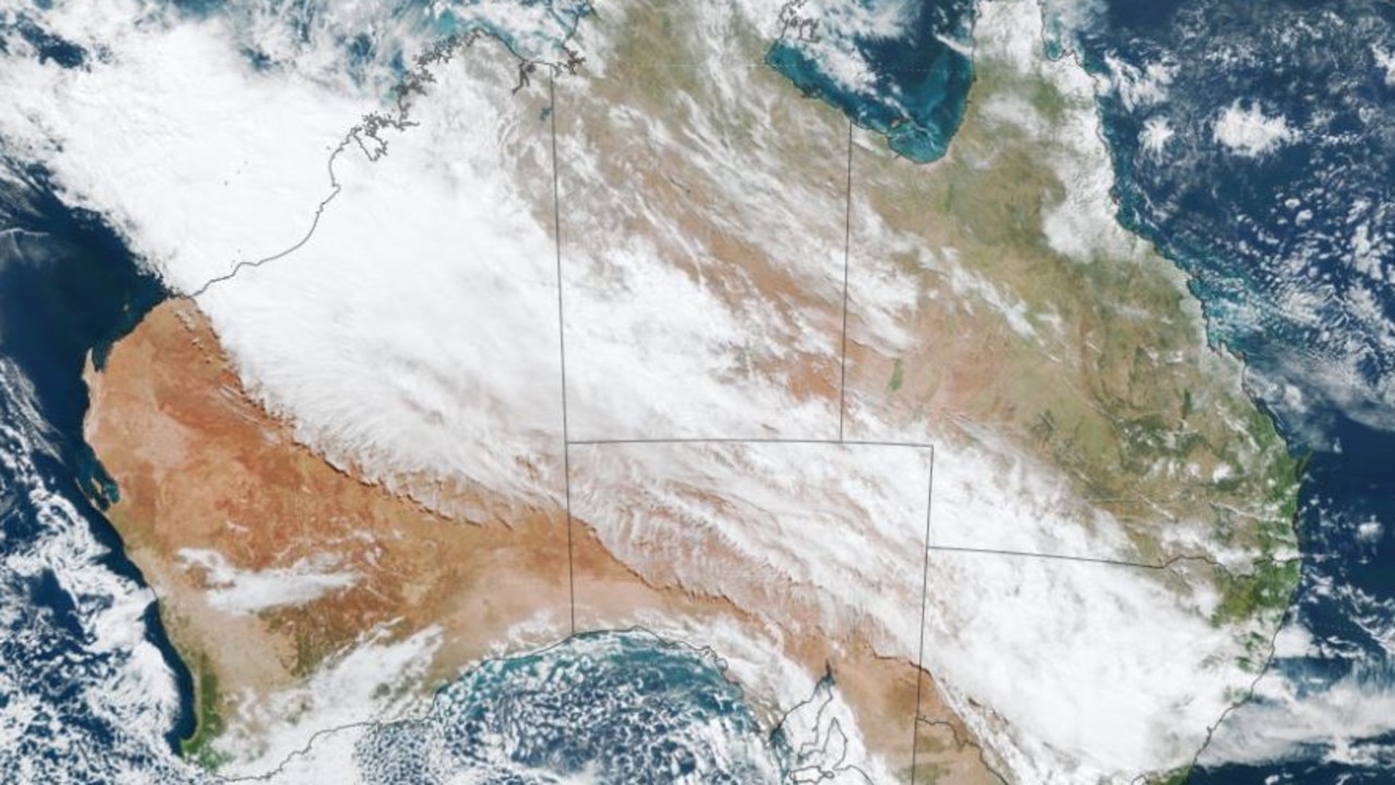
A 3000km rainband is sweeping across Australia towards Queensland bringing with it torrential downpours and dramatic temperature drops.
The northwest cloud band currently stretches from northern Western Australia into western Queensland and northern NSW.
Caused by tropical moisture flowing over Australia from the Indian Ocean, it is sweeping southeast with falls over 100mm forecast for central Queensland.
The most significant rainfall is forecast for Rockhampton, with 60mm on Friday followed by 45mm up to Monday.
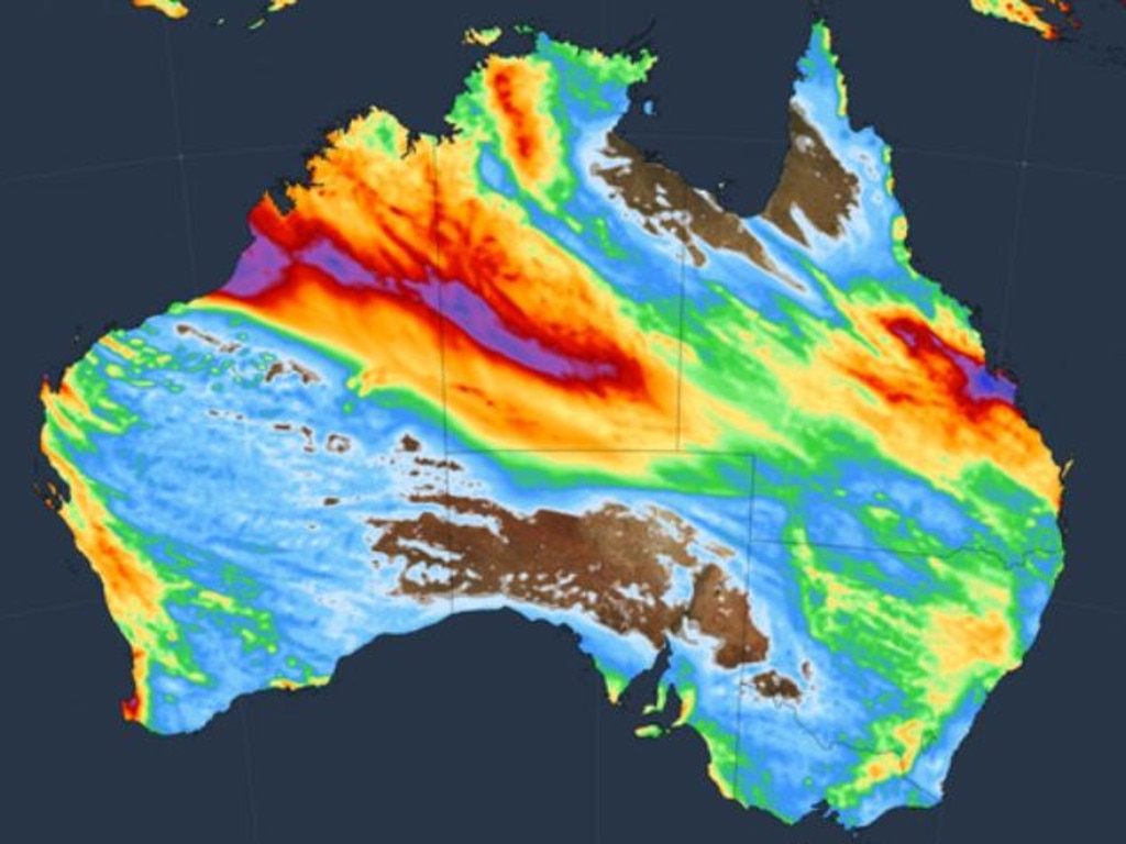
Gladstone is forecast to receive almost 100mm over four days from Friday with 70mm expected for Biloela, 110mm for Yeppoon and 85mm for Emerald.
South East Queensland will feel the impacts with over 40mm expected in Brisbane from Friday and 80mm on the Sunshine Coast.
“This week’s northwest cloud band will cause rain to spread over northern WA and large areas of the NT and Queensland, spanning an area roughly 3000km in length,” Weatherzone’s Ben Domensino said.
“This rain could cause outback flooding, which may cut off roads and isolated remote communities.”
In terms of temperatures, minimums will drop to 12C in Brisbane and 10C in Gatton on Thursday while Stanthorpe on the Granite Belt could get as low as 5C on Wednesday and Thursday.
“Brisbane today is going for 29 degrees, but dropping back to 23C. Then as things continue to be a bit cooler, the minimum temperatures will also trend down,” BOM meteorologist Daniel Hayes said
“Tomorrow morning we are forecasting around 14C, but then 12C by Thursday.
“We will see things cool off, particularly once the winds drop off there on Thursday morning. Even though that cool air will have moved through and we’ll see the maximum temperatures be cooler tomorrow, not quite so pronounced with the drop in the minimums, because it’ll still be relatively breezy.”
Mr Hayes said there’s a slight chance of showers developing this afternoon, with the possibility of thunderstorm activity across the Maranoa, Warrego, and Darling Downs regions.
“We are looking at a system moving through over the next day or two that will bring a shift in temperatures. At the moment around the south east we have a fair bit of fog in place, relatively light winds overnight and a bit of moisture in the air so we have seen that fog develop,” he said.
Originally published as Queensland weather: 110mm downpours, 5C minimum as massive rainband sweeps across the country

Watch: Police release CCTV after fight at Wynnum pub
Police have released footage of two men who they believe may be able to help their investigation into an assault at Wynnum this month.

‘Told the girls to run’: Dire warning after heinous national park act
A support worker’s day out with two young girls turned to horror when they came across a man in a popular national park.

GALLERY: 110+ fabulous faces at Childers Festival 2025
Stilt walkers, drummers and dancers turned Childers’ main street into a magical carnival at the weekend as the town’s signature festival drew record crowds.

Hospitality giant’s eye-catching addition to SEQ dining dynasty
One of Brisbane’s most rapidly expanding hospitality groups is set to gain another venue.

Butt-plugs and shoeys: Inside Australia’s most bizarre nightclub
We’ve discovered Australia’s weirdest and wildest nightclub, from cocktails poured from Seinfeld artworks to buyable kink paraphernalia and vintage goods. WATCH THE VIDEO.

Woman allegedly sent bomb hoax messages to school, childcare
A Brisbane woman has been charged after she allegedly sent bomb hoax messages to a local high school and childcare centre.