
Police issue warning as parts of Queensland begin to flood
Severe storm warnings for regional Queensland have been cancelled as a rain band persists across much of the state.
QLD News
Don't miss out on the headlines from QLD News. Followed categories will be added to My News.
The Bureau of Meteorology has cancelled severe weather warnings for some parts of Queensland, as the state battens down for more wild conditions.
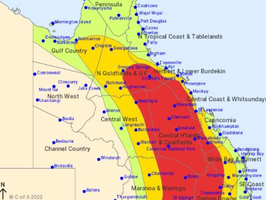
The bureau said storms were no longer occurring in the Northern Goldfields and Upper Flinders, Herbert and Lower Burdekin, Central West, Capricornia and Wide Bay and Burnett districts.
Severe weather warnings in the Central Coast and Whitsundays district have also been cancelled as the trough continues to move southeast.
WET WEATHER CHAOS: 26 CRASHES, IPSWICH ROADS FLOODED
The areas of St George, Rolleston, Springsure, Bogantungan and Mungindi remain at risk of damaging winds, large hailstones and heavy rainfall that may lead to flash flooding, according to the bureau.
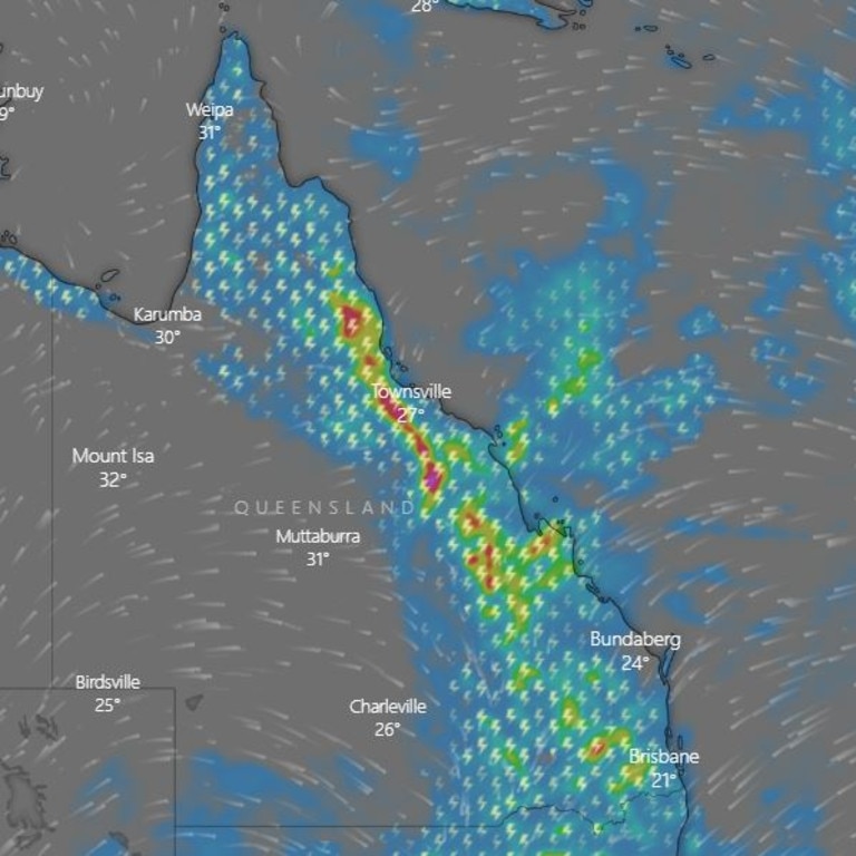
Earlier, bureau forecaster Helen Reid said the heaviest of the falls on Thursday would be similar to areas impacted Wednesday, “just slightly further east”.
“It is a very slow moving system so even though it is still moving, a lot of people through central Queensland will get almost a repeat today of what they had yesterday,” she said.
The highest accumulated rainfall since 9am Wednesday was recorded at Gladstone with 116mm.
In the central highlands, areas like Middlemount received just under 100mm with 97mm and Benaraby 91mm.
“Today we could certainly see similar rainfall, but if you end up under a storm it can be really hard to know how much might fall then,” Ms Reid said.
Up to 15mm can be expected in Brisbane on Thursday, the Bureau says, increasing to 35mm on Friday, and 40mm on Saturday.
To the north, 51mm was recorded in the hour to 1pm on Thursday at Glen Rock Alert (southwest of Emerald), 46mm in the 30 minutes to 11.30am at Dalbeghile, and 47mm in the 30 minutes to 11.30am at The Stonewall Alert (southeast of Collinsville).
“The end of the week will certainly shape up to be a bit more exciting,” Ms Reid said.
Rainfall totals will decrease to 25mm on Sunday, 10mm on Monday, and 5mm on Tuesday.
The Bureau’s storm forecast for Thursday said severe storms are likely across large swathes of the state, stretching from the Northern Goldfields north of Charters Towers south to the border stretching as far inland as Barcaldine and Charleville.
Revealed: What it’s like inside a Category 5 cyclone
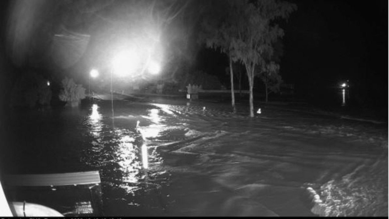
Wivenhoe Dam is today continuing sporadic releases of water to free up capacity. This morning it was sitting at 85 per cent capacity.
Releases have flooded Savages Crossing and Wivenhoe Pocket Road near the dam gates at Fernvale.
QPS said this new warning comes after a record number of Queenslanders have lost their lives due to flooding.
“Sadly, this year severe weather and flooding has seen motorists, pedestrians and boaties unnecessarily lose their lives and police are again issuing a public plea to heed the warnings and advice of authorities and to rethink their need to travel during intense, heavy or persistent rainfall or severe weather events” they said.
Police are also urging Queenslanders to rethink travel plans, and to avoid all unnecessary travel.
“Members of the public are urged to avoid roads, creeks and bridges likely to be impacted by rapidly rising water, storm debris and flood damage,” they said.
“Motorists are also reminded that road closures and road conditions can and do change rapidly, often within minutes.
“Intense rain, damaging winds and embedded severe thunderstorm activity can result in extremely hazardous conditions on roadways.
“Trying to navigate these hazards, either in vehicles or on foot, can be treacherous, as water levels rise and fall quickly, and very often with little or no warning.”
Motorists were asked to exercise caution if driving, and plan their trip accordingly.
“If driving please travel with extreme caution and drive to the prevailing weather and road conditions – plan your trip, allow additional travel time, incorporating travelling at lower speeds, delays and diversions and remember: ‘If it’s flooded forget it and just back it up,’ ” police said.
“Parents are also reminded to ensure their children are not playing in flood-prone waterways, watercourses and drains.”
DRAMATIC FLOOD RESCUE
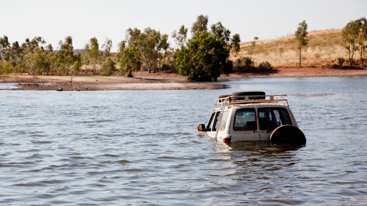
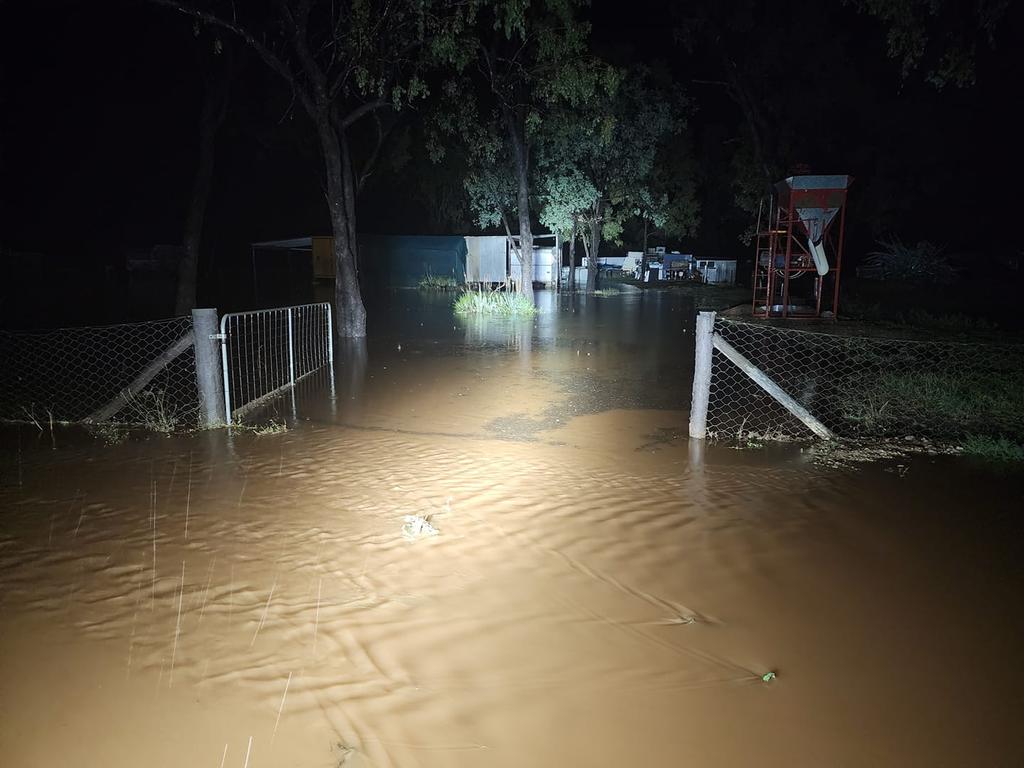
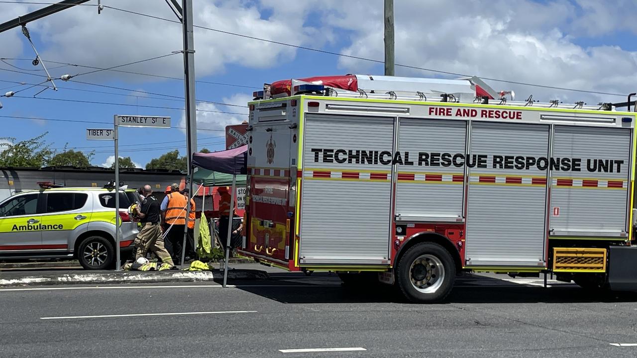
A woman in Central Queensland has been pulled to safety in a dramatic rescue after her car became submerged in flood waters near Mackenzie River, as parts of the state prepare for further flooding as a sizeable rain band travels across the state.
Emergency services received the initial call at 7.17pm but were unable to get to the woman until 9.48pm due to flooded roads.
A QAS spokeswoman said the woman attempted to drive through flood waters on Mount Stuart Bedford Weir Rd with her ute, before the vehicle began to sink.
The spokeswoman added that the stranded motorist was hanging on to the back of her vehicle for more than 90 minutes before rescue crews arrived.
QFES and SES enlisted the assistance of local mining company Gregory Mines to assist in the rescue with the use of their larger vehicle.
The woman was treated by paramedics at the scene, but was unable to be transported to hospital as emergency services had to wait for flood waters to recede.
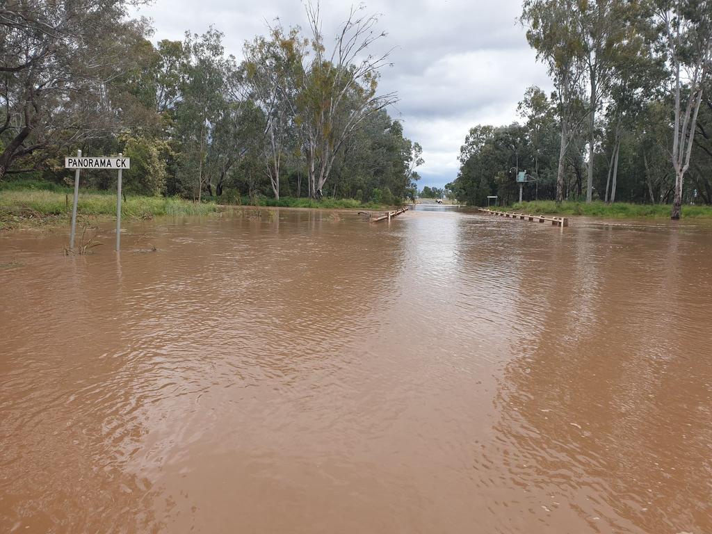
People living in the Central Highlands are experiencing flash flooding as severe storms with heavy rainfall batter the already drenched region for the second night in a row, knocking out power in some areas.
Multiple roads, including parts of the Capricorn Highway and Gregory Highway, were closed across Central Queensland on Wednesday morning after a slow-moving weather system dumped huge amounts of rain.
Gregory Highway 5km north of Emerald is closed at Theresa Creek due to flooding. If it's flooded, forget it. #qldtrafficpic.twitter.com/UzFnkQDVb3
— Queensland Police (@QldPolice) October 19, 2022
The Central Highlands Regional Council on Wednesday evening warned residents flash flooding is occurring due to ongoing heavy rain and ‘more is still to come’.
Gladstone Airport received more than 115mm of rain since 9am yesterday, while Gladstone itself got 88.8mm in the same time frame.
Emerald got another 42mm, off the back of big falls on Tuesday.
More Coverage
Originally published as Police issue warning as parts of Queensland begin to flood
Join the conversation

Struhs sentencing delayed as Elizabeth’s killers reject legal help
The religious hardliners who killed a little girl taken off lifesaving insulin as a test of faith have ruled out obtaining lawyers ahead of sentencing, which could occur later this week.
Read more

Wife’s anguish after popular street artist’s shock death
The family of a much-loved Queensland artist who died from a sudden heart attack soon after a devastating workplace incident has spoken of their grief as they adjust to life without their ‘best mate’.
Read more
Trains suspended after man in wheelchair hit at Brisbane station
Emergency services have rushed to the Coorparoo train station after reports a person was hit, causing trains in the area to be suspended.
Read more

Cockpit capers: Escort agency’s mile high Qld escape with gigolo pilot
A major Australian male escort agency has expanded into Queensland to offer women experiences including romantic flights to the Whitsundays with a pilot who doubles as a gigolo, a $21k “ultimate pleasure week” and a Pierce Brosnan lookalike.
Read more

Brisbane bus driver flaunts MAGA hat as tensions rise in union battle
A Brisbane bus driver has been spotted wearing red MAGA hat as tensions ramp up with union members.
Read more

‘Miss Purr’ not at work after widespread backlash
A teacher who referred to themselves as a cat, asked students to call them “Miss Purr”, hissed and licked the back of their hands is no longer working at the school after widespread condemnation.
Read more