
What CQ can expect from forming cyclone
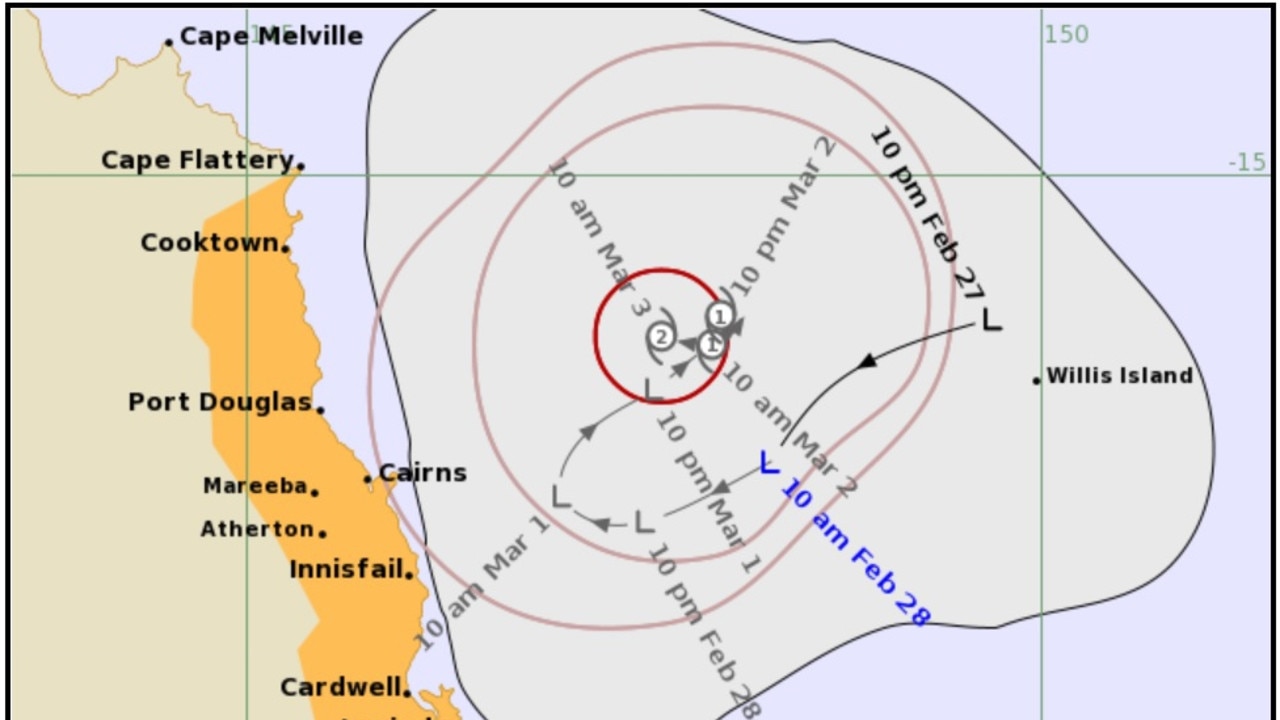
Current models show the cyclone will track towards the south east later this week bringing strong winds and rain.

Gladstone
Don't miss out on the headlines from Gladstone. Followed categories will be added to My News.
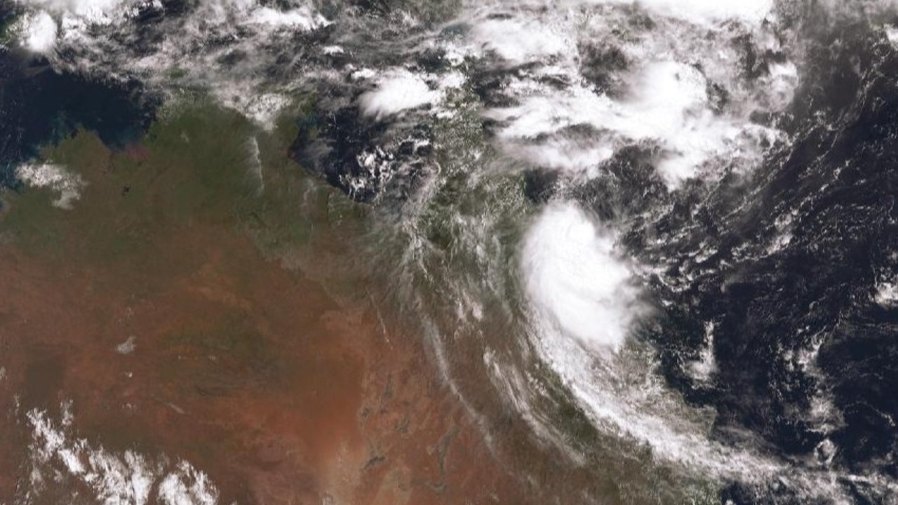
A cyclone predicted to form off Cairns in the coming days will begin to impact the Central Queensland region from Wednesday or Thursday, says the Bureau of Meteorology.
Meteorologist Matt Marshall said the tropical low, which was on Sunday sitting about 240km east of Cairns, would be called tropical cyclone Niran.
“We have issued the first tropical cyclone advice and also a tracking map for what is currently a tropical low,” he said.
“It is forecast to develop into a tropical cyclone in the coming days.
GREAT DEAL: $1 for the best local news, great rewards
“Currently we are expecting it to remain offshore, but its impacts will be felt along the coast.
“The next name on the tropical cyclone list is Niran...there doesn’t look like any other cyclones will form in our region before this one.”
The proximity of the cyclone to the coast, Mr Marshall said, would determine the severity of the impact between Mackay and 1770.
Mr Marshall said the situation was developing and tracking models could change by the time it reached the Central Queensland region.
“Mid to late this week it’s going to start to make its journey down toward the southeast, but current models have it remaining offshore as it does so,” he said.
“This will be felt mostly on the Central Queensland coast with the winds picking up on the coastal waters, the boaties will really see the winds picking up.
“If it hugs the coast tighter on its way down, we will see elevated rainfall and intense winds.
“If it remains further away from the coast as it travels down, we won’t see as severe impacts, we will see the winds pick up a bit and not too much rain.
How to activate free Courier Mail subscription
“There is also the potential for abnormally high tides.”
The first signs that cyclone Niran is on its way south will be a build up of rainfall.
“You will see rainfall starting to build up at least, probably around Wednesday,” Mr Marshall said.
“That will be more so around the Mackay area and a bit further south.
“The system itself won’t start moving toward the southeast until Thursday based on current models.
“It will be making its journey around the southeast late this week and into the weekend.
“The models show the cyclone pushing pretty far into the southern Coral Sea.
“As it moves into colder waters as it moves down to the south it loses its intensity.”
Other stories
Get your gear off – It’s better to sleep naked

WATCH: Dog rides shotgun on Rockhampton owner’s lawnmower
A Kelpie and his Rockhampton owner are capturing hearts with video emerging of the four-legged work dog riding a mower while the man is at work. WATCH

Trapped driver airlifted to Brisbane after hway car rollover
A woman trapped in a car with children during a single-vehicle car rollover on a Central Qld highway has been airlifted to a Brisbane hospital.

Man chops finger with machinery, taken to hospital
A man was taken to hospital after chopping a finger with machinery in Central Queensland.

Gladstone sale and auction results, week ending June 29
South Gladstone proved to be a hot market last week with seven properties selling for a total value of $3.1 million. See the latest auction and sales results.

Qld’s $12.5 billion green hydrogen project dead after investors pull out
Australia’s largest green hydrogen project is officially over with the collapse of the international consortium developing the $12.5bn plant and pipeline in Queensland.

‘Sold my PlayStation for drugs’: Teen boy threatens to kill aunty
A teenager who claimed his aunty ‘sold his PlayStation for drugs’ grabbed a kitchen knife and threatened to kill her in an incident at a Central Queensland home.