
BOM explains why Fraser Coast missed out on heavy hitting rain
Worst of wet system never made it here.
Community News
Don't miss out on the headlines from Community News. Followed categories will be added to My News.
It was wet but the weekend was nowhere near as wild as the weather bureau had expected it to be.
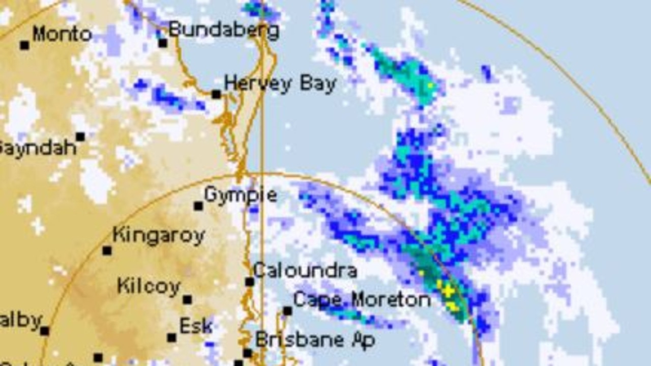
BOM officially cancelled a severe weather warning yesterday, four days after it began warning a subtropical low was tracking towards the region, triggering a subsequent flood watch.
Meteorologist Matt Marshall told the Chronicle on Monday that had the weather system moved closer to the Coast, the region would have experienced the worst.
“It moved down south and moved into more of trough … the question was how close was it going to get, it managed to hold off and it didn’t move close enough to bring severe weather,” he said.
“What we could still see is heavy, isolated rainfall occurring, we could see flash flooding if areas get heavy thunderstorms.
“Come tomorrow (Tuesday), that trough is going to be pushed further away off shore and take a lot of the weather with it.”
32mm fell on Hervey Bay on Sunday April 4, which was the heaviest rainfall for the weekend.
The region was still expecting showers for the rest of Monday and into the evening.
A hazardous surf warning is still in place for the Fraser Coast for Monday, April 5 and Tuesday, April 6.
Originally published as BOM explains why Fraser Coast missed out on heavy hitting rain

Transformed: 22 shops, projects that reshaped the Wide Bay Burnett
From new dining experiences and retail shops, innovative restaurants and huge infrastructure works there was no shortage of projects which transformed the region in 2024 and laid the groundwork for 2025. See the list:

Why Qld gun ownership has soared over last five years
Latest figures reveal there has been an almost 30 per cent increase in the number of registered firearms in Queensland in just under five years.

Your ultimate guide to every gun club in Queensland
A new public shooting gallery catering to unlicensed shooters as young as 11 has opened as firearm sports experience a surge in popularity. See our exclusive list of all gun clubs in Queensland.

‘My heart breaks’: Best friends’ tributes after pedestrian killed in crash
The best friends of a pedestrian who died after being struck by a ute on the Fraser Coast have shared the devastating pain of losing a person they considered a sister for more than 20 years.

Much-loved farmer killed in tragic accident at property
A much-loved farmer killed in a tragic accident on his property is set to be farewelled in Maryborough this week.

Minute’s silence for Speedway veteran, teen after tragic losses
Just days after a hearse carrying a coffin draped in a checkered flag honoured a 53-year-old speedway legend, he and a teen racer, who also tragically died of cancer, are being remembered at a regional race meet. VIDEO, TRIBUTES.