
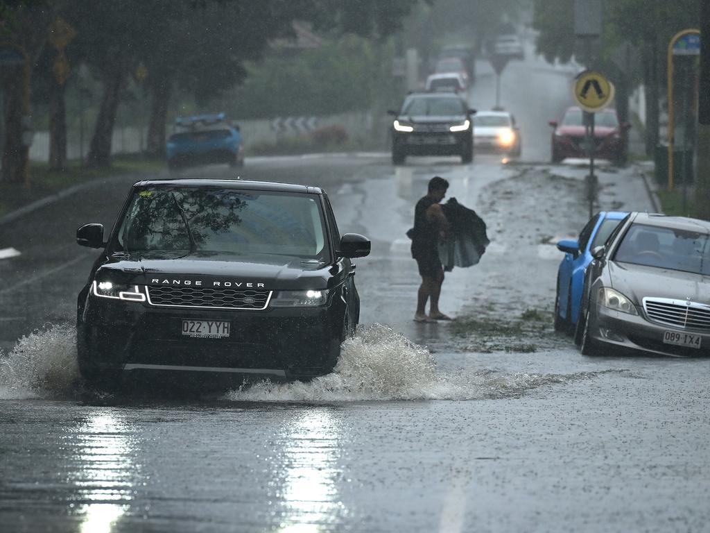
Autumn was one of the wettest on record but a soggy Winter is looking increasingly likely
Queensland has just set an astonishing new weather benchmark – smashing century-old records – with warnings that the unprecedented conditions are far from over.

QLD News
Don't miss out on the headlines from QLD News. Followed categories will be added to My News.
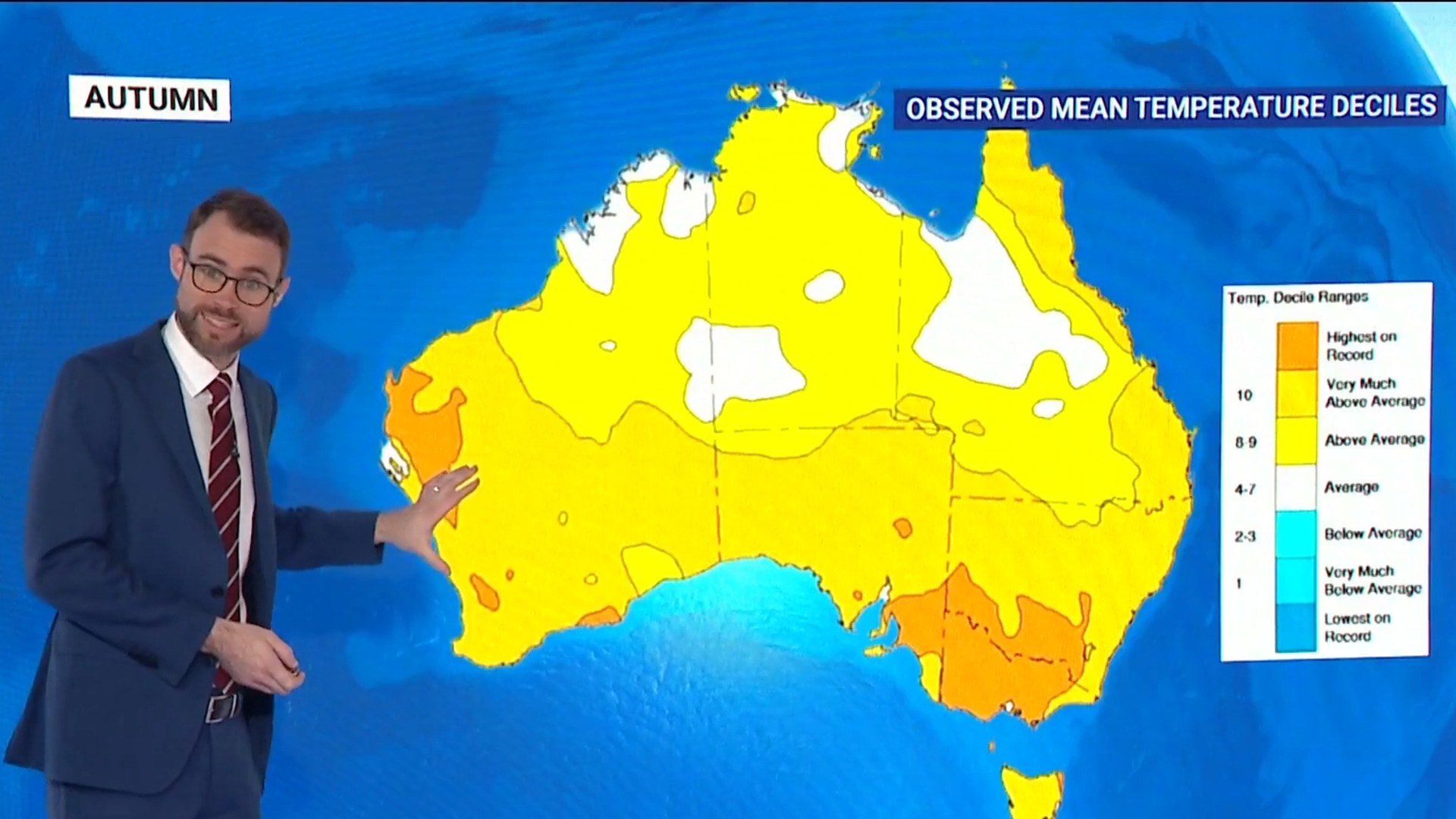
Autumn was one of the wettest in Queensland’s history smashing 100 year records and daily totals, but the forecast for winter is looking just as soggy.
Greater Brisbane received three times as much rain as average between March and May with Alderley weather station recording a drenching 945.6mm in the period.
Senior climatologist Hugh McDowell said the start of the year didn’t just feel wet the data says it was historic.
“We saw 50 days with any amount of rainfall and that could be anywhere from a few spots to quite wet days,” Mr McDowell said.
“It is actually the wettest March on record at that new Brisbane station and that goes back to 1999, so years – with 604mm, approximately.
“It’s not the most rainfall we have ever seen in Brisbane. They had wetter days of 800mm or more way back in the 1870s but it is a record for the new site.”
Data from across Brisbane’s weather stations showed the period was unseasonable wet and warm, with Toombul Bowls Club smashing a 1908 Autumn daily record with a whopping 448mm recorded back in March.
The strange conditions were the result of Subtropical high pressure systems in northern Australia that drifted further south than usual and bought warm weather and plenty of moisture.
The unique conditions helped drag Tropical Cyclone Alfred south where it unleashed in early March, Mr McDowell said expected winter to also be unusually wet.
“The forecast for Brisbane for rainfall is a 55 per cent chance above median rainfall, 10 per cent chance of unusually dry and a 35 per cent chance of seeing really wet conditions,” he said.
“We are also very likely, an 80 per cent chance, to see above median maximum temperatures for this time of the year as well.”
Above average sea surface temperatures across Queensland’s coast and a forecasted negative Indian Ocean Dipole which is the Indian Ocean equivalent to La Nina, was expected to bring greater cloud formation and subsequent rain in the coming months.
Farm manager Maple Egerton at The Folly Truffles in Ballandean was hoping for cooler weather after months of drenching rain had stopped her truffles from ripening.
“Once it starts to cool down that’s when they start to get really smelly, nice and ripe,” she said.
“By now we would have expected to have had a couple of frosts and a couple of weeks of consistent cool temperatures for them to do their ripening but instead we’ve really had warmish days and rain.
“When we have rain that kind of keeps the cloud around and it kind of keeps the temperature up, but today the wind is picking up and it does have that real wintry feel about it.”
Originally published as Autumn was one of the wettest on record but a soggy Winter is looking increasingly likely
Join the conversation
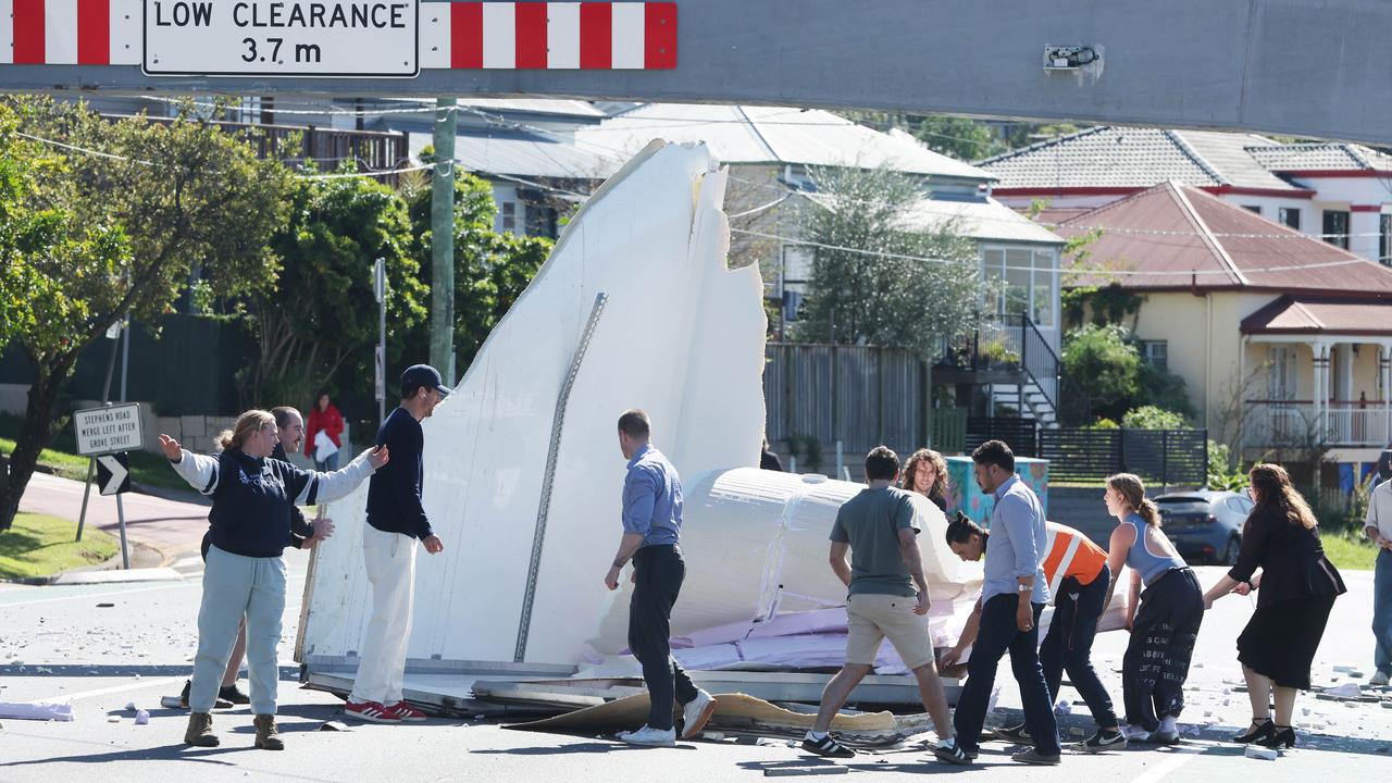
Truck disintegrates after slamming into bridge on busy Brisbane road
A truck has collided with a rail bridge protection beam, destroying the roof and sides of its cargo compartment.
Read more

NRL’s astonishing latest push in bid to go global
The likes of Reece Walsh could be lining up at the Olympic Games if the NRL gets its way. HAVE YOUR SAY
Read more

Meth, coke and cash: Police bust alleged QLD drug trafficking syndicate
Queensland police have charged 19 people with more than 271 offences over an alleged statewide drug trafficking syndicate. See the moment they pounced.
Read more

Brisbane’s surprising rates call as mayor drops big hint
There is some good news for Brisbane ratepayers struggling with the affordability crisis.
Read more

‘Just listen to me’: Moment housemate accused of Pheobe Bishop’s murder arrested
Footage has been released of the moment police arrested one of the housemates accused of murdering missing Queensland teen Pheobe Bishop. WATCH THE VIDEO
Read more
Emergency crews rush to popular hinterland mountain
A climber has reportedly become stuck on a popular Sunshine Coast mountain with emergency crews organising a rescue.
Read more