
‘Exceedingly dangerous’ weather set to hit
Four states – including one in its entirety – are under severe weather warnings as one cold front after another gets ready to hit Australia.


Weather
Don't miss out on the headlines from Weather. Followed categories will be added to My News.
At least four states are set to be hit by a five-day period of “exceedingly dangerous” weather, forecasters have warned, as a series of punishing cold fronts smashes the south east.
The SES has said it is “preparing for the worst” as winds of up to 125 km/h whip through.
One state has a severe weather warning place for its entirety.
There are also warnings to not enter rough seas.
It comes as temperatures soar in parts of Australia, in the last week of winter, to more than 10 degrees above average and almost summer time highs.
Sydney could get to around 30C on Friday and Brisbane 34C on the weekend.
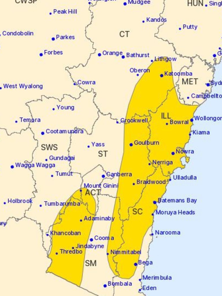
Severe weather warnings are in place for parts of New South Wales and the Australian Capital Territory, Tasmania, Victoria and South Australia.
It was only on Wednesday that some parts of Victoria and Tasmania recorded winds fiercer that 150km/h.
“It’s going to be exceedingly dangerous,” said Sky News Weather meteorologist Rob Sharpe.
“Plenty more trees will come toppling down.
“We’ll watch a series of further fronts, one coming through Saturday morning, another Saturday night and then again on Sunday night.
“Right through until Monday it’s going to remain windy for the southeast – there won’t be a let up in those severe weather warnings for southeastern Australia, they’ll just be chopping and changing.”
‘Preparing for the worst’
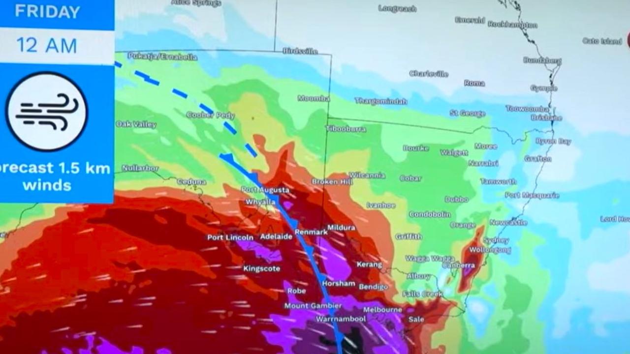
That series of cold fronts is pushing through from west to east across the Great Australian Bight.
The NSW State Emergency Services’ Dylan Whitelaw said damage similar to Wednesday was expected when tiles and windows flew from buildings and roads were closed.
“We’re expecting to see very similar peak gusts that are around 90km an hour and that might be exceeded in some areas across south east of NSW.
“So we are preparing for the worst,” said Mr Whitelaw.

Severe weather warning for whole state
Tasmania is in a weather mess with the entire state – from top to tip – sporting a severe weather warning for damaging winds and a flood watch in place too.
The winds will sweep in from the west and then across the island during Friday morning.
Winds could average 60-70km/h gusting to 100kmh/h. There may be a short break in the middle of the day and then the winds could pick up again.
“Periods of severe weather are likely to persist over Tasmania for the next several days,” said the Bureau of Meteorology (BOM).
Hobart could reach 14C on Friday with damaging winds and up to 15mm of rain. Similar conditions will persist on the weekend when more rain could fall and those repetitive front bring more winds.
There are minor to moderate flood watches across the state’s west and north.

Damaging winds, dangerous seas
Showers are likely in Melbourne with temperatures up to 19C on Friday and through the weekend. Brisk winds will be a feature each day.
The BOM has said damaging winds of around 100km/h could hit Melbourne and Geelong and the south west coast and up to 120 km/h in the Grampians and Alps.
At 2am on Friday, gust of around 115 km/h were recorded at Mt William and Mt Hotham. A gust of 98 km/h hit Fawkner, in Melbourne’s north.
A warning for damaging surf across most of the Bass Strait coast is also in place. Large and powerful waves are possible until Monday and there could also be the year’s highest tides.
Localised flooding is a concern, along with coastal erosion, and strong ocean currents.
“Damaging surf conditions are dangerous to swimmers, surfers and rock fishers,” stated the BOM.
“Stay away from impacted coastal areas until conditions subside.”
The severe weather warning continues across the NSW border stretching to the Snowies and the ACT as well the south east, the Illawarra and Blue Mountains.
Friday morning should see those winds come through with gusts of up to 125km/h on higher ground.
Canberra is looking at maximums in the high teens this weekend with winds of around 30km/h in the city whipping through from Friday and then into Saturday and Sunday.
Temperatures could be up to 12 degrees warmer than an average winter’s day in the Harbour City.
A warm Sydney will get to 29C on Friday with 40km/h winds. A sunny weekend of around 25C will then prevail but those gusts will still be in the mix.
Head up the mountains to Katoomba and those winds will only get fiercer and potentially more damaging.

Winter heat as hot as summer
Brisbane will be baking on the last days of winter – with 32C on Friday and then as high as 34C on Saturday and much the same for Sunday. In late August, highs of around 20C are far more standard.
The severe weather is unlikely to reach this far north, however.
Cairns is looking at 29C and mostly sunny this weekend.
The severe weather warnings for Perth have been cancelled but that’s not to say some may reappear over the weekend associated with the various fronts.
Friday could reach 19C and then as high as 21C on Sunday. Down south in Albany, winds of up to 50 km/h could be a feature on Friday and through the weekend.
Broome is set to peak around 33C on Friday and Saturday.
Toasty in the Top End with 33C maximums during a sunny weekend in Darwin.


Originally published as ‘Exceedingly dangerous’ weather set to hit
Cyclone less than 24hrs away from Aus
A tropical low sitting off the east coast of Australia is less than 24 hours from forming into a category 2 tropical cyclone – and could make its way towards millions.

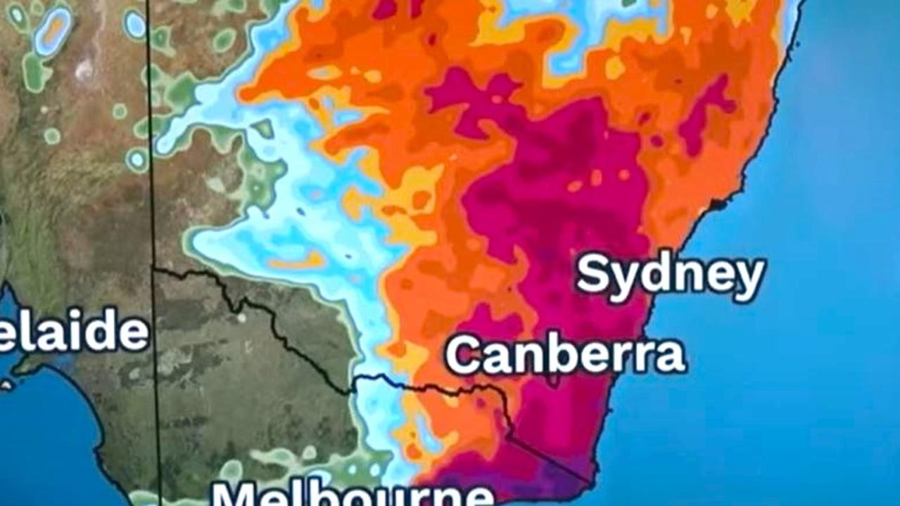
‘Extreme’ danger warning as temps soar
Millions of Aussies bracing for blistering temperatures this weekend, with the extreme conditions sparking several warnings.
Rivers of mud and rock hit LA fire zones after big rain
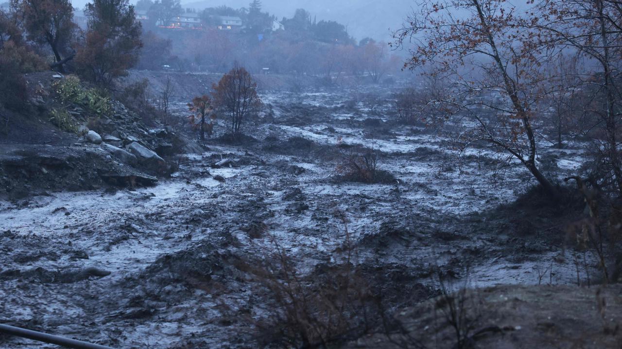
Suburbs decimated by the California wildfires have gone from smoldering to flooded after a powerful rainstorm turned scorched hillsides into rivers of mud and rocks.
‘Volcanic’: Aussies battle raging fires
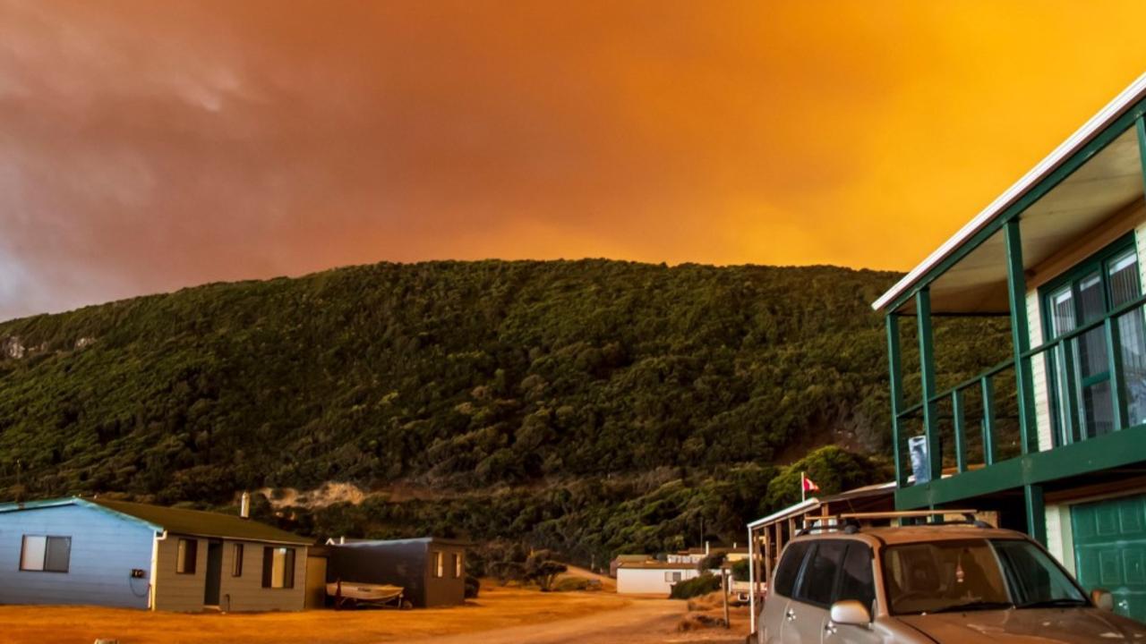
Residents in one state have captured startling photos showing apocalyptic scenes as they confront a complex web of bushfires.
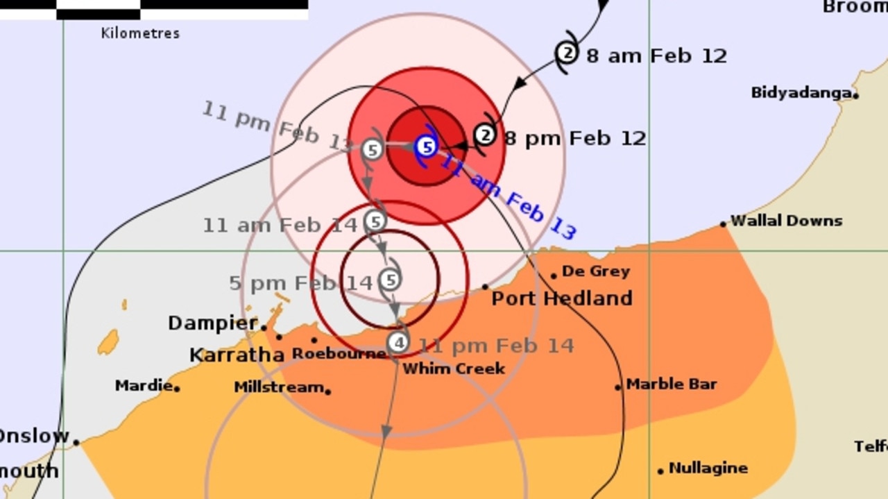
‘Threat to life’: Cat 5 cyclone declared in WA
Tropical Cyclone Zelia has been declared a category five system and is expected to make landfall on Friday afternoon, with winds up to 290km/h possible.
‘Dangerous situation’: Grim weather warning
Forecasters are warning of a “dangerous … multi day outbreak” of dire weather, with storms, heavy rains and floods all possible.