
Bureau of Meteorology forecasts more rain and issues severe weather warnings for most of the country
More rain and dangerous winds are expected to hit the country in the coming days as winter arrives with a bang.
Weather
Don't miss out on the headlines from Weather. Followed categories will be added to My News.
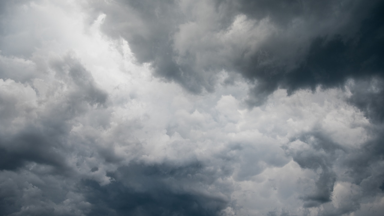
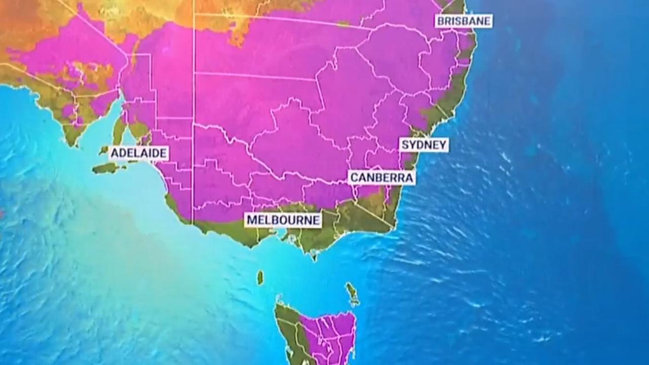
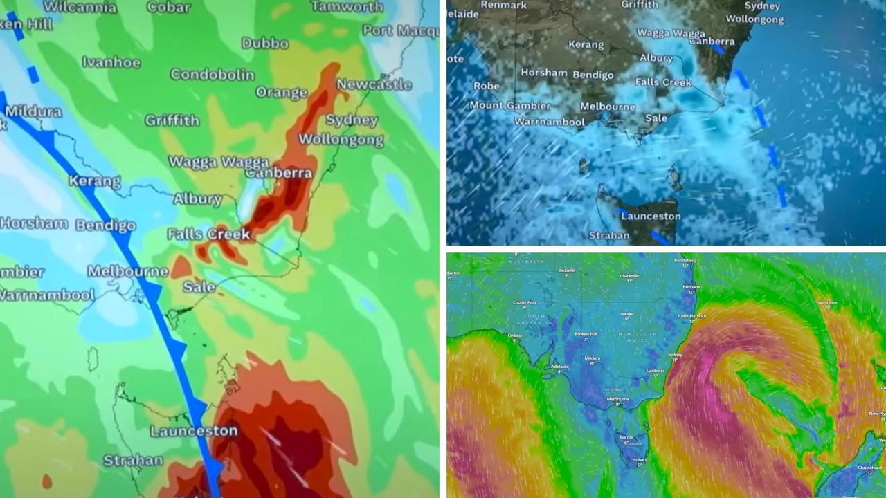
Aussies can expect a wet start to winter, as a 5000km rain cloud band continues to move across the country.
The Bureau of Meteorology forecasts the cloud band will continue its journey east throughout the coming days and is set to have brought rain to 90 per cent of the country by Sunday.
Senior Meteorologist Sarah Scully widespread rainfall totals from 5 to 15mm are expected on Friday night, with isolated totals of up to 20-40mm also forecast to occur within the rain band as well.
“On Saturday, it will continue to track eastwards into southeastern parts of Queensland with patchy rain and showers continuing in eastern parts of NSW,” Ms Scully said.
“On Saturday night that low develops of the coast of NSW and as we move into Sunday it starts to track eastwards and really wrapping moist air into the coast there.”
By Saturday, northern NSW and parts of southern Queensland will get some of the predicted wet weather, with a forecast of 15-50mm expected.
The small reprieve from the first cloud band in Western Australia will be short lived, as a second rainband is predicted to develop over the state with signs showing it’ll hit the interior by Monday.
All together, it’s expected that at least 10mm of rain will fall onto two-thirds of Australia, on top of what’s already been felt this week.
NSW
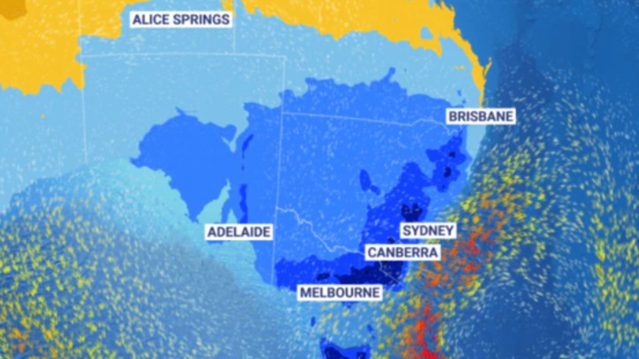
Ms Scully said it would be “another wet weekend ahead for eastern parts of NSW”, but couldn’t say exactly where the worst of the weather would be.
“The heaviest rain and strongest winds are high dependent on the position, movement and proximity of the low to the coast,” she said.
“If the low remains slightly offshore then the coastal impacts will be limited during the period, however if it is expected to move closer to the coast the forecast may be upgraded to mention an East coast low.
“The low is expected to move south towards eastern Vic and the east coast of Tasmania early next week.”
Residents in parts of the Snowy Mountains district are being warned for damaging winds up to 90km/h, with Jindabyne, Perisher Valley, Charlotte Pass and Thredbo expected to be affected.
The damaging winds are expected to cease by late afternoon or early evening.
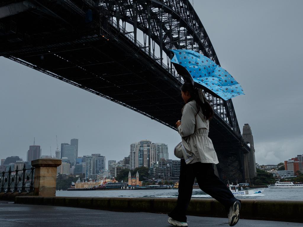
Rain is expected to hit Sydney on Friday, with a maximum temperature of 22.
Tasmania
Severe damaging winds are forecasted to affect residents in King Island, Furneaux Islands, Western, Upper Derwent Valley, South East, North East, East Coast, North West Coast, Central North, Central Plateau and Midlands Forecast Districts.
In particular, damaging winds averaging 60-70km/h with peak gusts around 100km/h are expected to hit King Island and move eastwards to the state’s northeast coast and the Furneaux Island on Friday afternoon.
Hobart and its surrounding area are expected to be affected by damaging wind gusts into the mid afternoon.
Hobart will be partly cloudy with an expected shower or two and a maximum temperature of 16.
Victoria
The BOM has issued a severe weather warning of damaging winds for residents in parts of East Gippsland and North East Forecast Districts.
Strong west to north-westerly winds averaging 50-60km/h with damaging gusts around 90km/h are forecasted for Friday.
An initial minor flood warning has been issued for the Seven Creeks.
Melbourne is expected to partly cloudy with a max temperature of 17.

Queensland
A thick blanket of fog shrouded Brisbane on Friday morning, leading to a road weather alert for commuters.
Reduced visibility in fog will make it dangerous for drivers today, hitting mainly the inner, southern and western suburbs.
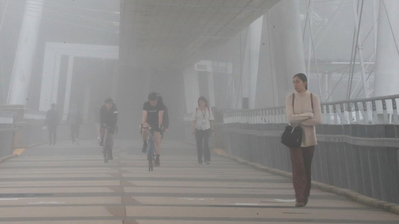
Several flights were diverted from Brisbane Airport before operations could resume about 8.45am.
BOM senior meteorologist Harry Clark said the fog stretched from Moreton Bay to Brisbane’s western suburbs.
“We have seen some pretty thick fog too, so the visibility has been as low as 50m at Brisbane Airport overnight,” he said.
A marine wind warning for the Gold Coast waters has been issued.
A shower or two is forecasted for Brisbane today, with a max temperature of 25.
Western Australia
The BOM has issued a gale warning for the Leeuwin Coast that will run across today and continue onto Saturday.
Strong winds are expected to hit the Perth Coast, Bunbury Geographe Coast and Albany Coast.
Moderate fire danger warnings have been issued for Swan Coastal North, Inland North and Coastal South.
Perth is expected to be hit with a shower or two and a max temperature of 22.
Australian Capital Territory
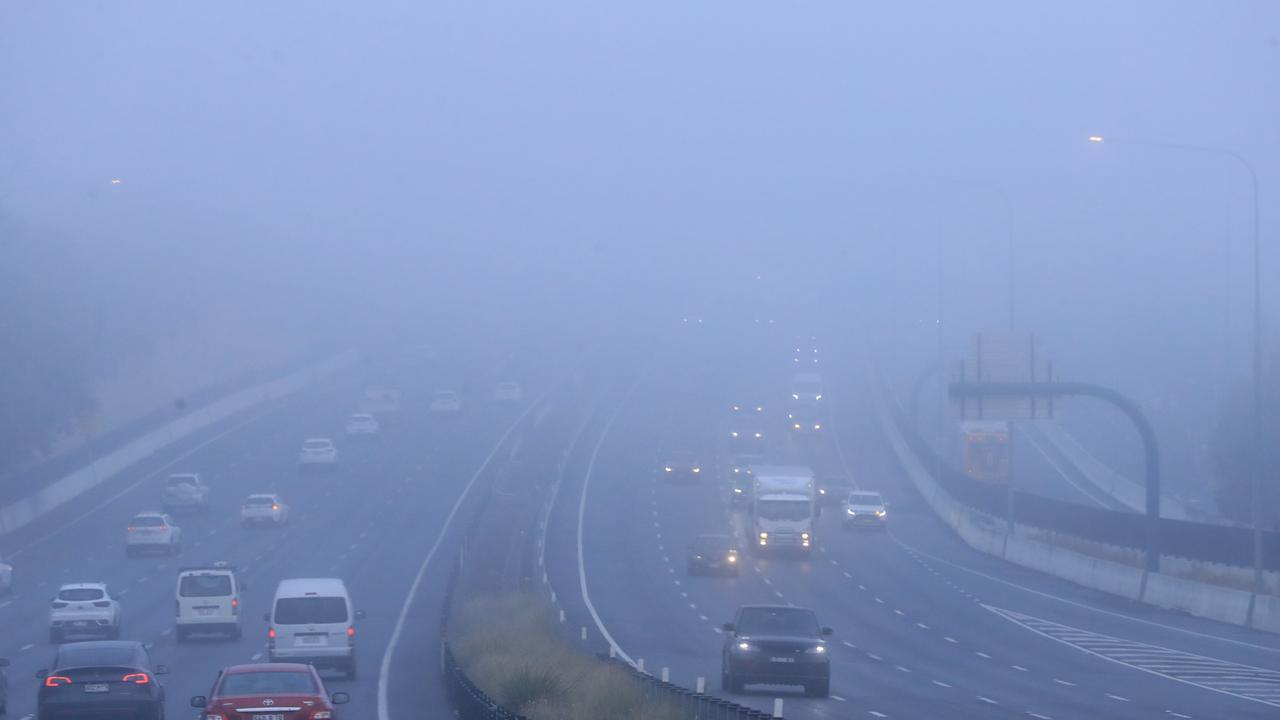
Motorists are being urged to take extreme care on this morning, after significant rainfall after a long dry spell is expected to make roads slippery and driving conditions dangerous in the Canberra area.
Cloudy weather with rainfall is forecasted for Canberra, with a max temperature of 16.

Originally published as Bureau of Meteorology forecasts more rain and issues severe weather warnings for most of the country

Australia braces for rare weather event
Aussies turned their heads to the sky just months ago for what is usually a rare experience, but the lucky country will get another chance to witness it tonight.
Aussies to shiver through record low temps
Millions will shiver through record-low temperatures as an icy blast continues to sweep through Australia, with one city to suffer through subzero conditions.
Millions of Aussies hit by icy blast
Fronts crossing the southern coast of Australia are bringing freezing-like conditions, leaving millions facing a bitterly cold weekend.
Millions to shiver through icy blast
Australians may need to pull out their umbrellas and beanies as an icy blast is set to hit multiple states.
Double weather whammy may ruin weekend
A double whammy of “vigorous” cold fronts is bearing down which could bring 100km/hr plus winds, rain, hail and snow for parts of Australia.
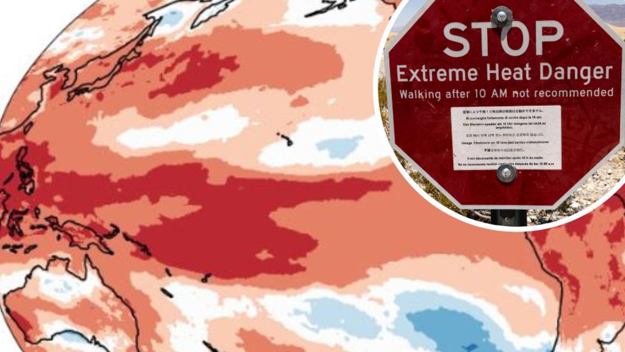
Mapped: Why 2024 could be our hottest year
Australia is suffering through a wet and chilly winter, but heat records are being broken all around the world - prompting new ideas about how we should be dealing with it.