
‘Temperatures are going to drop like a stone’: Icy blast to lash Australia’s southeast
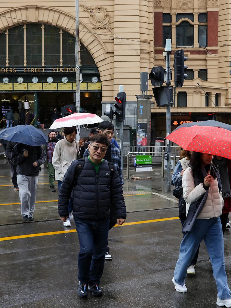
Australians may need to pull out their umbrellas and beanies as an icy blast is set to hit multiple states.

Environment
Don't miss out on the headlines from Environment. Followed categories will be added to My News.
Australians may need to pull out their umbrellas and beanies as an icy blast is set to hit following the last few days of warmth.
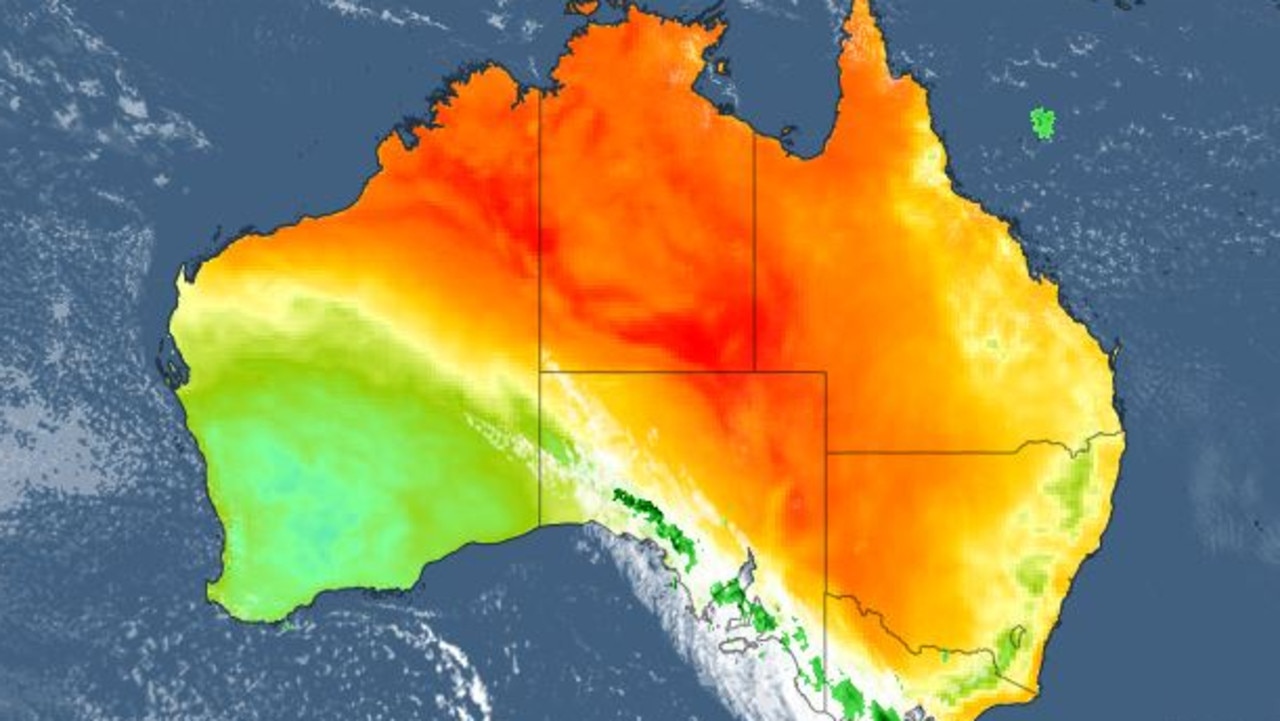
Sky News Meteorologist Rob Sharpe said temperatures will plunge for much of the southeast, with the winter blast set to begin from the Great Australian Bight on Friday before travelling to most of Victoria and parts of NSW and South Australia.
Despite Melbourne’s forecast highs of 12C, temperatures could feel colder.
“The cold front’s proper impacts won’t be felt until Saturday when it comes in, dropping temperatures, bringing a band of wet weather and then it will clear out pretty quickly on Sunday,” Mr Sharpe said.
“On Sunday, there’s just a couple chances of showers in southern Victoria, but those temperatures are going to drop like a stone. It’ll feel like midwinter again that’s for sure.”

Bureau of Meteorology meteorologist Miriam Bradbury said the drop in temperatures will be felt in a progression over the weekend.
“That cold air will take a little longer to reach the far east coast, so Canberra and Sydney will still see some mild weather on Saturday, but that colder air will come through by Sunday,” she said.
“So they will just get the drop in temperature a day later, but we will also see scattered showers moving across from later on Friday continuing through most of the weekend, with the risk of some small hail in parts through Saturday and early Sunday.”
There’s the chance for chilly wind, and combined with showers, the “feels like” temperature is going to be “pretty wintry this weekend”, Ms Bradbury said.
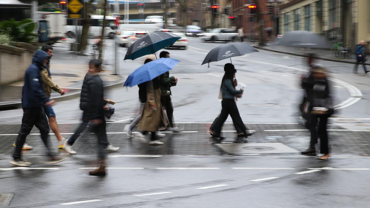
The southeast is expected to experience between five and 15mm of rainfall, with fairly patchy showers.

This is potentially bad news for those who were hoping to go to the snow this weekend, with low snowfall expected compared to the last couple weeks.
“So definitely it will feel very, very cold, but we won’t get the dumping of snow that we had last week, it’ll be less than that,” Ms Bradbury said.
However showers should begin to clear on Sunday, with more settled weather expected through the early part of next week.
“So it’s not going to linger for a long time, this very wintry weather,” Ms Bradbury said, warning cold mornings with frost are expected early next week.
“But daytime conditions are starting to look much better as we go through the week. So the skies will start to clear out, we’ll get a bit more sunshine, and the temperature comes back up as well,” Ms Bradbury added.
Despite the weather set to improve, there may be more showers across the east coast — including NSW — with the risk of dangerous swell and surf.
“We might see some hazardous surf warnings along the coast,” Ms Bradbury said.
“Even as the weather starts to improve, it still might be hazardous out on the water. So that’s just something for people to be aware of going into early next week.”

Sydney is set to reach a maximum of 21C across Friday and Saturday with possible showers before plummeting to a high of 16C on Sunday with a slight chance of showers.
Melbourne will drop from a maximum of 16C on Friday to a high of just 12C across Saturday and Sunday, with a high chance of showers across the weekend.
Brisbane is set to have a few foggy mornings, with a top of 26C across Friday and Saturday before dropping to a high of 23C on Sunday with a chance of showers.
Perth is set for a shower or two on Friday with a top of 18C before temperatures are expected to lift slightly to a top of 20C on Saturday and Sunday, though there’s a high chance of showers on Sunday.
Adelaide will have possible showers on Friday and Saturday with temperatures set to drop from a high of 17C to 13C between Friday and Saturday. There’s a chance of hail on Saturday, while Sunday will be cloudy with a top of 14C.
Hobart will have possible showers right through Friday to Sunday, with a top of 15C on Friday dropping down to respective highs of 12C and 11C on Saturday and Sunday.
Canberra is looking fairly clear until Sunday in terms of rain, with highs of 15C on Friday and Saturday followed by a top of 11C on Sunday.
However temperatures are expected to plummet to a minimum of -2C on Saturday and 0C on Sunday in Canberra.
Darwin is expected to reach highs of 31C and 32C through Friday to Sunday, with conditions expected to be partly cloudy with a slight chance of showers across Saturday and Sunday.


Originally published as ‘Temperatures are going to drop like a stone’: Icy blast to lash Australia’s southeast

Horror moment as magpie season kicks off
A chilling video has revealed that the season Aussies dread most has arrived earlier than expected.
Months of ‘destructive’ weather to hit Aussies
One state has been warned to anticipate destructive storms and high temperatures over the coming months, with experts urging people to prepare their homes.
‘Power is out’: Thousands impacted by quake
People across NSW woke up to shaking beds this morning after a “large” earthquake hit the state, leaving thousands without power.
Entire city quarantined as threat spreads
An Australian capital city is in quarantine, as the state government tries to curtail the spread of a bug.
Fire danger warning as temps soar to 30
High fire danger warnings have been issued across Australia, as climbing temperatures and strong winds provide a perfect storm.
‘No warning’: Government’s ‘hidden’ move
An Aussie government has been caught out pulling a sneaky move – and according to Caleb Bond, it’s a dangerous sign of things to come.