
‘Antarctic outbreak’ set to envelop Australia leading to colder than average weather
Heavy rains and warmer temperatures are due over the coming days but an approaching polar blast is set to change all that.


Weather
Don't miss out on the headlines from Weather. Followed categories will be added to My News.
Australia could see a slightly milder winter week.
And there ends the good news.
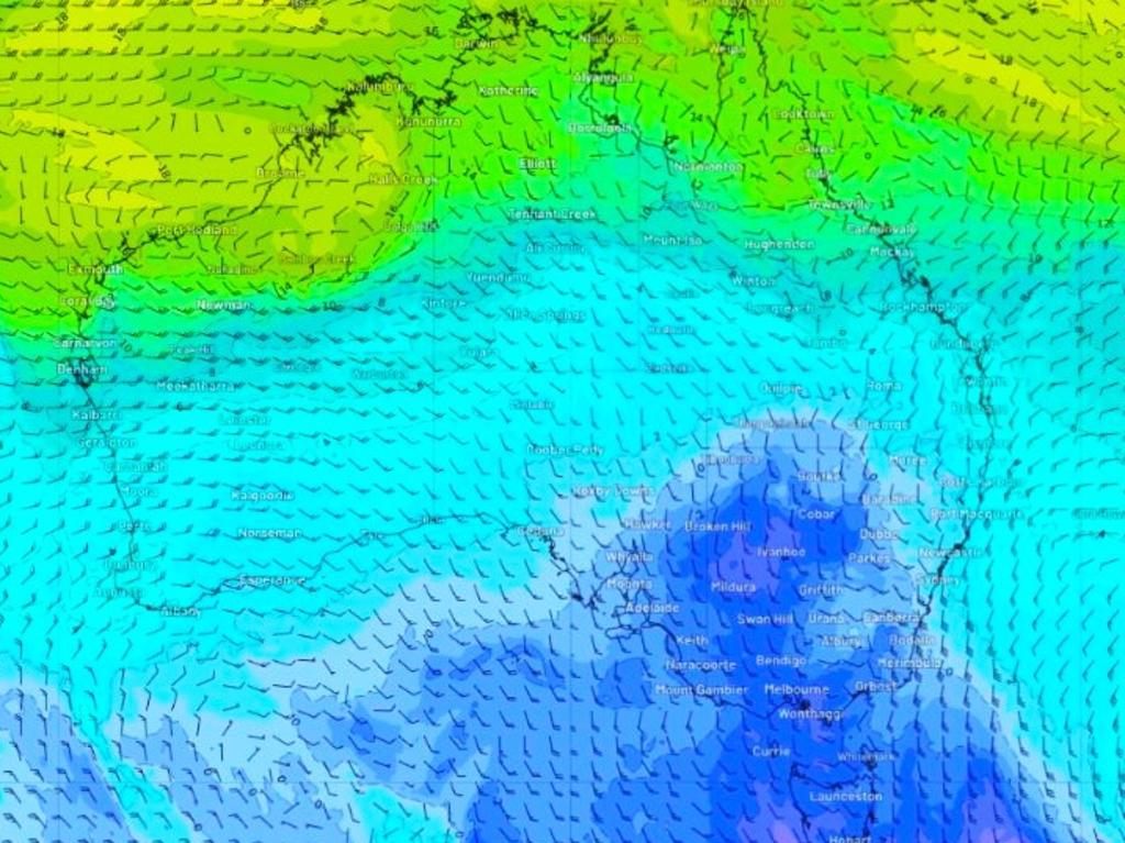
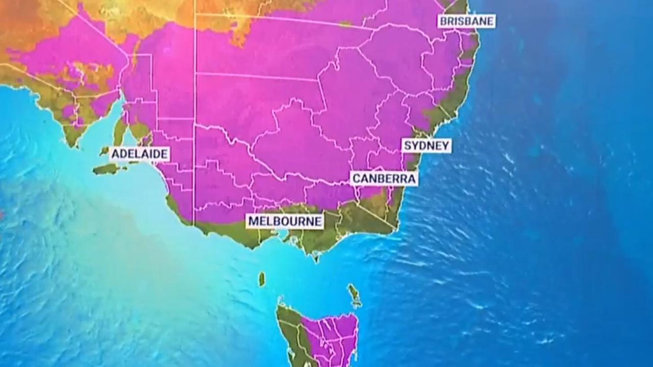
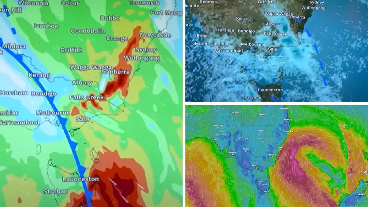
Not only could it be soggy this week but an “Antarctic outbreak” of cooler than average winter weather is sprinting towards Australia towards the end of this week and into next week which could see temperatures plunge once more.
“The frigid air will be dragged from Antarctica by a cold front sweeping across the continent this weekend,” website Weatherzone has stated.
“A high-pressure system will quickly follow in the front’s path and remain over southern Australia until at least mid-next week, prolonging this cold outbreak.”
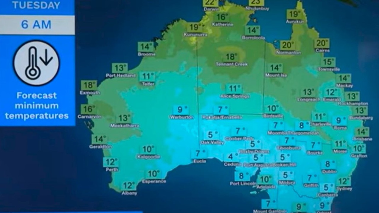
The high pressure system and low should keep temperatures two to four degrees below average, perhaps down to 14C highs at 3pm in Sydney and mid-single digit lows across the weekend.
Even parts of Queensland such as Brisbane could see some tepid temperatures across the weekend.
The winds, however, could mean the “feels like” temperatures appears to be substantially cooler.
But it’s worth remembering that this many days out, forecasts could still change.
The next few day’s forecast has more detail.
“There will be rain around large parts of both the east and the west,” said Bureau of Meteorology meteorologist Angus Hines on Monday.
“And something that many will be glad to hear, it won’t be as cold as what it was last week.”
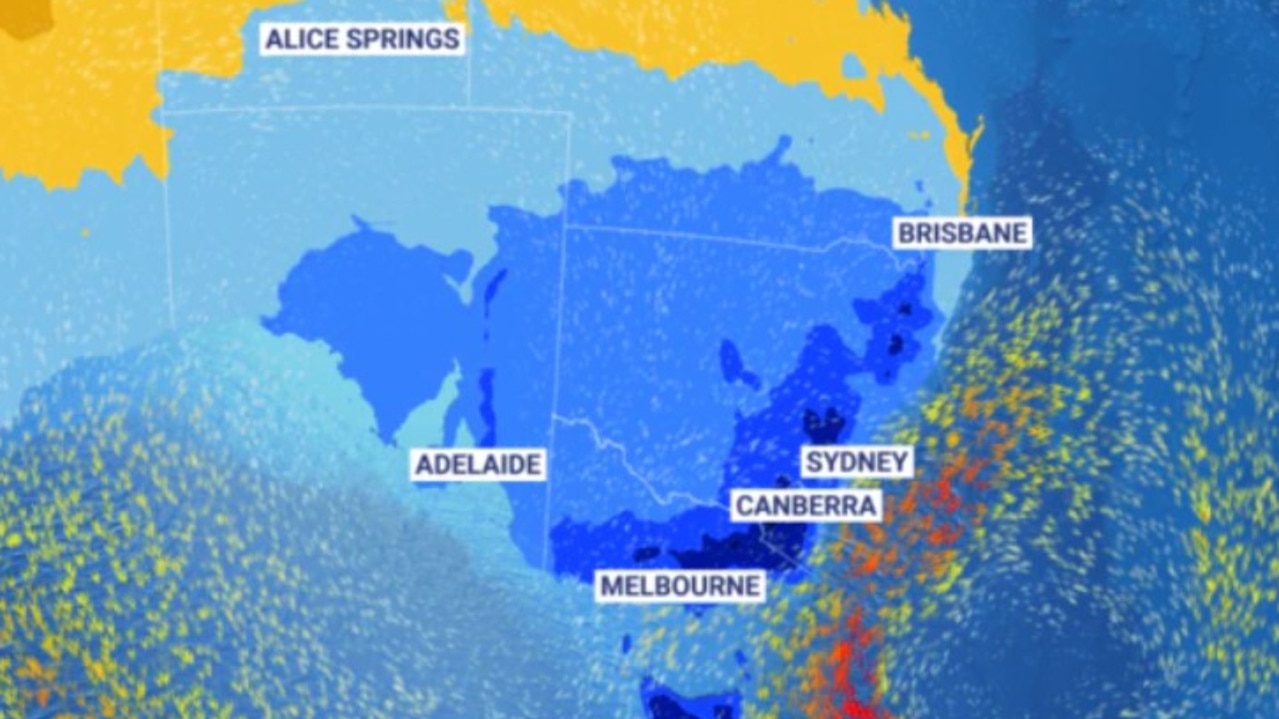
Rainy Tuesday across Australia
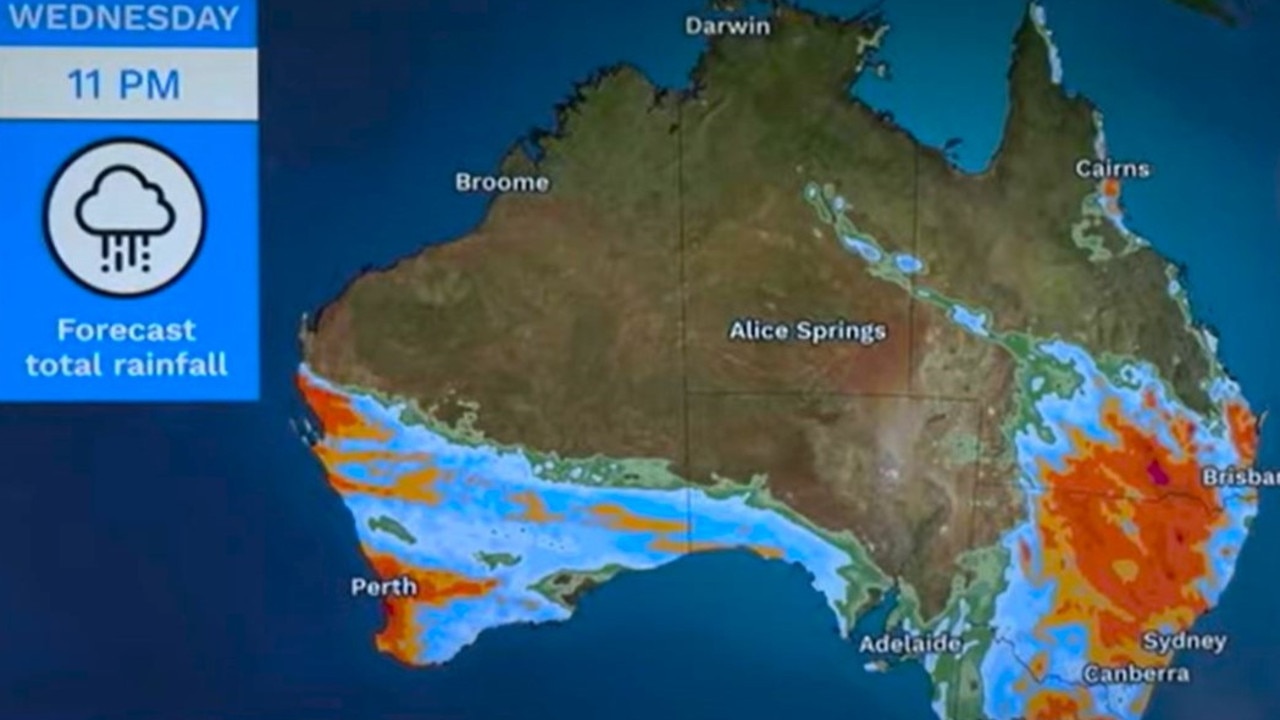
Low pressure troughs in the east are bringing wet weather to many cities in the east with Perth seeing rain and potential thunderstorms on Tuesday.
“Overall the rain will be extensive but a key point is for most places won’t be particularly heavy,” said the BOM’s Mr Hines.
“So we will expect to see widespread rain from about southeast Queensland all the way to southern Tasmania – and for many that will be somewhere between 10 and 25mm which is a solid drop of rain – but not expecting to see widespread flooding or severe weather impact with that.”
Around 10-25mm could fall on Perth on Tuesday during the later part of the day with a high of 22C.
That rain could continue during the morning on Wednesday, potentially up to another 15mm. But by Thursday, drier weather should return. Expect highs of 18C and lows of 8C at dawn.
Adelaide should peak at 17C today and then will bob around the 18C mark on Wednesday before the mercury heads down to 14C on Saturday. Minimum temperatures could be as low as 7C on Wednesday.
On Wednesday evening, that rain band from Perth will likely enter Adelaide. Then on Thursday 7-25mm could fall on the city.
Soggy in Melbourne on Tuesday with 6-15mm leading into a dry and sunny Wednesday. But showers could return later in the week. At 3pm, expect mid-teens highs peaking at just 13C on Wednesday and on the weekend. Overnight, 9C in Melbourne will be standard but 5C could usher in Saturday.
Maybe a spot of rain in Hobart on Tuesday and then some more heftier falls, possibly as much as 10mm midweek. But it should then dry up. Temperatures of around 14C most days in Hobart but sinking to just 11C high on the weekend. There will be lows of between 3-9C.
Canberra could see just a drop or two of rain on Tuesday – or up to 7mm. It should then remain mostly dry for the capital. Tuesday’s high will be 14C and then down to 12C on Friday and just 11C by Sunday. It will hover above freezing at down for most of this week but -1C is to be expected on Saturday morning.
Highs in Sydney almost approaching 20C on Tuesday and Wednesday but they are set to fall towards the mid-teens on the weekend. Minimums are around 8-9C. Tuesday could see rain in the Harbour City of up to 10mm.
Brisbane will see a steady drop in the mercury from around 24C to nearing 20C on the weekend. Tuesday could see up to 9mm of moisture coming down.
Dry in Darwin with 33C highs and 22C lows.

Originally published as ‘Antarctic outbreak’ set to envelop Australia leading to colder than average weather
Australia braces for rare weather event
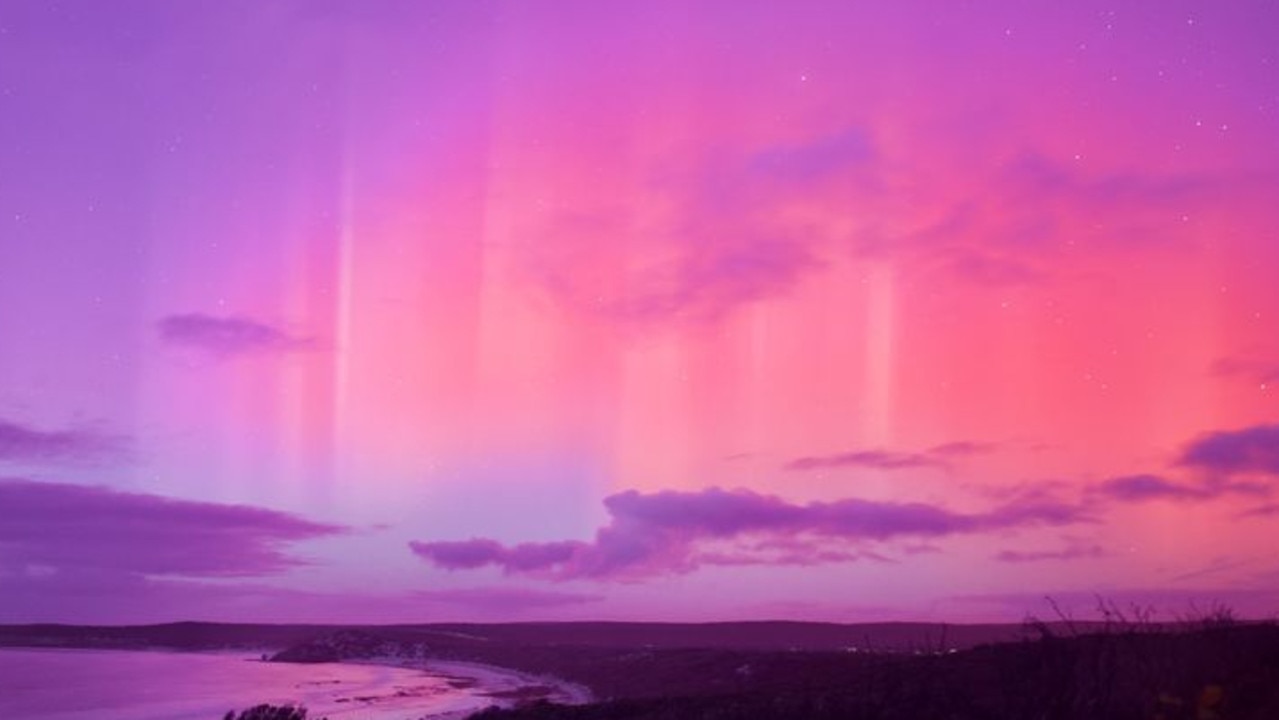
Aussies turned their heads to the sky just months ago for what is usually a rare experience, but the lucky country will get another chance to witness it tonight.
Aussies to shiver through record low temps
Millions will shiver through record-low temperatures as an icy blast continues to sweep through Australia, with one city to suffer through subzero conditions.
Millions of Aussies hit by icy blast
Fronts crossing the southern coast of Australia are bringing freezing-like conditions, leaving millions facing a bitterly cold weekend.
Millions to shiver through icy blast
Australians may need to pull out their umbrellas and beanies as an icy blast is set to hit multiple states.
Double weather whammy may ruin weekend
A double whammy of “vigorous” cold fronts is bearing down which could bring 100km/hr plus winds, rain, hail and snow for parts of Australia.
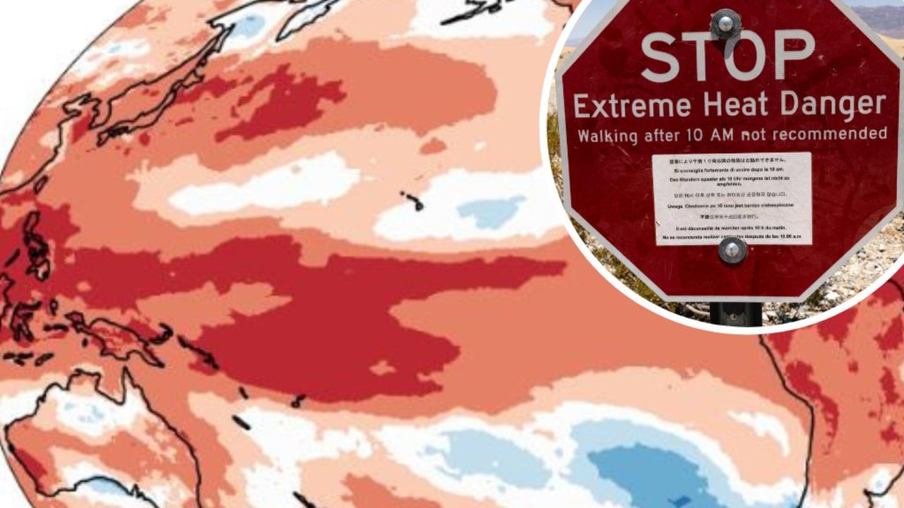
Mapped: Why 2024 could be our hottest year
Australia is suffering through a wet and chilly winter, but heat records are being broken all around the world - prompting new ideas about how we should be dealing with it.