
Hinchinbrook floods: BOM issues severe weather warning for disaster-struck shire
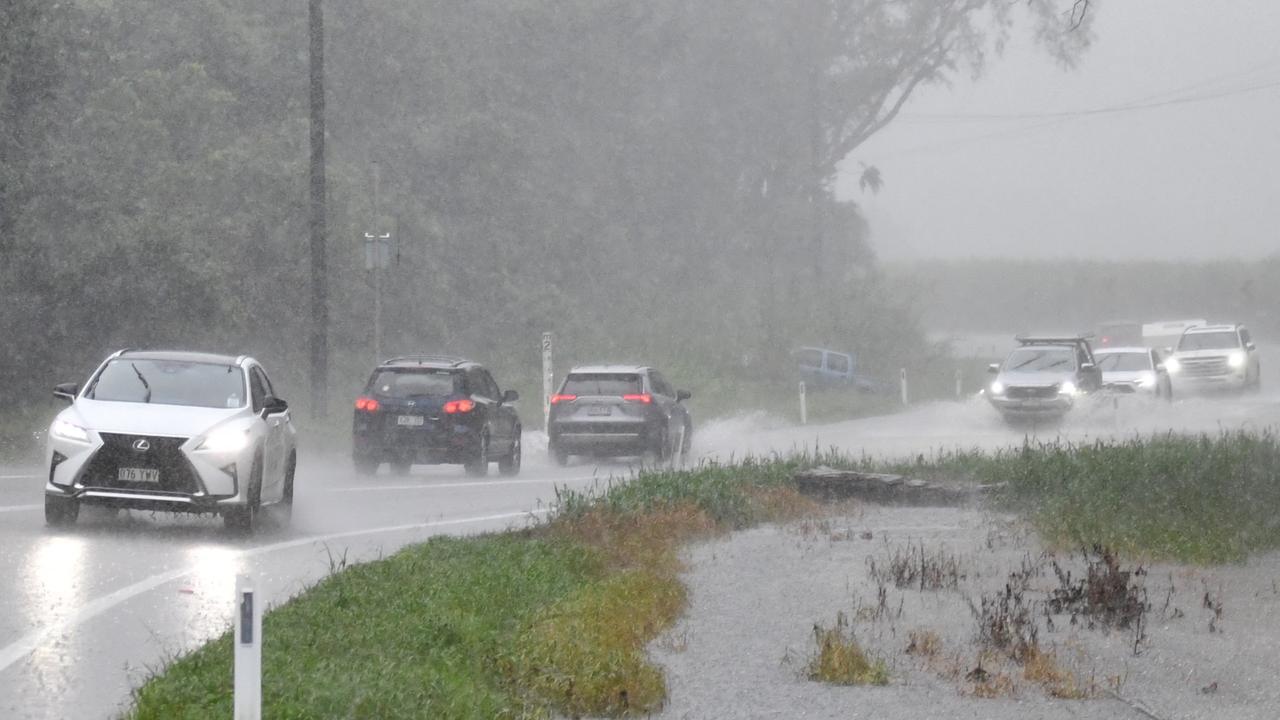
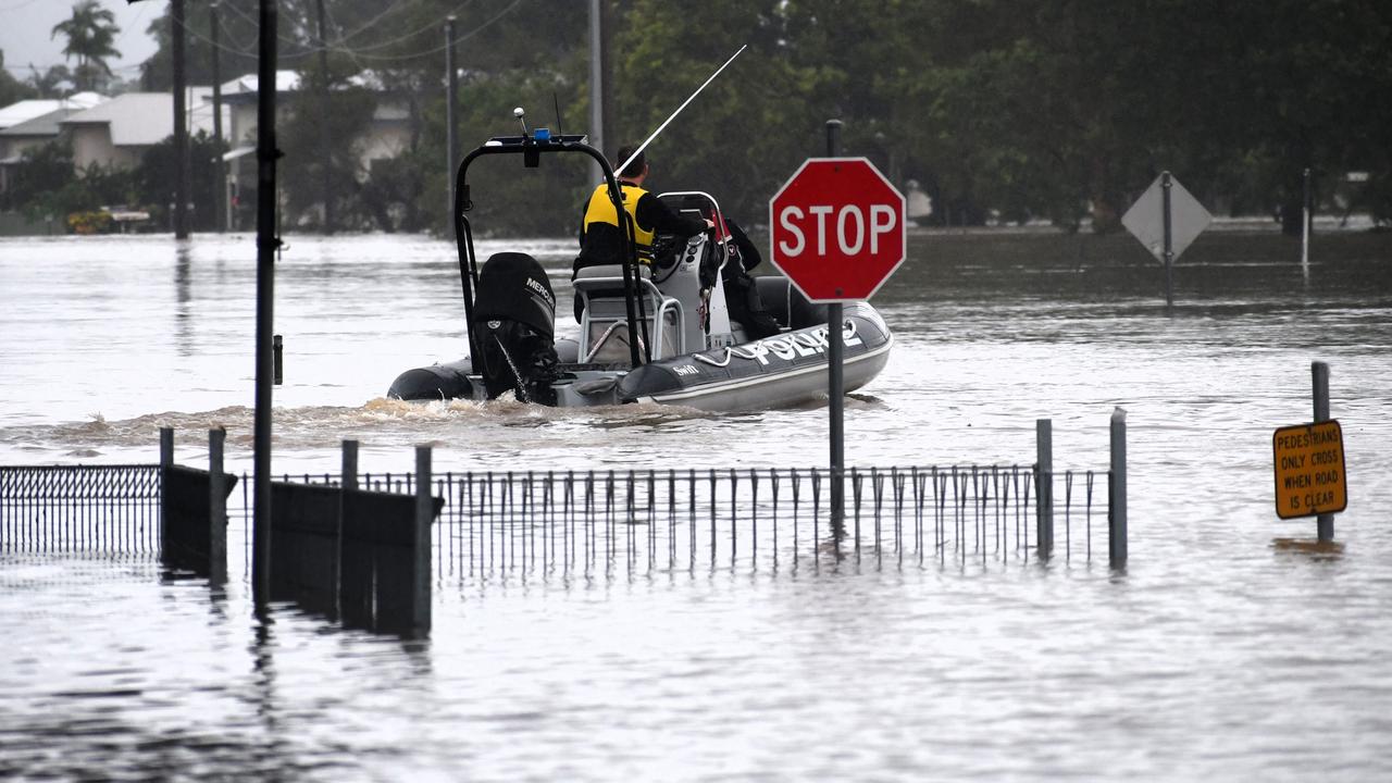
The Bruce Highway has yet again been closed north of Ingham as severe weather again lashes the Hinchinbrook district and Cardwell in the lower Cassowary Coast.


News
Don't miss out on the headlines from News. Followed categories will be added to My News.
The Bruce Highway has yet again been closed north of Ingham as severe weather again lashes the Hinchinbrook district and Cardwell in the lower Cassowary Coast.
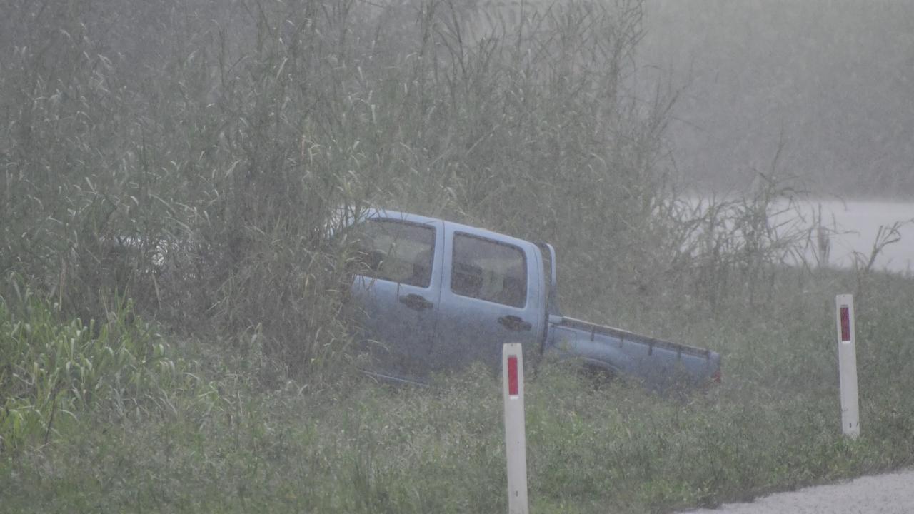
A single vehicle has also skidded off the already flooding section of the Bruce Highway at the S-bends at Gairloch just north of Ingham.
There are no reported injuries, Queensland Ambulance Service confirmed.
The Bureau of Meteorology issued the warning at 7.52am on Tuesday morning, confirming that heavy showers and thunderstorm had developed over the region.
More than 120mm was recorded at Cardwell Gap in the two hours to 7:50am, the BOM said. “Severe thunderstorms are likely to produce heavy rainfall that may lead to flash flooding in the warning area over the next several hours,” it said.
“Locations that may be affected include Ingham, Cardwell, Abergowrie and Lucinda.”
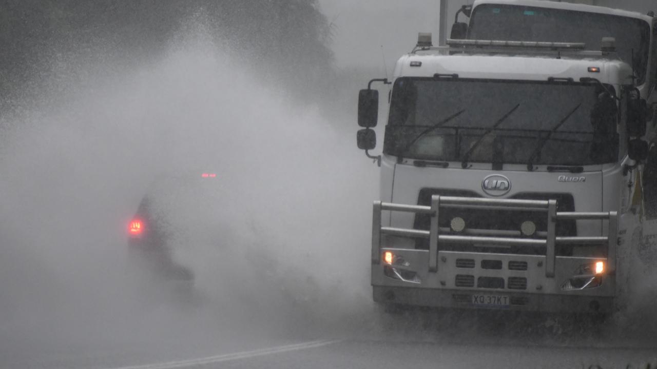
The Bruce Highway was officially shut at the Seymour Bridge in Bemerside just after 2pm, although motorists continued to navigate the flood-prone stretch before it was closed.
The notorious flood-prone stretch of the Bruce Highway has long been criticised by local politicians and members of the community but pleas for urgent upgrades continue to fall on deaf ears.
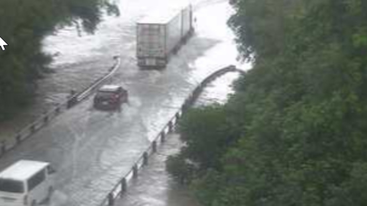
Floodwaters, meanwhile, were threatening to cut the Bruce Highway south of Ingham at Helens Hill.
The highway remains open but the advice is not to drive through floodwaters.

A woman in her 90s returning to her Hinchinbrook home after surgery in Townsville was rescued from near neck-high floodwaters in dramatic circumstances after the vehicle she was a passenger in left the Bruce Highway.
MORE TO COME.

‘Prepare’: BOM not ruling out new Hinchinbrook floods
Disaster-struck Hinchinbrook is again battening down the hatches with severe weather forecast for the stormy week ahead.
The Bureau of Meteorology on Monday would not rule out fresh inundation to hit the already waterlogged district as the district continues to deal with the aftermath of February’s historic flood disaster and renewed torrential downpours and localised flooding last week.
Ergon Energy Network confirmed on Monday that its representatives on Local Disaster Management Groups, including Hinchinbrook, worked closely with emergency services during severe weather events.
“Our warehouses are stocked with essential equipment for emergency response,” a spokeswoman said.
“We have generators on standby to support critical services.”
BOM meteorologist Livio Regano said the blue skies above Hinchinbrook midday Monday belied the battering that Townsville had suffered after its dome breached.
“They’ve just had another round of 100mm+ falls overnight, mostly between Rollingstone and Ayr (in the Burdekin) (but) over the next couple of days it will move north to Innisfail and that will include Hinchinbrook,” he said.
“We could get isolated falls of about 200mm daily although most areas will between 50mm and 100mm.”
Mr Regano said exact rainfall totals were hard to predict.
“The nature of rainfall is that it is very patchy and you don’t know exactly where the strong patches are going to be … whether one is going to be sitting over Hinchinbrook or even … Halifax or the Cardwell Range.”

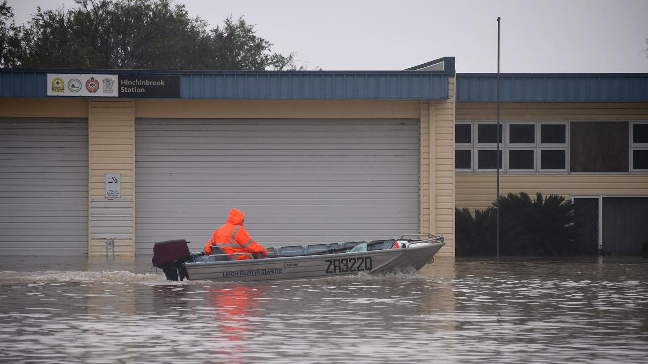
More than 100mm fell in the Cardwell Gap in the 24 hours to Monday morning.
The Gap has seen heavy rainfall totals since February, with the Bruce Highway being completely severed on multiple occasions at the Arnot Creek and Seymour River bridges as well as the Gairloch S-bend.
The state of the notorious flood-prone highway north of Ingham has been condemned.
The town of Halifax and the Lower Herbert has been cut-off from Ingham on multiple occasions leading to widespread and ongoing disruptions to the education of hundreds of children.
A minor flood warning is currently in place for the Herbert River but that is expected to again rise along with the river during the week, although severe weather warnings are yet to be officially issued.
Mr Regano said the weather was being caused by predominant south-easterly trade winds were colliding with a winds from a broad trough connected to a low in the Northern Territory.
“The clockwise winds around that low are bring north-easterly winds down from the Tropics and they are crashing into … the trade winds, we call it a convergence,” he said.
“That convergence has been sitting right over Townsville (currently), that’s where the heaviest falls have been.”
Mr Regano could not rule out renewed flooding in Hinchinbrook.
“Townsville has already broken its March record for rainfall … we’ve had about 300mm odd this month so far and the previous record was in the high 200s,” he said.
“We are also well and truly on track for having our wettest calendar year on record, we’ve only got a couple of hundred mm to go and we could break that just in the next few days and we’ve got the whole year to go.”

Mr Regano said it was crucial for North Queenslanders to remain abreast of the latest weather or flood warnings as conditions were highly changeable.
“They are changing minute by minute.”
He said the river to look out for was the “already soaked” Herbert.
“It won’t take much to get that one up.”
Hinchinbrook Mayor Ramon Jayo said residents “must continue to remain vigilant of the rain and above all else, be prepared for what may arrive”.
“Hopefully you have already attended to your normal preparations and have your emergency kits ready and pantries restocked with all essentials to get you through any periods of isolation that flooding in particular may bring,” he warned.
“If not, then sooner rather than later would be better as roads may close pretty quickly in current conditions.”
More Coverage

Originally published as Hinchinbrook floods: BOM issues severe weather warning for disaster-struck shire
Join the conversation

LNP pledges half a million for NQ community sports club
Funding for a community sports centre to improve its shade protection from the harsh North Queensland sun is on the cards, if the LNP is elected. See the commitment.
Read more

‘Smoke and mirrors’: Advocate rips into latest youth crime reforms
A former Townsville cop has dismissed the latest set of Adult Crime Adult Time laws set to get passed this week as nothing but “smoke and mirrors”, saying young offenders aren’t fazed by the threat of maximum sentences. Do you agree? VOTE IN OUR POLL.
Read more

Lifeline for NQ patients: Brighter Lives launches Biggest Raffle
Townsville Biggest Raffle launches today with a multitude of prizes up for grabs and all funds raised helping those in need in North Queensland.
Read more

‘Traumatic’: Breast scan backlog leaves women in limbo
Queensland women with lumps in their breasts are being subjected to wait times in excess of a month for scans to find out if they are cancerous or not. See what medical experts are calling for as the solution.
Read more

‘Immense challenge’: Trekkers plan record charity hike
Three intrepid trekkers plan to bush-whack their way through more than 100km of extreme terrain in a record-breaking journey to raise $10,000 for NRL Cowboys House.
Read more

If you were a woman, would you stay in Trump’s America?
Words matter. They describe what is important, and banning them is like burning books, with the same chilling effect. And yet, this is what is now happening under Donald Trump, writes Madonna King.
Read more