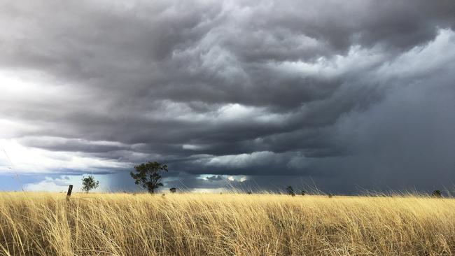
La Nina weather to bring spring rain
A weather event – known as La Nina – is expected to deliver a rainy spring and relief to drought-stricken communities.


Eastern Australia could have higher than average rainfall over the next six months with the Bureau of Meteorology’s weather models predicting the chances of a La Nina event are rising.
The BOM said cooling waters over the Pacific Ocean were pointing towards a La Nina forming.
The other major influence on the nation’s weather, the Indian Ocean Dipole, was also pointing to a wetter-than-average six months.
The predictions will be welcome news for drought-hit farmers in parts of Queensland and NSW.
With the ENSO outlook moving to La Niña Watch, our word for #WeatherWordWednesday is 'La Niña'.
— Bureau of Meteorology, Australia (@BOM_au) June 24, 2020
La Niña typically means above-average winter-spring rainfall for eastern, central and northern Australia.
Learn more about #LaNiña: https://t.co/WqjSR8fgKo pic.twitter.com/an0qXeZYsj
In a statement on Tuesday the BOM said both the El Nino – Southern Oscillation and Indian Ocean Dipole remained neutral.
“The Bureau’s ENSO Outlook is at La Nina watch, indicating the chance of La Nina forming in 2020 is around 50 per cent — roughly double the average likelihood,” the BOM said.
The surface and sub-surface of the tropical Pacific Ocean had cooled over recent months. “While the cooling trend has eased compared to two weeks ago, over half of the surveyed international climate models anticipate this cooling will approach or exceed the threshold for La Nina during spring, the BOM statement said.
The event typically brings increased rainfall across much of Australia, as well as cooler daytime temperatures outside of the tropics. It also usually marks a shift towards extreme temperatures and more tropical cyclones.
Other ENSO indicators, such as the Southern Oscillation Index, trade winds, and cloudiness near the international date line, were also consistent with a neutral ENSO state.
Much of the eastern Indian Ocean remained warmer than average and three of six weather models continued to suggest the possibility of a negative IOD developing by early spring – another sign of above-average rain.
The news came after rainfall in June was the third-lowest on record across the entire county and below average for most of Australia, according to the BOM.
A lack of rain has affected much of the southeastern quarter of Australia since early 2017.
Some of the worst affected areas have been in the northern and western Murray-Darling Basin, and across much of eastern and central Gippsland in Victoria.
Add your comment to this story
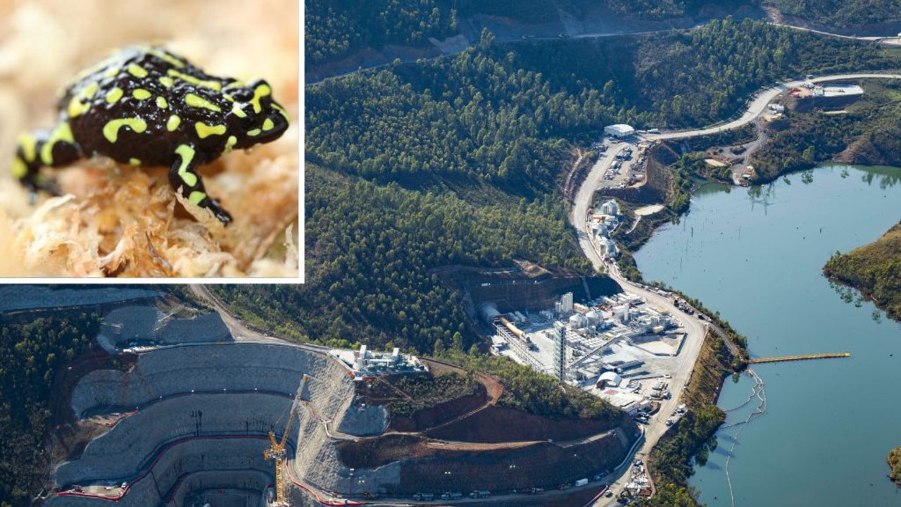
Snowy 2.0 hit with frog fees for pollution
Frogs will be the winners in the latest Snowy 2.0 pollution payout – but what about the long-term damage to Kosciuszko National Park, environmentalists ask.
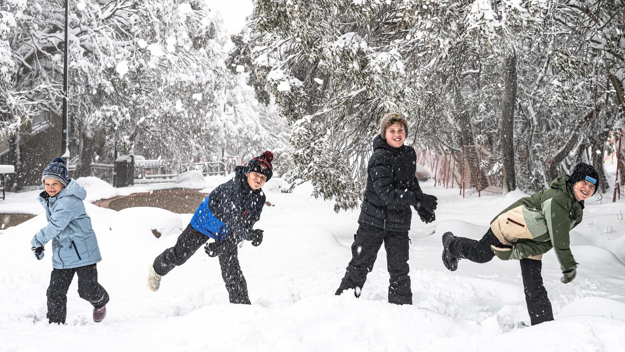
Ski season gets under way and all is white with the world
A blanketing of snowfall starting the ski season is the latest gift of a seasonal weather shift that has broken droughts through the eastern interior and brought a cool shift across Australia.
To join the conversation, please log in. Don't have an account? Register
Join the conversation, you are commenting as Logout