Ski season gets under way and all is white with the world
A blanketing of snowfall starting the ski season is the latest gift of a seasonal weather shift that has broken droughts through the eastern interior and brought a cool shift across Australia.

A blanketing of snowfall starting the ski season is the latest gift of a seasonal weather shift that has broken droughts through the eastern interior and brought a cool shift across Australia.
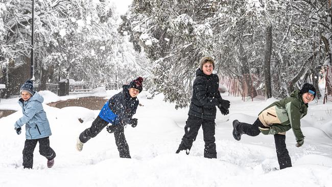
A pelting white-out across Australia’s peaks arrived over the weekend as snow resorts across Victoria and NSW officially began their 2025 ski season.
On Mount Buller, a 31cm snow drop greeted the first skiers of the season, with another 26cm falling by Sunday afternoon.
Temperatures sat at around -1.2C after an overnight low of -2.5C, with snowfall expected to continue through Monday before tapering off across the week.
“It’s been a ripper start to the season,” Mount Buller snow reporter David Clark said. “The trees are covered in snow.
“It’s been an amazing turnout not just from skiers and boarders, but everyone wanting to soak in the vibrancy of opening weekend.
“You can’t ask for a better start to the season. We had been making snow ready to open … then Mother Nature came to the party, so for the people that are out there skiing and boarding at the moment, they have hit the jackpot.”
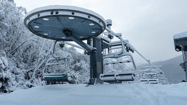
In the NSW Snowy Mountains, Perisher recorded snowfall as high as 45cm through the weekend, while a cold front in the state’s south was expected to be joined by more severe fronts ahead of a high-pressure ridge settling over the state next week.
Further south, Mount Hotham reported 51cm of snow across the weekend, with temperatures sitting even lower at -3C.
“We’re seeing a trifecta of conditions aligning that point to significant snowfall – a surge of cold air from the south, a connection to tropical moisture and a ‘cut-off’ low-pressure system slowly moving over the southeast of Australia,” meteorologist Jane Bunn said.
“Saturday and Sunday look to be the main days for huge snowfalls, and it’ll be bitterly cold too so the snow is perfectly dry – this should set us up for a great start to the season.”
Victorian farmers also rejoiced in the winter shift after a weekend of inland rain broke months of drought, among the worst in recent memory.
Droughts sloping across the eastern flank of the Great Australian Bight have driven farmers to the wall, presenting the worst rainfall deficiencies on record for some communities.
Farmers in Tasmania, WA and NSW also were not left unscathed.
Western Victoria had up to 20mm of rain on Saturday.
Over Sunday, Mortlake, Ballarat and Mount William each enjoyed 15mm of rain between 9am and 3pm.
Rain is expected to hold up across the Surf Coast all week, with an average up to 10mm on Monday and a few millimetres on each of the following days.
The autumn season exhibited the rising polarity in Australia’s extreme weather on either side of the Great Dividing Range, as flooding savaged the eastern coastline and drought wracked inland communities.
Add your comment to this story

Deep-sea desalination on the cusp of helping slake world’s thirst
The world is running out of clean water – this radical new technology promises to fix it.

New nasal spray could assist in treating traumatic brain injuries
When inhaled through the nose, the drug, based on a solution known as ALM (adenosine, lidocaine and magnesium), bypasses the blood-brain barrier and directly enters the brain.
To join the conversation, please log in. Don't have an account? Register
Join the conversation, you are commenting as Logout