Bushfires: Astronaut Paul Scully-Power in ‘space age’ plan to save wildlife
Australia’s first astronaut, Paul Scully-Power, is behind a hi-tech plan to save larger numbers of wildlife during future bushfires.

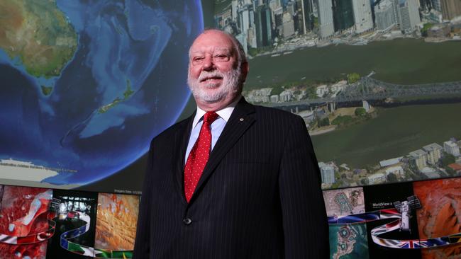
Australia’s first astronaut, Paul Scully-Power, is behind a hi-tech proposal developed with the US Defence Department that could speed up emergency aid and save larger numbers of wildlife during future bushfire seasons by combining targeted satellite imagery with drone technology.
Dr Scully-Power, who served as a payload expert aboard the US Challenger space shuttle in 1984, said the response in bushfire-ravaged areas could be cut from days to minutes using an artificial intelligence program shared by the Pentagon’s Defence Innovation Unit.
The 75-year-old oceanographer and former navy diver said the capability now existed for AI algorithms to identify and grade bushfire damage quickly across thousands of square kilometres from satellite imagery.
In a two-step process, drones could then be deployed automatically from the ground to fly to bushfire-affected areas to kickstart the distribution of aid and rescue operations.
Dr Scully-Power, co-founder of local drone company Ripper Group, has formed an alliance with others in the drone industry to help wildlife rescue charity WIRES save endangered animals in the bush. Drone alliance members say they were moved to help following reports that half a billion animals may have died in recent fires.
Dr Scully-Power said his satellite-drone proposal was based on an offer made to him by Bryce Goodman, chief strategist with the US Defence Department’s innovation unit, to help with Australia’s bushfire recovery by sharing advanced AI algorithms.
He said the development was the result of a public competition in the US sponsored by the Pentagon’s innovation unit in which participants were asked to build algorithms capable of automatically identifying and classifying damage to buildings, using before-and-after satellite images.
Dr Scully-Power said he had advised the chief of staff in Defence Minister Linda Reynolds’s office about the Pentagon unit’s offer to help, and believed the two Defence Departments were now “working closely together testing and applying algorithms”.
A spokesman for Senator Reynolds confirmed the Pentagon’s Defence Innovation Unit had provided her department with a series of developmental AI algorithms to “assess if they can help with detection and mapping of damage caused by bushfires”.
The spokesman also said the AI algorithms had been referred to the Australian Geospatial-Intelligence Organisation.
“These AIs, and those like them, could help Defence quickly generate important information that can be used both in domestic disaster management and in support of Defence’s international humanitarian assistance and disaster relief missions,” he said.
According to Dr Scully-Power, his own alliance group conducted a successful test on Wednesday with the support of NBN mobile trucks operating in remote bush areas to provide connectivity.
He said the NBN trucks had helped relay a series of high-definition satellite images of pockets of land that were not burnt out in the fires. Drones were then sent to the targeted areas as part of the test.
Dr Scully-Power said he was optimistic about his proposal, and that saving wildlife was the first stage of a wider use of satellite and drone technology that would require government support to work by agreeing to enhance satellite monitoring.
He also said he was facing some scepticism.
“From the Australian side, they are saying we are still developing this capability,” he said.
“I think the Defence Department is also getting a bit of push-back from the fireys basically saying: ‘We’ve got it all under control, we don’t need any help, our planes know where everything is.’
“This is true up to a point, but when a bushfire comes through, they say ‘Australia is burning’. That’s where the high-resolution satellite and (two-step) thing comes in. By that stage, the fireys no longer have planes in the air spotting anything.”
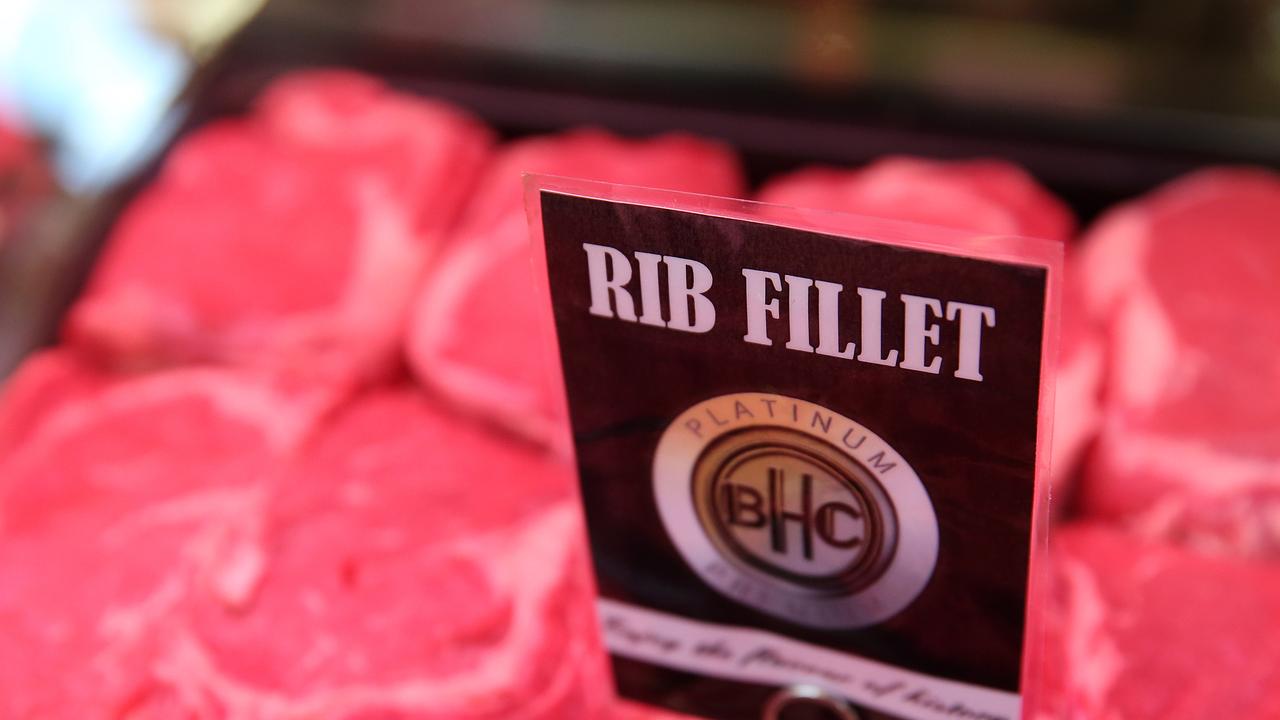
Researchers caution against activists’ anti-red meat agenda
The guaranteed benefits of eating red meat outweigh the “low-certainty” evidence used to discourage its consumption, researchers say.
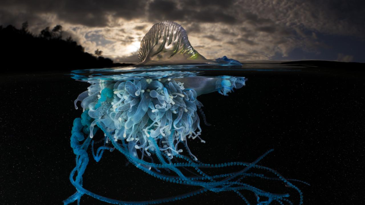
A sting in the tail
They’re the bane of summer days at the beach. But who knew bluebottles were so beautiful, and so interesting?