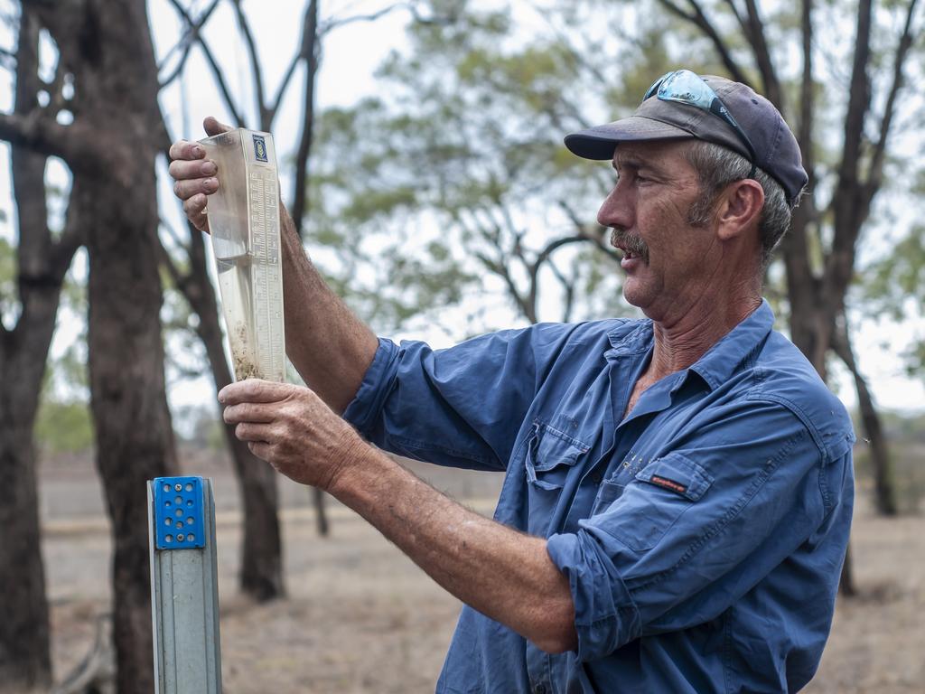
Weather: Eight-day drenching looms for Queensland, NSW
Flood warnings have been issued for parts of Qld and NSW, with more rain forecast over fire-affected regions.
Southeast Queensland and northeast NSW have received a drenching, with the next eight days likely to deliver more rain over fire-affected regions.
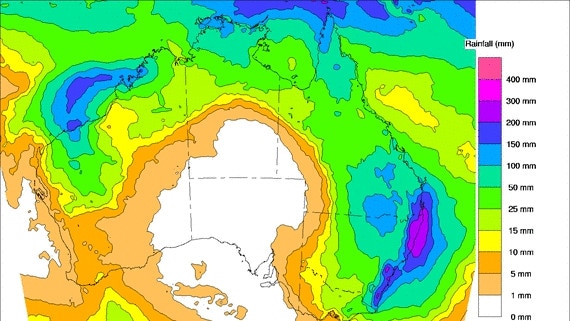
Overnight some parts of Queensland nearly saw 150mm, with Mt Elliot receiving 140mm, Coops Corner receiving 128mm and Bidwell receiving 109mm – the most across the state.
Drought affected areas in the west including the Lockyer Valley and West Dalby did not see much rain, where about 10mm or less fell.
However NSW and Victoria did not share in the heavy rainfall, the most in Victoria just 1mm in Darnum near the south, while Terania Creek in NSW’s north received 24 mm.
Significant rainfall ☔ totals last night between Noosa and Bundaberg with 141mm recorded at Mt. Elliot and 128mm at Coops Corner. Moderate rainfall expected to continue along the southeast coast, moving offshore and onto the Gold Coast tomorrow.
— Bureau of Meteorology, Queensland (@BOM_Qld) February 5, 2020
Forecast: https://t.co/84QfRx7d0U pic.twitter.com/qzhSTTpLSC
The Bureau of Meteorology’s Alex Majchrowski said more rain could fall where it’s needed today.
Mr Majchrowski said 5-15mm would fall on the Lockyer Valley and up to 30mm would fall on West Dalby.
Severe thunderstorm warnings, including heavy rainfall and damaging winds, have been issued for areas from the Gulf to Marino and Warrigo, extending to the Peninsula today.
Mr Majchrowski said the wild weather is expected to ease up on Friday.
The Bureau of Meteorology is forecasting 10-20mm over drought-hit northwest Queensland and down to Mildura in northwest Victoria.
Heavy rain has been forecast by the BoM over the next few days for NSW and the ACT. Some areas of the central and northern coast of NSW will see falls of between 100mm and 300mm, with some areas potentially receiving 500mm over the next eight days.
Heavy #rain has been forecast for #NSW and the #ACT over the next few days. Now is the time to clean out those gutters! For all warnings https://t.co/K1nVeIHqq7. For information on preparing for rain and possible flooding refer to the NSW #SES at: https://t.co/AbGRsGsth5 pic.twitter.com/IENwoP7Ary
— Bureau of Meteorology, New South Wales (@BOM_NSW) February 4, 2020
Scorched areas of Victoria could miss out. “Coastal troughs are notoriously difficult to predict,” BOM meteorologist Dean Sgarbossa said.
“The greatest chance is over the weekend if the trough near NSW deepens and moves — it will bring rainfall to numerous bushfire sites over eastern Victoria and southern NSW.”
But he warned it was too soon to call the drought over.
“We need to be careful to avoid the temptations of saying drought-breaking rain,” he said. “We need to experience many months of above average rainfall just to make up the drought deficit.”
Some areas of NSW are currently 60 per cent below their average rainfall, with many areas recording their lowest yearly rainfalls on record.

Add your comment to this story

British defence chiefs shore up AUKUS pact with 50-year commitment
The announcement, made in Sydney, comes amid uncertainty over AUKUS as America reviews the agreement and Anthony Albanese fails to land a sit-down meeting with Donald Trump.

Top British officials touch down to touch base on AUKUS
AUKUS will be the focus of talks between UK and Australian ministers including British Foreign Secretary David Lammy and Defence Secretary John Healey, in Sydney on Friday.
To join the conversation, please log in. Don't have an account? Register
Join the conversation, you are commenting as Logout