Prepare for battering after polar blast triggers blizzards
A “storm of the season” is expected to batter the southeast with thunder, snow, hail, flash flooding and icy winds.
A “storm of the season” is expected to batter the southeast of the country with thunder, snow, hail, flash flooding and icy winds at the weekend, following a dangerous polar blast that wreaked havoc in South Australia yesterday and triggered blizzards and emergency warnings in Victoria and NSW.
Authorities in South Australia scrambled through heavy rain to respond to damage caused by destructive winds of 100km/h, with 6000 properties left without power and felled trees blocking stretches of road and hitting houses.
The Bureau of Meteorology upgraded its severe weather warning to “destructive” for winds in South Australia as winds on Hindmarsh Island topped 100km/h.
A severe weather warning has been issued for Eyre and Yorke peninsulas, the mid-north and the southeast, with wind gusts of up to 130km/h forecast.
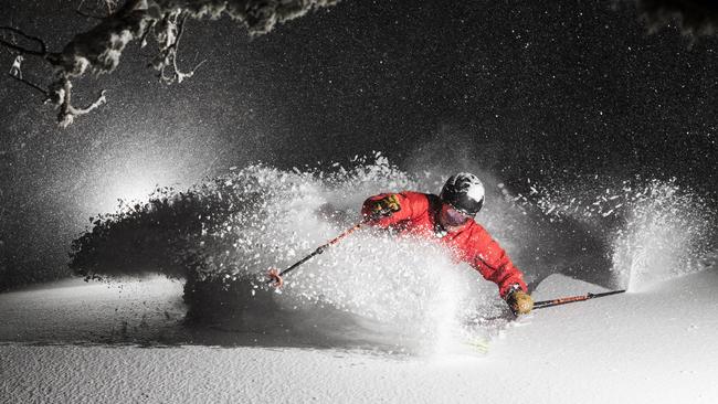
The system of dual cold fronts also brought the “snowstorm of the season” in Victoria and NSW, with up to 150cm of powder expected by the end of the weekend at resorts in the alpine regions.
The storm will push further into NSW today, with the potential for snowfall in lower altitude areas such as the Blue Mountains, Orange and Barrington Tops.
Victorian authorities last night issued an emergency warning for residents to prepare blackout kits, avoid flash flooding and fasten loose furniture, as volunteers doorknocked communities across the southwest and centre of the state to warn of the risks of the storm.
Spokesman Chris Hocking said Mount Hotham ski resort in the state’s alpine region was booked out over the weekend.
“It’s basically the snowstorm of the season so far,” he said. “For powder hounds it’s music to their ears.”
There were no injuries from a small avalanche at the resort yesterday after about 40cm of snow fell in 24 hours.
Senior meteorologist Tom Delamotte from the Bureau of Meteorology said snow could fall in the Melbourne area, including around Mount Dandenong, as well as Ballarat and near the Macedon Ranges.
“By Friday night we should start to see the snow level lower to about 500m across much of Victoria including the Melbourne area,” he said.
Victoria will be blasted as a cold front brings icy winds with the bureau issuing a severe weather warning for northern parts of the state. Melbourne is expected to be hit by gusts up to 110km/h with the worst expected to hit early this morning.
Mr Delamotte said temperatures across Melbourne would feel about 6C colder in coming days than they actually were, due to low humidity. “We do have maximums of around 11C forecast for both Friday and Saturday,” he said.
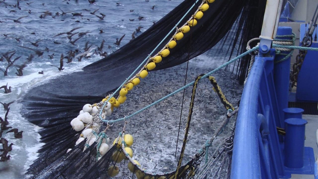
‘Holy grail’ fish discovery comes with one big catch
The discovery of a rare, untapped, abundant and delicious food source off Australia’s southern coast is quickly shaping as an unsavoury battle.
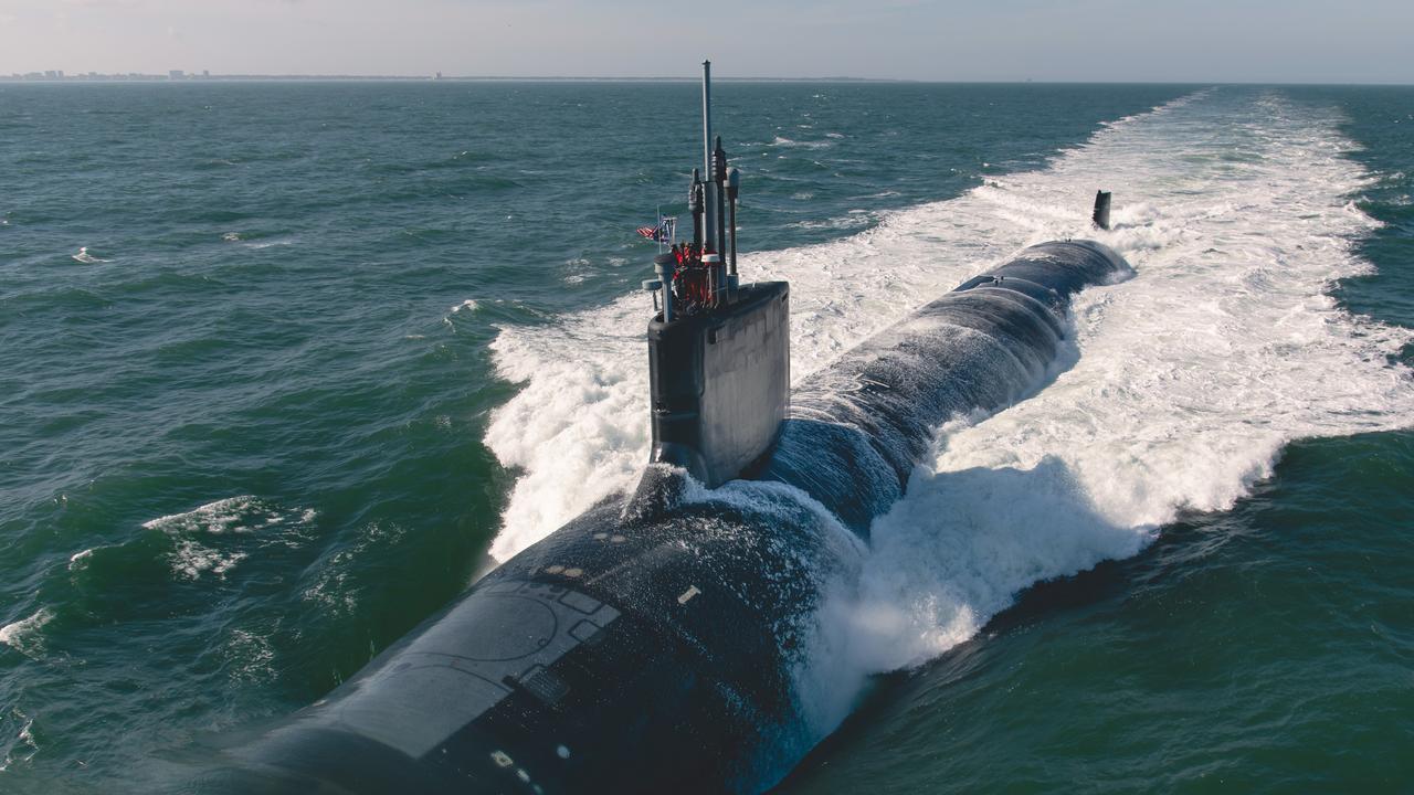
Marles pays US an AUKUS advance
Australia has made its first AUKUS down payment to the US as the Albanese government looks to lock-in Trump administration support for the submarine program.