The secret lifestyle zone seven million Aussies don’t want the rest of us to know about
There’s a reason locals don’t want this newly-discovered demographic wall that defines modern Australia revealed: they want to keep it all to themselves.

It is an issue that has shaped Australia for more than a century. It is the city-bush divide.
It was present in Banjo Paterson’s Clancy of the Overflow (1889), which was a city clerk’s lament about how he longed to take a turn at droving where the seasons come and go. It is present today in voting patterns, in popular culture, in the demography of the Australian people.
What we as Australians require is a more nuanced way of viewing our nation that more fully appreciates the scale of demographic change that has emerged outside our largest cities.
Australians have long tended to view the Australian nation and continent through the lens of state capital city “and the rest”.
In this perspective of regional Australia I have mapped population change over the decade to June 2023 at the smallest area level possible to identify a new and emerging lifestyle region spreading across five states and the ACT.
In the technical world of the Australian Bureau of Statistics, “metropolitan Australia” comprises the capital cities of eight states and territories that, in June 2023, added to 17 million. The population of regional Australia (ie, “the rest”) at this time was nine million.
I have always thought that the concept of a single vast regional (or non-metropolitan) Australia is flawed because it lumps together fast-growing lifestyle areas such as the Gold Coast with sparsely populated and often contracting communities in, say, the wheatbelt of Western Australia.
I think we need to start viewing regional Australia differently based on an emerging contiguous lifestyle zone that abuts and draws demographic support from our five largest cities.
Australians have similar lifestyle preferences across the mainland and Tasmania, as is evidenced in the sea-change and tree-change zones present within each state and territory.
However, these emerging lifestyle zones combined with intensive agriculture (such as horticulture and dairying) and proximity to the capital city have effectively merged to form a closely settled strip stretching along the eastern seaboard and across the southwest tip of WA.
At an aggregate level I think at June 2024 there were about 17 million Australians living in Sydney, Melbourne, Brisbane, Perth and Adelaide, and about 10 million living in other parts of the nation.
And of this “balance” I estimate around seven million live in a more or less contiguous single lifestyle zone, and that three million live in remote and detached areas including the whole of the Northern Territory, the state of Tasmania and across various state parts of the interior.
The point is that Australia has five big cities of a million-plus residents as well as another single region that isn’t remote, that isn’t detached, and that in some ways has been regarded as either overspill from capital cities (in each state) or as legacy settlements from the 19th and 20th centuries.
This single amorphous lifestyle region extends in a rural-urban coagulation from Rockhampton in Queensland along both the eastern and western slopes of the Great Dividing Range through NSW (including cities such as Dubbo and Wagga) to Victoria, along the coast and the Riverland of South Australia, across the southern tip of the Eyre Peninsula, and including the southwest tip of WA.
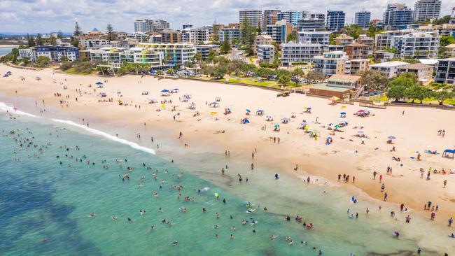
This single region, excluding the big capitals, effectively unites seven million Australians in a community that is bigger than Sydney and that over the past decade has added 87,000 net extra residents per year at an average annual growth rate of 1.4 per cent.
It’s a bit like “discovering” a new capital city hiding in plain sight, sitting quietly, minding its own business, happily allowing the vocal local state capital to commandeer popular attention as well as the usual congestion and affordability issues.
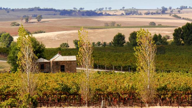
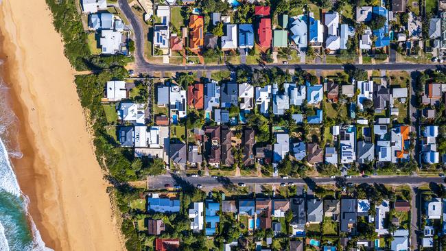
Here is a single region united by retirement (includes Gold Coast), by industry (includes Wollongong), by lifestyle (include Surf Coast), by proximity to capital city amenity (includes Barossa) and by the fact that it offers a laid-back way of life (includes Margaret River).
Here is a closely settled strip that has never been regarded as a single region previously and yet each of its components, I would argue, have more in common with each other than with their respective capital cities. Here is a region I think at the very least deserves the sovereignty and the respect of a distinctive name. I like “the near regions”.
In some ways this definition of the near regions follows the logic of the Goyder Line, which was drawn by South Australian surveyor-general George Goyder in 1865 in order to mark the limits of arable land based on rainfall.
Using ABS data published annually at the smallest area level possible (SA2, districts of about 10,000 residents) I have, together with data scientist Hari Hara Priya Kannan, exposed a single (yellow) line that separates the great Australian interior from the arable lands, and modern lifestyle zones, located closer to the coast.
There are parts of the near regions that are losing population but these are generally isolated places and include, for example, parts of dairying communities where farm aggregation is ongoing. Other losses can be explained by one-off mine (or other business) closures. The bigger macro trend within the near regions is one of growth and of positivism over the decade to 2023.
The line separating the interior from the near regions (shown in yellow) presents as a demographic wall holding the line between population increase and decrease. However, population losses aren’t always associated with a decline in economic activity.
I prefer to see much of the interior’s population loss as evidence of the use of agribusiness technology rather than contracted labour. Australian wheat production has increased from 25 million tonnes in 2000 to 36 million tonnes in 2022, an increase of 44 per cent over 22 years, which was achieved (evidently) from a wheatbelt access to progressively less labour in the wheatbelt’s red zone.
The loss of population from the interior can result from forces such as mechanisation and automation, which deliver greater efficiencies. It opens up the possibility that cities such as Roma, Dubbo, Wagga, Hamilton, Mt Gambier and Northam may evolve further as agricultural machinery supply, servicing and training centres. It suggests that state governments in these jurisdictions should support the training of, for example, diesel mechanics in these cities.
A 25 per cent increase in world population by 2086, as projected by the UN Population Division, suggests food (such as wheat)-exporting nations such as Australia should be planning to increase food production, and efficiencies generally west of the near regions line, by no less than, say 40 per cent in the 21st century.
A 40 per cent lift in food production means Australia is taking market share in a global market. It also suggests that port handling facilities at, say, the Port of Fremantle should plan for expansion in the decades ahead.
All this is evident, I think, from the discovery and the mapping of what is effectively a modern-day Goyder Line.
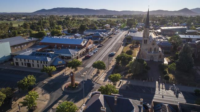
What does this look like at the coalface? In the map inset I show the SA2s (districts) facing off either side of a demographic wall west of Dubbo. Places where the population has dropped over the decade to 2023 include Narromine, Coonabarabran, Parkes and Gilgandra. Places that have experienced growth include the rural residential areas surrounding Dubbo, Orange and Mudgee.
Within this context population losses can reflect greater efficiencies in agribusiness operations, while population growth can reflect a lifestyle preference for workers to commute from acreage allotments outside townships.
New data from the ABS will enable a 2024-based update of this map and of the near regions line in April 2025. The question I have is whether this line is fixed or whether every year it drifts further to the east (or west), reflecting broader forces shaping the edges of Australia’s near regions.
In either case I say it’s time to embrace all parts of the Australian continent and to recognise that we are a lifestyle-driven people shuffling around and making a living in a vast and sparse continent.
But there is also the observation that Australia also offers a hitherto unacknowledged gem, a universal lifestyle idyll that offers Australians the best of all worlds: rural charm, the opportunity of continued growth, and relatively easy access to a capital city.
Maybe that’s why this new near region has never been formally “discovered” and defined: the locals want to keep the allure and the amenity of their near region all to themselves!
Bernard Salt is founder and executive director of The Demographics Group; data and mapping by Hari Hara Priya Kannan
More Coverage
Add your comment to this story

Never again: Aussie Holocaust survivors shine light of hope into dark
Holocaust survivors gather for a national reunion in Sydney, celebrating resilience and life while refusing to let hate overshadow their spirit.
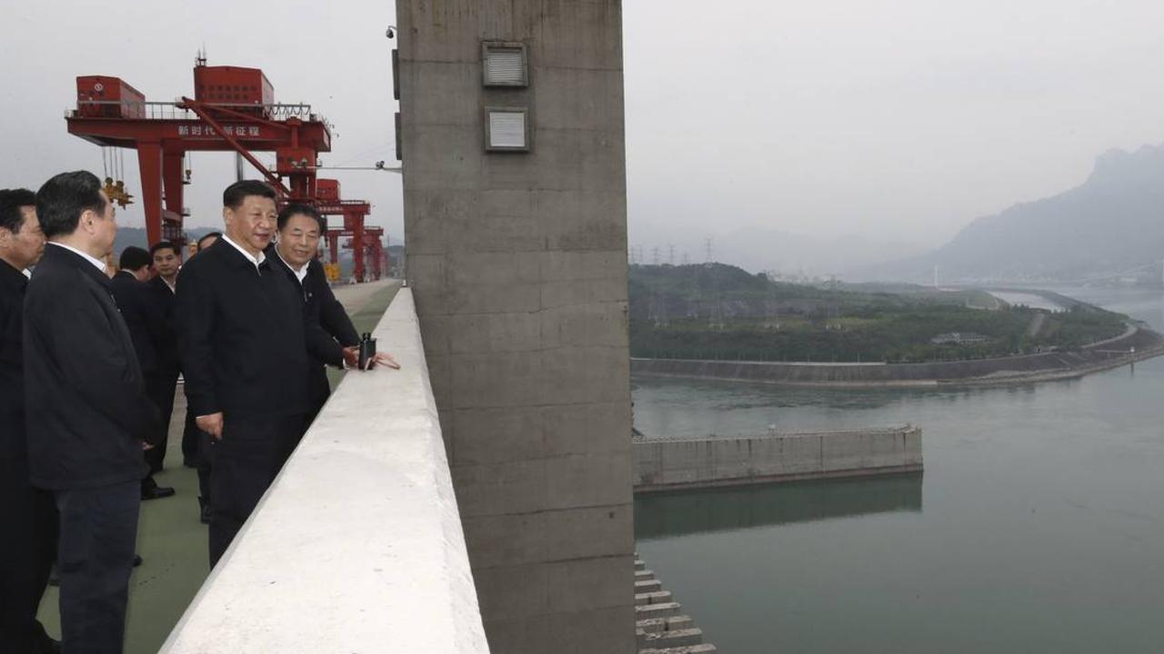
China laughing at Snowy 2.0? Dam straight it is
Beijing has approved a mega hydropower project in Tibet, which would generate 27 times more energy than Snowy Hydro 2.0. Unlike in Australia, industrial disputes are not expected to delay its construction schedule.
To join the conversation, please log in. Don't have an account? Register
Join the conversation, you are commenting as Logout