Storms to rain (a lot) on holiday-makers’ parade in NSW and Queensland
Torrential rain and storms are expected to batter the southeast Queensland and northern NSW coast this week, in a blow to holiday-makers who have braved Covid-19 restrictions and paid thousands of dollars for accommodation.

Torrential rain and storms are expected to batter the southeast Queensland and northern NSW coast this week, in a blow to holiday-makers who have braved Covid-19 restrictions and paid thousands of dollars for Christmas accommodation.
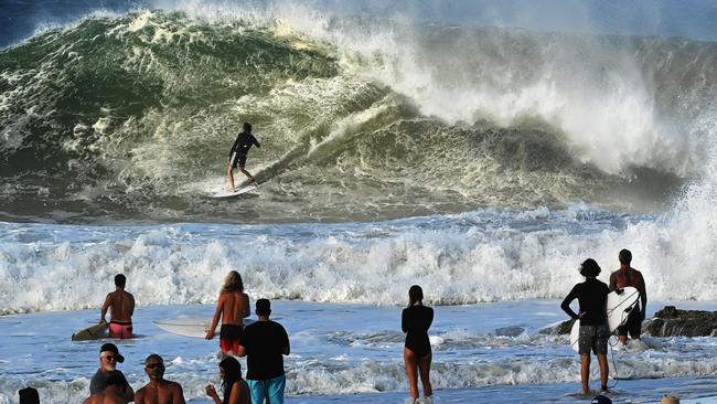
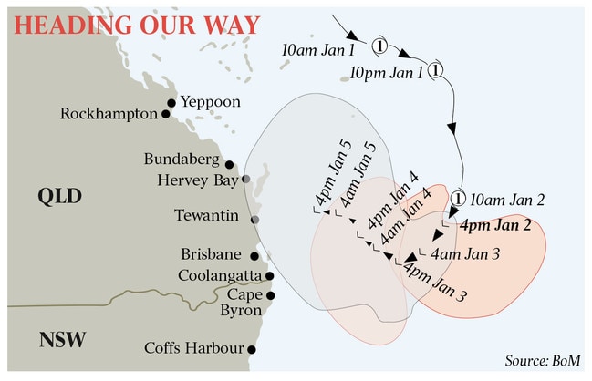
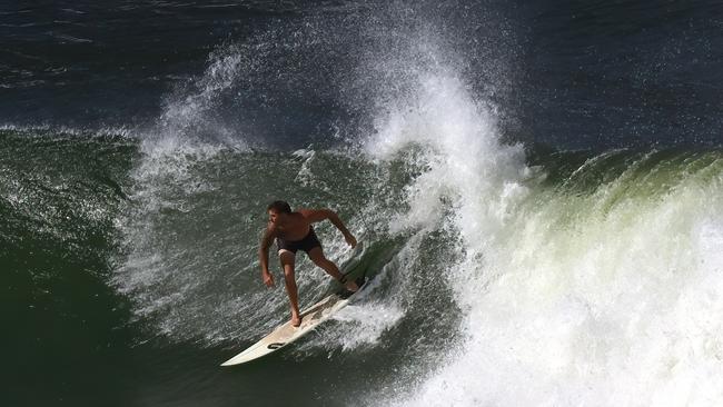
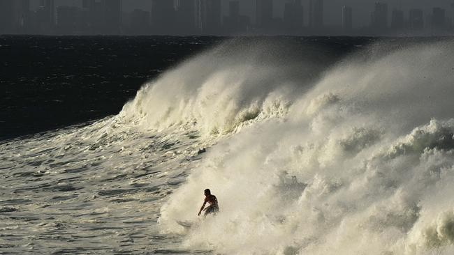
Tropical Cyclone Seth, later reclassified as a “subtropic weather system”, produced swells up to 4m and closed more than a dozen beaches from Noosa to Coolangatta. Flash flooding also cut off some roads north of Brisbane as the storm system tracked south offshore.
Even though the system weakened on Sunday as a result of moving south, Bureau of Meteorology forecaster Shane Kennedy said the storm was likely to continue to produce strong winds and rain as it edged towards the coast and moved north in the coming days.
“It still has, essentially, all of the same impacts – the wind, the rain, the dangerous seas,” Mr Kennedy said.
“It is expected to weaken over the next few days but in the short term is expected to pack just as much punch as a category one tropical cyclone.”
The storm system was sitting 560km east of Brisbane on Sunday afternoon and expected to move west on Monday. Its movements later in the week are more uncertain, with current forecasts showing the low crossing the shoreline somewhere along the northern NSW or southern Queensland coast midweek.
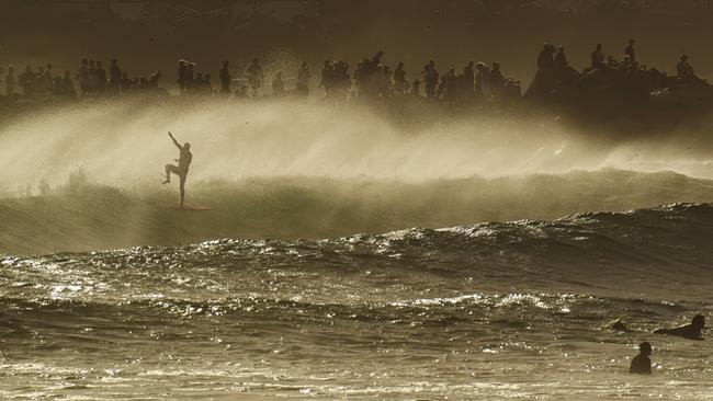
Seas generated strong swells over the new year weekend, with predictions that the high tide may exceed normal forecasts – known as the highest astronomical tide, or HAT – by around 0.5m at some southeastern locations, including the Brisbane area, early this week.
Ex tropical cyclone Seth is not expected to directly impact the mainland until Tuesday. Should the system follow its forecast trajectory, strong, gusty and potentially damaging winds may develop on its approach.
Meanwhile, a heatwave is expected to grip central Queensland, including the coast between Cairns and Rockhampton, until next weekend.
Assistant police commissioner Shane Chelepy warned holiday-makers and locals that, like all cyclones, Seth was unpredictable and being monitored closely.
“It is really important that anybody going to the coast today and over the next couple of days is very mindful that there will be significant surf on the coast, damaging waves and some very high tides, which will cause rips along the coast and some local flooding,” he told reporters in Brisbane on Sunday.
Gold Coast City Mayor Tom Tate advised people to keep away from stormwater drains and local creeks, including Loders Creek and the main rivers feeding into the Broadwater.
Heightened cyclone activity is expected through the early months of 2022 as a result of a La Nina, which is categorised by wetter weather. Mr Kennedy said that may explain why the tropical low has travelled unusually south.
“That would definitely be the main factor here, for sure,” the meteorologist said. “It’s pretty unusual. Usually, they (cyclones) lose their tropical characteristics further north, south of Rockhampton, for example.
“But certainly when the oceans are warm enough and there is enough moisture available, they can, as we have seen here, keep their tropical characteristics as they move towards the south.”
Another storm system is being monitored near far north Queensland over the Coral Sea and may intensify into a tropical cyclone by next weekend.
More Coverage


Time to stop the rot on anti-Semitism, says spy boss
In his strongest comments yet on the issue, ASIO chief Mike Burgess is calling on all Australians to reflect and act on the scourage of anti-Semitism allowed to flourish in the country.

Burke plays roulette politics in brazen ‘citizenship for votes’ blitz
Tony Burke has executed one of the more unsubtle pre-election acts, moving to protect Labor mates in western Sydney seats by fast-tracking thousands of new citizens and voters in key electorates.