Severe weather warnings for NSW as the state prepares for a wet week
Warnings for flash flooding have been issued to mid-north NSW, as severe thunderstorms venture south.
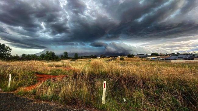
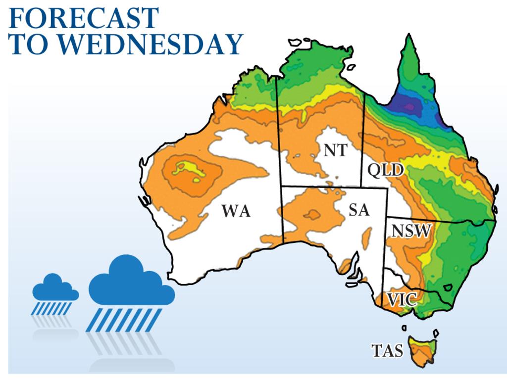
Tens of thousands of people across NSW have been urged to remain on high alert for ferocious thunderstorms that could dump heavy rain and cause life-threatening flooding in the coming days.
An inland trough, which inundated central-western NSW and brought damaging winds and large hailstones to Parkes over the weekend, is expected to impact Sydney on Monday.
“The thunderstorm will be severe in mid-north NSW,” said meteorologist Shuang Wang. “With more heavy rainfall comes further risk for flash flooding.
“We may also see that storm move down south, which could mean heavy rainfall, damaging winds and large hail for Sydney on Monday afternoon.”
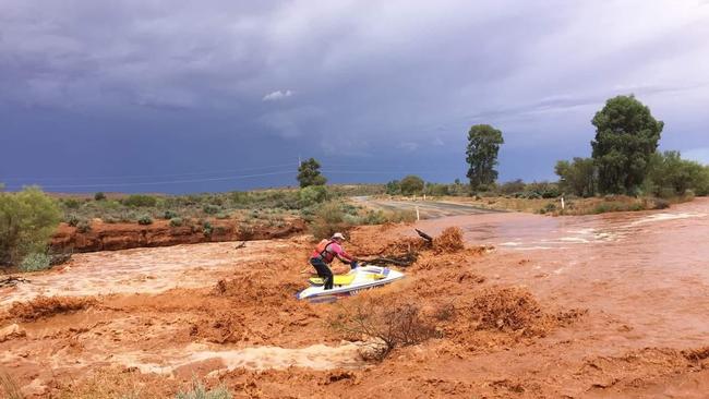
In western NSW, a Woolworths and a motel in Parkes were flooded on Sunday, while the roof of an aged-care facility collapsed following heavy rain.
Broken Hill and Wingham were the towns worst affected by the floods, according to the SES. A number of homes at Harrington, Camden Haven and Taree were also severely damaged by the powerful storm system.
Victoria was also hit with flash flooding at the weekend, after a severe thunderstorm warning was issued by the Victorian SES for “damaging winds” and “life-threatening flash flooding”.
Warrnambool, in the southwest of the state, received 33.8mm in 15 minutes on Saturday, the heaviest rain the town had seen in 100 years.
“The rainfall was intense but short lived,” BOM meteorologist Christie Johnson said.
“As it is moving quite slowly, the towns affected are seeing a lot of rain all at once. It’s not widespread enough to be riverine flooding, so after the rain is done, the water drains away.”
The storm is moving slowly eastwards towards the northeast corner of the state, where towns can anticipate large hailstones, heavy rainfall and flash flooding on Monday.
Further north, the first cyclone of the summer formed in the Gulf Of Carpentaria on Sunday afternoon. The storm system swept over Mornington Island at lunchtime before intensifying into a category 1 storm about 4pm.
Tropical Cyclone Imogen is expected to cross the Queensland coast in the early hours of Monday, north of Karumba, before it weakens back into a tropical low. Severe thunderstorms with heavy rainfall and damaging winds are likely around parts of the Cape York Peninsula and Gulf Country, according to the Bureau of Meteorology.
Gales of more than 100km/h are expected in parts of far north Queensland early on Monday, and will likely be accompanied by heavy rainfall, possible flash flooding and high tides.
Tropical Cyclone Imogen is expected to pass over Australia’s eastern coastline between Cairns and Townsville later in the week.
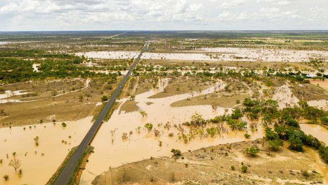
Almost 2000 people were isolated by flood waters in NSW over the weekend, while flooding is expected to affect rivers that stretch from the mid-north coast to Newcastle on Monday.
The Bureau of Meteorology issued a severe weather warning late on Sunday for people in parts of the mid-north coast and Hunter districts, with flood alerts issued for the Hastings, Manning and Lower Hunter rivers.
The NSW State Emergency Service said it had responded to “hundreds of calls” at the weekend from people seeking assistance with damaged roofs, collapsed trees and threatened homes.
Two adults and three children were stranded in a car in Tibooburra on New Year’s Eve as they awaited emergency assistance to remove them from the vehicle.
Two other people were rescued from rising waters in Wauchope on the mid-north coast.
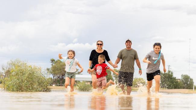
“This is why we tell people not to drive through flood water,” Ilana Pender-Rose, of the SES, said. “Always run or ride.”
Holiday-makers by rivers in mid-northern NSW were another cause for anxiety, as the water levels of low-lying areas rose.
Additional reporting: MACKENZIE SCOTT
More Coverage

Price to retain business program
A Coalition government would retain the Indigenous procurement policy that has delivered $10bn to businesses owned or part-owned by Aboriginal and Torres Strait Islander people.

‘Relief needed to lure buyers back’
Interest rates would need to be cut five or six times to motivate buyers back into the property market, with younger Australians likely to purchase sooner.