Freezing weather warnings for Australia and the country prepares for a rainy week
A concoction of damaging winds and icy rain will tear through Australia this week, with winter holidaymakers crossing their fingers the cold weather will mean heavy snowfall.


A freezing concoction of damaging winds and icy rain will tear through Australia this week, with winter holidaymakers crossing their fingers the cold weather will mean heavy snowfall.
Early season snow conditions on the eastern states have been “absolutely amazing”, seeing skiers and snowboarders racing to the mountains to make the most of the heavy laden slopes.
Resorts are hoping the trend continues as school holidays kick off, and the forecast seems ready to accommodate.
“We’re seeing really strong demand for skiing and snowboarding ahead of the holidays,” a Thredbo Resort spokeswoman said. “There is snow forecast for Wednesday through Friday this week, so it’s looking really good for the early season.”
But a cold weather front whipping across the country isn’t good news for everyone, with “cold, wet and windy” conditions expected to cause “treacherous” road conditions this week.
A low pressure system will build in the southern parts of Western Australia on Monday, with showers and isolated thunderstorms set to blast the majority of the state.
With Perth expecting highs of only 14 degrees, Bureau of Meteorology meteorologist Dean Narramore said temperatures in the central coast of the state would struggle to get to double digits.
“Temperatures could drop anywhere from four to eight degrees below the June average,” Mr Narramore said. “That’s pretty cold for them, seeing as some of these places have a similar latitude to Sydney or Newcastle.”
Some sections of the Stirling Ranges could see flurries of snow, he said, while in the north parts of the state, the Pilbara, can expect heavy rains and thunderstorms.
On Tuesday, the thick band of rain will move further east, through the south of the Northern Territory and the northern parts of South Australia, lashing the Great Australian Bight by Wednesday.
New South Wales and Victoria will experience only light showers between Monday and Wednesday, but by Thursday it will begin to pelt down.
“A good amount of rain will also land on inland ranges, on lots of agricultural communities and in cropping areas,” Mr Narramore said. “The places with the best chance of getting good rain are Dubbo (25mm), Forbes (25mm), Wagga Wagga (25mm) and Bendigo (10mm).”
Melbourne will see up to 6mm of rain on Thursday, while Sydney will have 5mm.
Damaging winds and some heavy rainfall could lead to some flash flooding in localised areas, Mr Narramore added, urging residents who planned to travel to “keep an eye out for weather warnings.”
Some areas on the northern coast of NSW could see winds reaching 40km/h, while parts of Victoria’s eastern coast will experience 30km/h gusts.
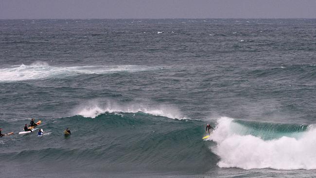
At the weekend, sections of the east coast saw huge swells of up to six metres, forcing authorities to caution against entering the ocean.
The warning, which extended from the Victoria-NSW border up to Newcastle, has since been retracted, and surf conditions have settled back to normal peaks.

Just cool it on rate cuts: Chalmers
The Australian understands that Jim Chalmers has been privately telling Labor colleagues not to speculate on an interest-rate cut ahead of the RBA decision, in an effort to manage expectations of relief.

This hellishly good Hadestown cast is simply heavenly
The show boasts a suite of charismatic stars but Rokobaro is something else, scorching with off-the-charts sex appeal, wild physical abandon and powerhouse singing.