Wild storms to continue for rest of the week as cold fronts move across Western Australia
Storms have lashed a state, with a possible tornado ripping a roof off a home, and there’s more wild weather on the way.
Ferocious storms will batter Western Australia for the rest of the week as an “unusual” cold front system continues to move across the state.
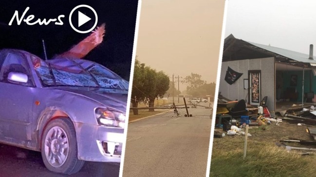
The supercell storm event hit southwestern WA on Monday with rainfall totals topping 30mm and flash flooding reported in some areas.
More than 1200 homes and businesses were left without power in Bedfordale, Mount Richon, Roleystone and Lower Chittering.
A possible tornado ripped a roof off an Eagle Bay home on Monday while a family slept.
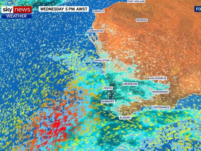
Bureau of Meteorology duty forecaster Catherine Schelfhout said there would be a slight break in the fierce weather on Wednesday morning, but the storms would “pick up again” on Wednesday evening.
“It’ll be gusty with showers and a chance of thunderstorms continuing all week,” she said.
“There will be showers and possible thunderstorms around the southwest of the state today (Tuesday) and a severe weather warning is in place for Perth.”
She said damaging winds, averaging 60 to 70km/h with peak gusts in excess of 100km/h were possible, and could cause damage to homes and property.
Cape Leeuwin recorded a wind gust of 98km/h at 3.21am on Tuesday, while Cape Naturaliste recorded a gust of 85km/h just after midnight and Mandurah recorded a wind gust of 100km/h at 7.05pm on Monday night.
“The ground is very wet after flash flooding in parts of the state on Friday – localised flash flooding is still possible but there’ll be consistent showers - not intense, short periods like Friday,” Ms Schelfhout also warned.
She said the wild weather was caused by a series of cold fronts moving across the state at the same time and described the weather pattern as “unusual”.
“Normally we get cold fronts moving through every five days, but multiple cold fronts are moving through at the same time every two or three days,” Ms Schelfhout said.

There will be light showers across the state over the weekend before the weather is expected to ease early next week.
A severe weather warning remains in place for parts of the Perth Metropolitan, South West, Lower South West, Great Southern and Goldfields-Midlands areas.
The advice from 6.18am on Tuesday morning was that Albany, Bunbury, Busselton, Katanning, Mandurah, Manjimup, Margaret River, Mount Barker, Narrogin and Perth could be affected by storms.
“This is an unusually prolonged event with damaging winds expected to continue within squalls and thunderstorms until late Tuesday,” a Department of Fire and Emergency Services warning said.
Emergency services have already answered more than 106 calls for help since 4am on Monday.

Man arrested for alleged murder of woman
A man has been arrested following investigations into the suspicious death of a woman who was found dead in her home.

Horror way tourist killed while driving
Police are appealing for information after an international tourist died as a result of a shocking and unexpected incident while driving.