Qld beaches closed amid hazardous surf as strong wind warning active for Victoria
Treacherous conditions that have closed beaches in one state are set to get worse as a huge weather system begins to build out of the Tasman Sea.

Queensland and Victoria are bracing for another day of wild weather, as hazardous surf and destructive wind warnings remain active on Wednesday.
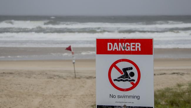
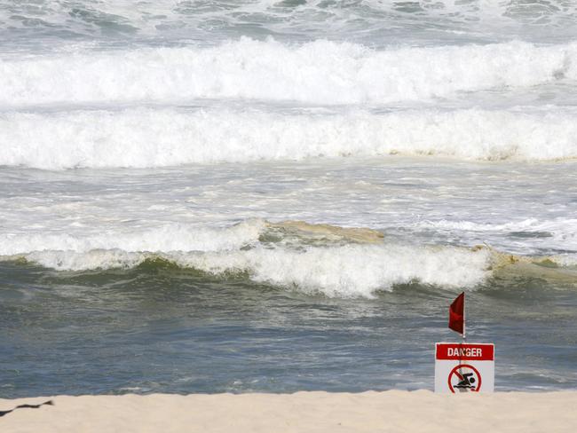
Hazardous surf has impacted Fraser Island Coast, Sunshine Coast, and Gold Coast waters, the Bureau of Meteorology has warned, however conditions have eased overnight. A number of beaches will remain closed on Wednesday, however.
“An east to south-easterly swell (1.5 to 2.5m with a period of 12 to 13 seconds) has eased below warning thresholds about the southeast for Wednesday, but is expected to return to warning levels on Thursday evening (2 to 3 metres, 14 to 16 second period),” the Bureau said.
“This swell is being generated by a low pressure system and a high pressure system interacting near New Zealand.”
Five beaches on the Gold Coast – Sheraton tower 41; Staghorn Ave tower 36; Surfers Paradise tower 34; Mermaid Beach tower 26; and Nobby’s tower 23 – remain closed on Wednesday.
On the Sunshine Coast, Kings Beach remains closed, but Mudjimba has been reopened by Surf Life Saving Queensland. Main Beach on North Stradbroke Island is expected to remain closed on Wednesday.
#CLOSED - #MainBeach on #NorthStradbrokeIsland is closed due to dangerous conditions. Please stay out of the water. pic.twitter.com/qpMgtFqpGi
— Surf Life Saving Queensland (SLSQ) (@lifesavingqld) May 24, 2021
Surf Life Saving Queensland says people should consider staying out of the water, and avoid walking near surf-exposed areas.
In addition, boaters planning to cross shallow water and ocean bars should “consider changing or delaying their voyage”, but if they do venture out should wear a lifejacket and consider their safety management plan.
By Thursday night, the Bureau has warned surf and swell conditions will become hazardous for certain coastal activities, and more beaches could be closed.
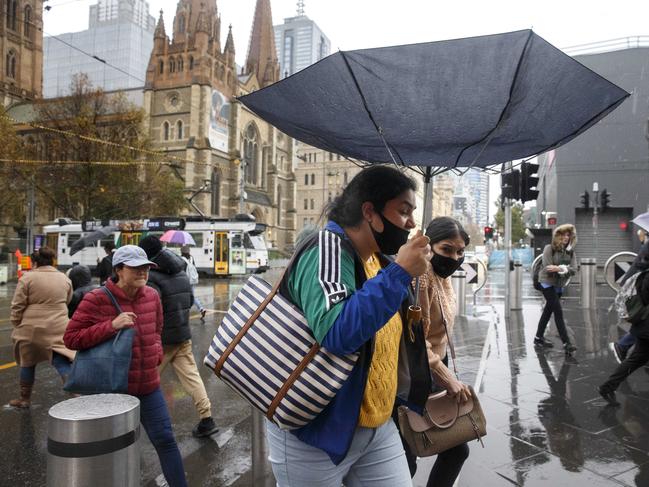
It comes as Victoria braces for another day of destructive winds, after gusts of up to 126 km/h were recorded in the state on Tuesday afternoon.
A trough will move eastwards across southern Victoria during Wednesday morning, with associated “squally” west to north-westerly winds set to extend across coastal and adjacent inland areas.
The Bureau has warned Warrnambool, Portland, Colac, Geelong, Wonthaggi and Rosebud could be impacted by strong and squally west to north-westerly winds, averaging 30 to 50 km/h, with peak gusts around 90 km/h on Wednesday.
Winds are expected to ease later in the day.
The Bureau has also cancelled its severe weather warning for the East Gippsland, North East and Wimmera districts after strong wind gusts were recorded on Tuesday.
Strongest gusts in the 12 hours prior to 3am Wednesday:
- Mt Hotham: 126 km/h at 4.27pm
- Falls Creek: 109 km/h at 6.19pm
- Mount Buller: 106 km/h at 5.41pm
- Aireys Inlet: 93 km/h at 11.45pm
- Cape Nelson: 93 km/h at 1.53am
Wild weather leaves passengers stranded
Passengers hoping to get a flight out of a popular holiday spot have been turned away after a regional airport closed its doors amid wild weather.

‘Grotesque’: Family’s fury after 95yo tasered
The family of a great-grandmother fatally tasered by a police officer are staring her killer down in court as they share their grief over his actions.