Perth residents urged to sandbag homes as another big storm front closes in
Forecasters have urged Perth residents to sandbag their homes as the second major storm in four days approaches, fearing more flash flooding.
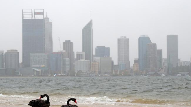
A storm is expected to batter already-sodden Perth for 36 hours and may damage homes, weather forecasters warn, after Friday’s storm caused flash flooding and gave the city its wettest start to July since 1965.
The Bureau of Meteorology forecasts the cold front arriving Monday morning will be the strongest this year, bringing squally weather including the potential for damaging winds, with gusts of more than 100km/h along Western Australia’s west coast and south west regions.
The BoM has issued a severe weather warning stretching from just north of Jurien Bay to Bremer Bay and all areas in between, including Perth, which is expected to remain in effect until Wednesday morning.
People in those areas can expect for damaging winds and surf, heavy rainfall and abnormally high tides.
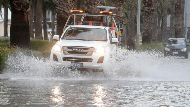
In a rare move, forecasters have urged Perth residents to sandbag their homes, fearing drains are full from recent heavy rains while soils are saturated.
A lengthy deluge on Friday caused many streets, businesses and homes to flood, partly submerged many cars and turned parks into lakes.
“The intensity of rain at times during Friday’s storm was a rare occurrence,” BoM said on Sunday.
“Rain is not expected to fall as fast and hard as it did at times on Friday, but sustained showers and heavy rain in isolated areas is likely to lead to flash flooding, particularly during the passage of the cold front Monday morning.
“The heaviest rain, and greatest potential for flash flooding, is expected around the Darling Scarp and in areas that are already saturated.”
Perth has already had 117.2mm of rain this month, 82 per cent of the monthly average.
Three-day rain totals of 20-50mm with isolated falls as high as 100mm are possible, BoM says, while winds as strong as expected in Monday’s cold front usually occur only twice a year.
Gusty conditions will continue throughout Tuesday, and damage to trees and homes could occur.
Higher than normal tides and dangerous surf across the coast from as far north as Shark Bay through to Albany will continue for several days, with the potential for coastal erosion and inundation in low lying areas such as Riverside Drive in the Perth CBD.

Man arrested for alleged murder of woman
A man has been arrested following investigations into the suspicious death of a woman who was found dead in her home.
Horror way tourist killed while driving
Police are appealing for information after an international tourist died as a result of a shocking and unexpected incident while driving.