NSW and Victoria on flood watch as unseasonable weather continues
The torrential rain may have stopped, but another problem is now facing much of southeastern Australia and could cause more havoc.
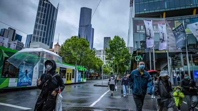
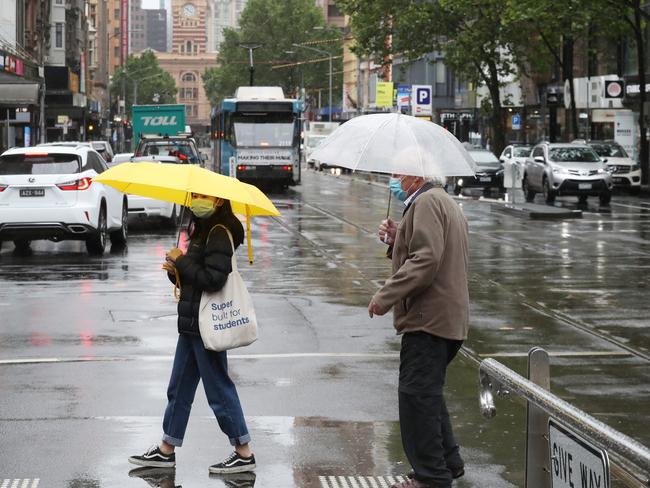
Southeastern Australia remains on high alert as the after-effects of last week’s wild weather continue to wreak havoc across much of the country.
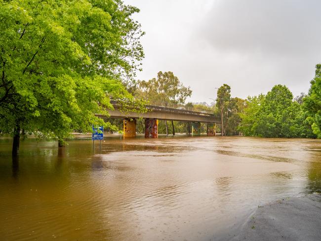
Multiple flood warnings are in place across most of NSW and Victoria after heavy falls led to overflowing catchments.
In NSW, major flooding is causing rivers to rise with flooding similar to the devastating September 2016 floods possible by Monday evening for the town of Forbes in the central west. Cottons Weir and Jemalong were also expected to flood Sunday evening. Water levels are also peaking at Cowra.
Bureau of Meteorology senior meteorologist Dean Narramore said while the low pressure system had since moved across to New Zealand, as much as 150mm had fallen on some areas.
âš ï¸Moderate to Major #Flood Warning updated for the #LachlanRiver. Flooding similar to Sep 16 event possible at #Forbes. Major flooding occurring at #Nanami. See https://t.co/AdztI2rqg1 for details and updates; follow advice from @NSWSES. #NSWFloodspic.twitter.com/tL0a79M9Mh
— Bureau of Meteorology, New South Wales (@BOM_NSW) November 14, 2021
âš ï¸Moderate to Major #Flood Warning updated for #LachlanRiver. Flooding similar to Sep 16 event at #Forbes. Major flooding at #Nanami. Minor flooding current at #Forbes, #CottonsWeir, #Jemalong, See https://t.co/AdztI2rqg1 for details; follow advice from @NSWSES. #NSWFloodspic.twitter.com/tWb9EnhFaX
— Bureau of Meteorology, New South Wales (@BOM_NSW) November 14, 2021
“It fell on already saturated soils that has led to numerous minor and moderate flood warnings,” he said.
In Victoria, Avon, Mitchell, Macalister, Thomson, Latrobe, Yarra, Bunyip Werribee, Kiewa, Murray, Snowy and Mitchell rivers have all been inundated.
While in NSW, there are also flood warnings in place for the Namoi, Macquarie, Bell, Lachlan, Paroo, Belubula, Macintyre and Dumaresq rivers.
Even parts of inland Queensland have been affected.
Mr Narramore said while the flood risks would continue to ease over the coming days, a strong front would bring more unseasonable weather to southern NSW and Victoria.
“We’re going to see some pretty cold temperatures, anywhere from five to 15 degrees below average,” he said.
The front is moving into the eastern suburbs of #Melbourne, shifting winds from WNW'lies to SW'lies.
— Bureau of Meteorology, Victoria (@BOM_Vic) November 14, 2021
Squally showers moving through with cold air and small hail. The chance of a storm this afternoon too! 🥶🌧ï¸ðŸŒ¨ï¸ðŸ’¨ðŸŒ©ï¸
Radar: https://t.co/1FIs2228z7pic.twitter.com/4210fPeOR6
Melbourne will reach a top of just 15 degrees on Monday, while inland areas will feel even more of a chill.
“It’s going to feel more like July or August weather,” Mr Narramore said.
Snow is also predicted to fall as low as 200m in Tasmania overnight, with powder also expected down to 1000m in Victoria, before the temperature creeps back up to normal later in the week.

Saints great defends Godfather offer
St Kilda’s pursuit of Tom De Koning gets the thumbs up from Nick Riewoldt, who believes big contracts offer flexibility.

Aussies staple you’ll be lucky to find
Floodwaters in North Queensland have cut off supply routes for an Aussie staple that will be in short supply at your local supermarket.