More heavy rains to smash southern Queensland, weather bureau issues multiple flood warnings
Multiple flooding warnings have been issued for one state that’s already been battered with heavy rainfall over the past week.
More flooding is expected to sweep parts of southern Queensland as La Nina continues to batter Australia’s east coast with storms, rainfall and hail.
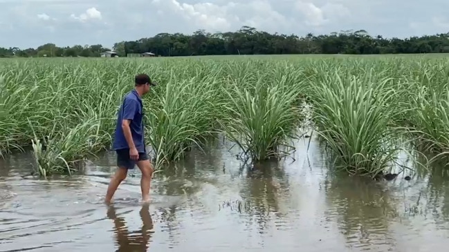
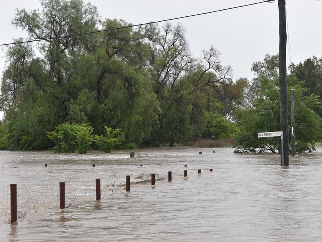
The Bureau of Meteorology issued multiple flood warnings on Sunday across central and southern Queensland, including major flood warnings for Macintyre and Dumaresq, Condamine and Balonne, and Dawson and Warrego.
Meteorologist Shane Kennedy said the focus was turning to the Condamine and Balonne catchment, with properties at risk of being inundated in the northern Darling Downs.
He warned much of the state could expect isolated showers and thunderstorms, with possible severe thunderstorms, heavy rainfall, damaging winds, and large hail in southern Queensland on Sunday afternoon.
That storm system would then move into the southern interior and western Queensland on Monday.
Meteorologist Felim Hanniffy said a reprieve wouldn’t be on the way until at least Thursday or Friday, when northern Queensland becomes the “focal point” for the rainfall.
He said the wild weather was a result of the La Nina weather event.
The major climate driver has already taken hold over much of eastern Australia in the past two months with heavy rain and thunderstorms resulting in the flooding of the Lachlan River catchment in the NSW central west.
Former fire chief Greg Mullins told a Climate Council briefing on Friday that there was “a lot of anxiety” among emergency management personnel about this summer’s La Nina weather event.
“The problem at the moment is the frequency of events and the amount of rainfall,” he said.
“We’re in a situation now where, across Queensland and New South Wales in particular, water catchments and the soil can’t take on any more moisture.
“Any more rain simply runs off the top fills up creeks, rivers, dams, and they get to capacity and then you get riverine flooding.”
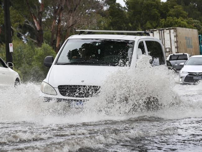
NSW can expect “unsettled weather” to increase through the new week as an inland trough deepens, with wet and stormy weather forecast for much of the state until the trough moves offshore during the latter part of the week.
Victoria will see warm temperatures on Monday, with Melbourne expected to reach a top of 28 degrees.
But the mercury will plummet on Tuesday as a trough bringing rainfall and cooler temperatures moves across western Victoria on Monday evening.
The weather bureau says this La Nina event is likely to persist until at least the end of January 2022.

Sydney seeking derby clean sweep
Juan Mata has been named in an extended Wanderers squad for Saturday’s Sydney derby despite carrying a hamstring injury.

ABC’s apology to former Aussie soldier
An independent review of ABC war crime reporting that sparked criticism for editing gunshot footage has found the broadcaster failed in its duty to its audience.