‘Please stay away’: Warning over dangerous act in NSW flood zone
‘Sightseers’ entering flood-ravaged regions have been issued a stern warning after reports of dangerous acts.
Residents on NSW’s Mid North Coast have been issued a stern warning after reports or people entering flooded areas with heavy machinery to take photos.
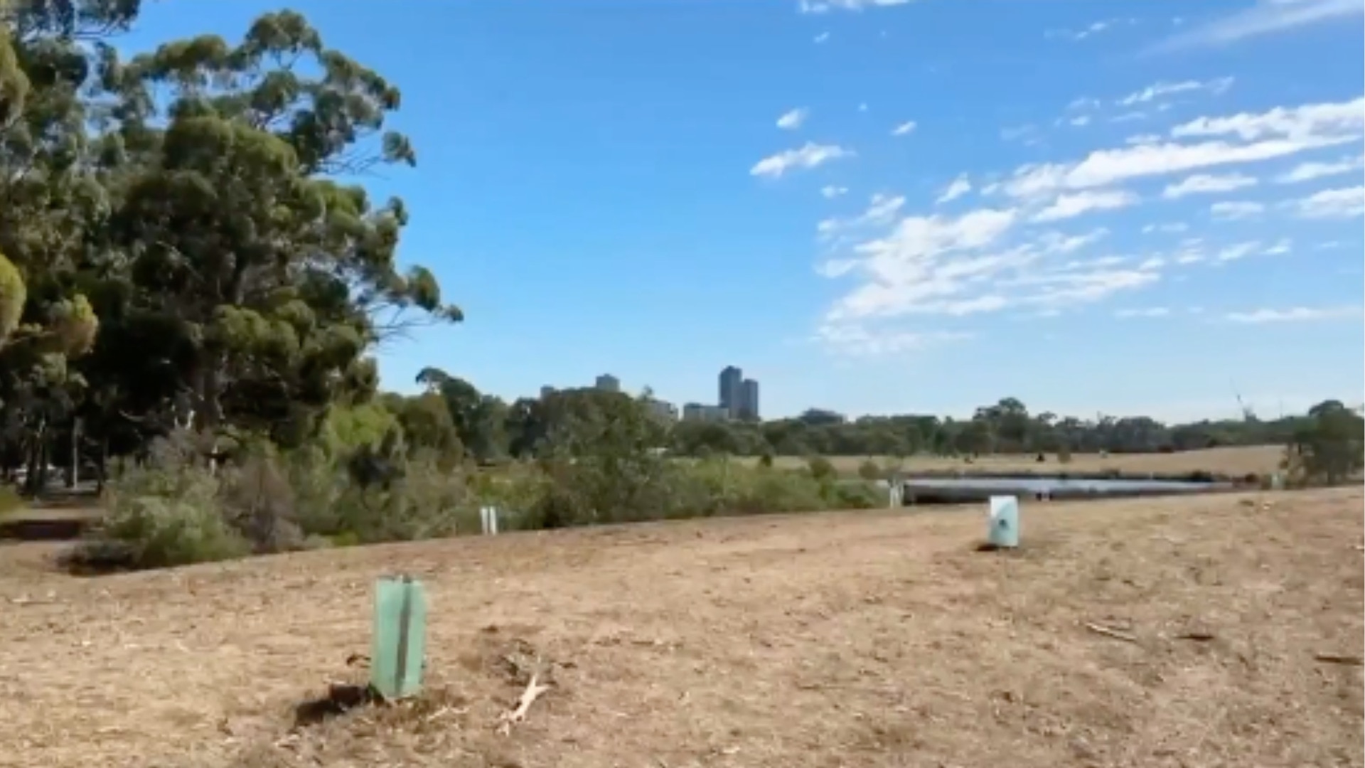
The skies were mostly clear on Sunday at Forster, more than three hours north of Sydney, after the town was drenched with 113mm of rain in Friday.
The deluge came as swathes of northern NSW were drenched with heavy rains that caused widespread flooding and at least two people killed.
As the area began to dry, MidCoast Council Mayor Claire Pontin warned residents to avoid flooded areas after reports of dangerous acts.
“We’re getting reports that there are a lot of people driving around town now that the roads are open trying to have a look at everything,” she said.
“I appreciate people’s curiosity but the message is ‘please stay away from these places’ and particularly respect the traffic control barriers that are there.
“Apparently people are risking their safety by going into areas where there’s heavy machinery working to take some photos. Please stay away.”
Ms Pontin said some residents did need to access flooded areas, as well as “anyone who’s legitimately helping”.
“But, if you’re just driving around please stay away and spread the word,” she said.
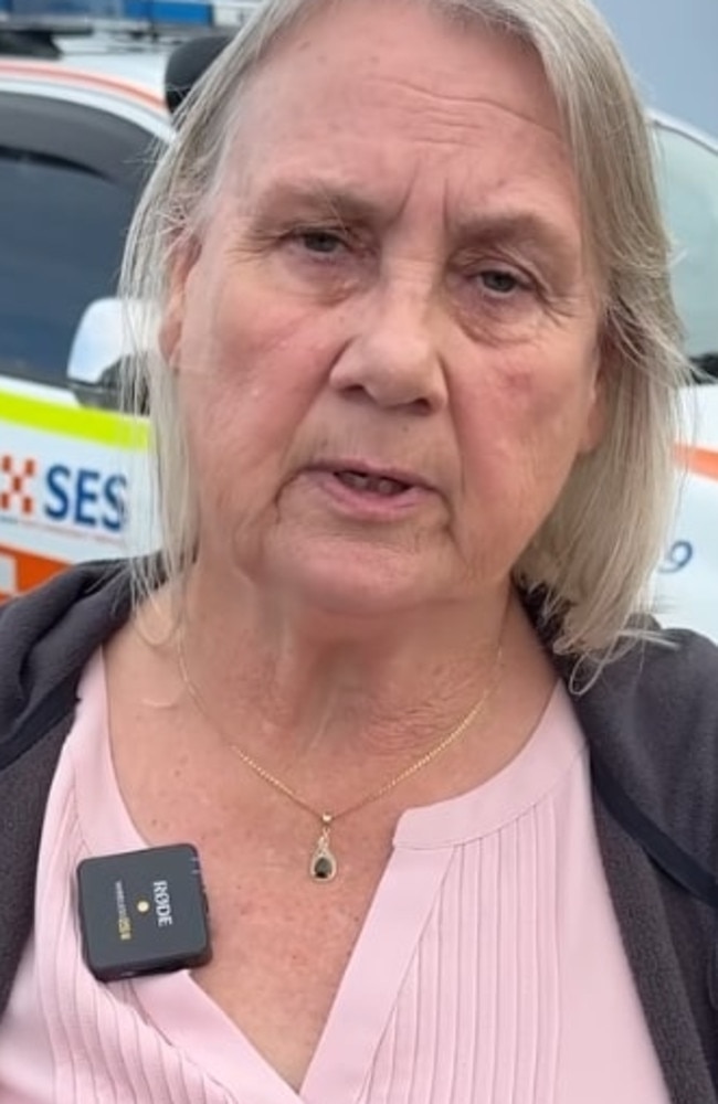
“They’re risking their own safety and they’re actually obstructing the work.
“The area of particular concern at the moment is down around Wingham Peninsula. There’s a narrow road and apparently a lot of people trying to get in there to have a look.
“We really don’t need sightseers. Please just leave room for the people who need to do the work.”
The MidCoast Council said sightseers were impacting the ability to get machinery into at-need areas and was hampering the clean-up effort.
In comes as the Bureau of Meteorology warned that a cold front is due to sweep into southeastern Australia, bringing rain, destructive winds and even snow.
With winter just a week away, meteorologist Jonathan How described it as the most powerful cold front of the year.
The cold front is moving in from the Southern Ocean and is expected to make its mark on southern Australia on Sunday and Monday.
The BOM says that residents in southern states can expect strong northerly winds and there is the risk of dust storms across the agricultural regions of South Australia and Victoria.
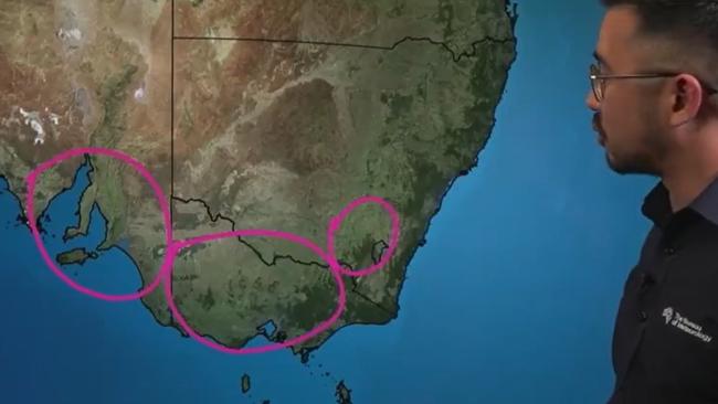
On Sunday night, the cold front will reach Adelaide, bringing rain, strong winds and thunderstorms.
Ten to 25mm of rain is expected in the South Australian capital on Monday, with showers easing by the middle of the week.
The bureau has issued strong wind and gale warnings for large swathes of South Australia and Victoria for Sunday.
The BOM also warns that winds over 90km/h are expected in the NSW Snowy Mountains and alpine regions.
Conditions are expected to ease across southeastern NSW on Sunday before northerly winds pick up again the following day.
On Monday, the cold front will push across the rest of south eastern Australia.
“We see these very strong winds coming up from the south, with widespread damaging winds expected to across much of south east South Australia, Victoria, and also New South Wales,” Mr How said.
Sydney is expected to be mostly sunny on Sunday, but rain is forecast to return next week.
Tuesday is expected to be cold, with sub-10 degree minimums expected in Adelaide and Melbourne, with possible snow in the alps.
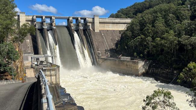
DAM SPILLS
Meanwhile, Sydney’s Warragamba Dam has spilt after a week of heavy rain.
WaterNSW said that Warragamba Dam – which services much of Sydney – reached 100 per cent capacity on Saturday afternoon.
It said that inflows into the dam were slowing as rain clears, however it was now at capacity.
“Residents are reminded to remain alert to warnings,” WaterNSW said in a statement.
“If you are downstream of the dam, stay away from fast flowing or deep water near waterways and flood plains.”
An outflow of 20 gigalitres is expected on Sunday.
78.7mm of rain has fallen across the Warragamba catchment over the last week, according to WaterNSW.
Several other smaller dams across greater Sydney are already spilling including Woronora, Nepean, Cataract, Avon and Tallowa.
Warragamba spilt three times last year, in April, May and June.
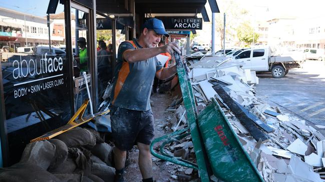
CLEAN UP BEGINS
The NSW SES says the clean-up is beginning, while they are looking to resupply residents that have been cut off due to rising waters during record floods across the NSW Mid North Coast and Hunter regions.
NSW SES acting assistant commissioner Allison Flaxman said they estimate 10,000 properties have been impacted by the floods.
“As the river levels begin to subside, NSW SES members and our partner agencies are today commencing the task of assessing properties which have been flood affected,” she said.
The SES is warning residents to let damage assessments take place before anyone tries to return home.
“It’s important we need to evaluate the extent of property and infrastructure damage to ensure your property is safe to return to,” Ms Flaxman said.
At the same time she said the SES will continue to carry out resupply operations of essential foods and medications to stranded residents.
“The NSW SES has carried out 200 resupply requests in the last two days,” she said.
“There are still many communities that remain isolated, with 50,000 people estimated to be impacted.”

‘Targeted’ attack plunges shopping centre into lockdown
A man has been rushed to hospital in a serious condition after 10 people were allegedly involved in a fight that plunged a busy shopping centre into lockdown.

Kamala shocks with surprise Aussie gig
One of the most powerful people in the former US administration has spoken to a major real estate conference on the Gold Coast.