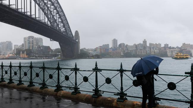
Heavy rain and thunderstorms set to batter NSW
Residents across much of NSW are set to be battered by heavy rain, with more than 200mm expected in some parts of the state this weekend.

NSW residents will be bracing for additional wet weather, with more than 200mm of rain expected to batter some parts of the state this weekend.
Heavy rain and isolated thunderstorms are predicted across much of NSW and southwest Queensland this week, with showery conditions set to continue along the coast and the eastern ranges for the next few days, as a series of slow-moving, high-pressure systems crossing Tasmania maintain onshore easterly airstream across NSW, the Bureau of Meterology said.
The Bureau said while some heavier rainfall might impact the coastal fringe of the NSW central and mid north coast, total rainfall on Tuesday was unlikely to exceed about 30 to 50mm.
Along the southern half of the NSW coast, more than 100mm of rain is likely across the weekend, with some areas predicted to potentially receive more than 200mm.
Persistent coastal showers will continue along much of the east coast this week, particularly #NSW as onshore flow continues this week and into the weekend. Latest: https://t.co/4W35o8i7wJpic.twitter.com/JaK8eRN3gV
— Bureau of Meteorology, Australia (@BOM_au) May 7, 2024
Ten to 40mm of rain is predicted to hit western NSW between Thursday and Saturday, with 50 to 80mm expected in the north.
“From Friday and across the weekend, eastern NSW will see an increased risk of moderate to heavy falls due to an upper-level trough combining with a moist onshore flow,” the Bureau said.
“This may bring a risk of widespread heavy rain to the southern half of the coast and adjacent ranges during the weekend and into early next week.
“Moderate rainfall accumulations are expected this week through inland and coastal parts of NSW, as well as parts of southern Queensland, which may impact recently flood-affected areas.”
The flood risk for NSW will remain elevated in the coming days, particularly from the Hunter through to the south coast, where soils are already saturated.
On the other side of the country, residents in Western Australia will also need to keep their umbrellas handy, with more rain forecast for the state’s southwest later this week.
This comes after Weatherzone captured more than 32,000 lightning strikes in the Kalgoorlie region on Sunday and Monday.

Forecast for capital cities for the rest of the week:
Perth
Wednesday — sunny, max 27
Thursday — partly cloudy, max 27
Friday — showers, max 26
Melbourne
Wednesday — partly cloudy, max 18
Thursday — cloudy, max 19
Friday — shower or two, max 18
Sydney
Wednesday — showers, max 21
Thursday — showers, max 21
Friday — rain, max 21
Brisbane
Wednesday — shower or two, max 24
Thursday — shower or two, max 24
Friday — shower or two, max 24
Adelaide
Wednesday — mostly sunny, max 23
Thursday — mostly sunny, max 23
Friday — sunny, max 22
Canberra
Wednesday — possible shower, max 17
Thursday — shower or two, max 17
Friday — rain, max 17
Hobart
Wednesday — showers, max 16
Thursday — partly cloudy, max 18
Friday — cloudy, max 18
Darwin
Wednesday — sunny, max 33
Thursday — mostly sunny, max 33
Friday — mostly sunny, max 34


