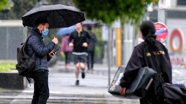
Flash flooding in Victoria as rain lashes state
Wild weather has made its way to Victoria with some areas of the state reporting high levels of rainfall and flash flooding, which is set to continue.
Wild weather has made its way to Victoria with some areas of the state reporting high levels of rainfall and flash flooding.
After a gloomy 24 hours the rain descended on the state on Thursday afternoon, with severe storms and heavy rainfall expected across much of the state into Thursday night.
The Bureau of Meteorology issued a severe weather warning for the northwest of the state, as heavy rainfall lashed all corners.
It’s growing! That’s a large area of rain and it’s gradually moving to the left of the radar. #melbweather#melbourneweather#melbournepic.twitter.com/kjGCXHOLoJ
— Victorian Storm Chasers (@VicStormChasers) September 30, 2021
Regional areas in the east, north and west has so far received the majority of the downpour, with Boonah on the Surf Coast seeing a whopping 42.2mm, with Yanakie in South Gippsland receiving 22.2mm and Pyalong in the Mitchell Shire recording 15.2mm by Thursday afternoon.
Metropolitan Melbourne in comparison recorded an average of 6mm across its suburbs, with Eltham, Ferny Creek, Rosebud and Cape Schanck the hardest hit.
Some areas of the state has already seen flash flooding, with a garden in Diamond Creek shown overflowing with muddy water.
Diamond Creek not long ago. Have you seen flooding? Send us a photo or video!
— Victorian Storm Chasers (@VicStormChasers) September 30, 2021
🎥 Wendy Gemmell @JaneBunn@heidimur@abcmelbourne#StormHour#melbweather#melbourneweather#melbournepic.twitter.com/3A6O4yrBOG
âš¡ Thunderstorm forecast for THURSDAY. Short bursts of heavy rainfall are possible with any storms, but those in the yellow area (including parts of #Melbourne) have the potential to cause flash flooding. Warnings will be issued as required at https://t.co/jhIInuw5Gf#VicWeatherpic.twitter.com/Ry3zXZPoQA
— Bureau of Meteorology, Victoria (@BOM_Vic) September 30, 2021
The Bureau of Meteorology on Thursday forecast short bursts of heavy rainfall with storms, with a large part of the state, including Melbourne, northeast, east and central Victoria likely to see flash flooding.
Meteorologist Christopher Arvier said showers and isolated thunderstorms would continue across the central and eastern parts of the state.
He said between 5-15mm was expected before the rain would start to ease off into Friday.
“It does eventually weaken and move out over to the south and the east on Friday and away from the state into the weekend, but it’ll be causing a bit of trouble as it moves across.” Mr Arvier said.
“Although we are looking at widespread areas of thunderstorms for most of Thursday, and within that there could be quite significant activity which could lead to some intense totals locally.”
rhiannon.tuffield@news.com.au

The day Adelaide rumbled like never before
Adelaide lived through LIV’s first Watering Hole hole-in-one, but the energy that created was nothing on the breakaway tour’s team playoff win by four Aussies riding an unforgettable wave.

Saints great defends Godfather offer
St Kilda’s pursuit of Tom De Koning gets the thumbs up from Nick Riewoldt, who believes big contracts offer flexibility.