Dangerous blizzard conditions forecast for nation’s east coast
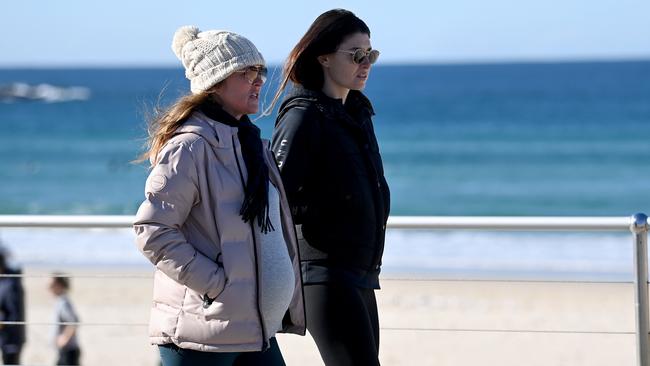
A ‘vigorous and dangerous’ cold front expected to bring blizzard conditions and severe weather warnings is marching towards the east coast.
A dangerous weather system that could bring blizzard conditions to alpine areas is a chance to hit Australia’s east coast this week.
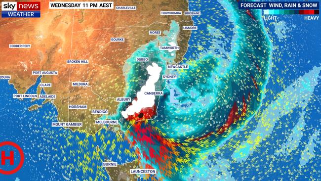
Meteorologists are monitoring a possible east coast low, which could form late Wednesday into Thursday.
Sky News Weather meteorologist Rob Sharpe said east coast lows were one of the most dangerous types of weather events in Australia and bring the threat of flooding rain, damaging winds and dangerous surf.
“In this case even blizzard conditions are a threat for the alpine areas,” he said.
While there is still no guarantee the system will meet the technical requirements to be classed as an east coast low, Mr Sharpe said it was still going to be a wild week of weather across the nation.
“It may not be quite strong enough or it may not remain near the coast for long enough,” he said.
“Even if it isn’t an east coast low, heavy rain, strong winds and plenty of snow is forecast for eastern Victoria and southeastern NSW.”
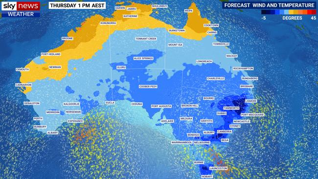
Southern Queensland could also receive snow as the temperature plummets across the country, with even Darwin expected to feel some of the impact.
“By Thursday the cool change sweeps across the country, even Darwin will notice the change coming through Wednesday night into Thursday morning,” Mr Sharpe said.
“We’ll see it right across the Queensland tropics (as well), it’s only in the Kimberley of Western Australia where you won’t really be seeing the impact of this change because there’s a different weather system moving into Western Australia.”
Snow will fall to about 1000m in Victoria and NSW on Tuesday and Wednesday, while in Tasmania’s central and southern regions it is expected to fall to 900m.
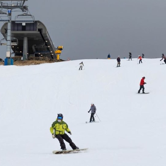
About 40 to 50cm of snow is forecast for the lower and mid-slopes of the alpine regions, but up to 1m could fall on the higher peaks.
A “rare” light sprinkling could also fall in Queensland’s Darling Downs on Wednesday night or early Thursday morning.
While rare in Queensland, snow does fall from time to time, mostly near the border, with snow flurries last falling near Eukey in June 2019, and the last significant snowfall was back in 2015.
Eastern Victoria, Gippsland and southeast NSW are expected to cop the brunt of the heavy rainfall and damaging winds.
Up to 100mm is expected to fall in those regions, while between 25 and 50mm is forecast for all of Tasmania, the ACT and parts of the NSW ranges.
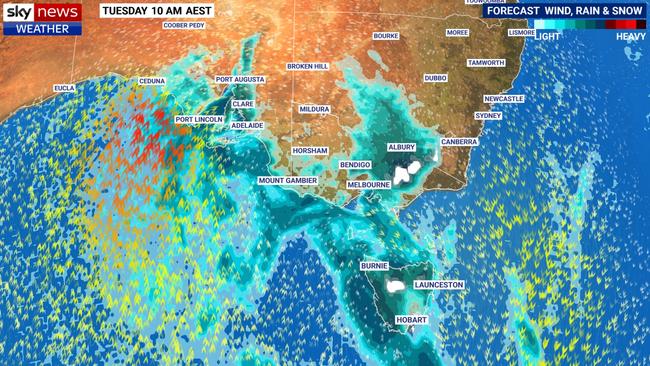
Weather bureau meteorologist Sarah Scully said the “very strong cold front” would move across southeastern Australia on Monday and Tuesday.
Cold, wet and windy weather is on the way for southeast Aust this week, with widespread showers, damaging winds, thunderstorms, snow to low levels with areas of heavy rainfall that may lead to flash flooding. Stay safe and 👀 latest forecasts& warnings https://t.co/pIVv1tfrIhpic.twitter.com/j104mHypmM
— Bureau of Meteorology, Australia (@BOM_au) June 6, 2021
“We’re forecasting strong and gusty northwesterly winds possibly severe, which may whip up some dust, particularly through parts of South Australia and northwestern Victoria,” she said.
“Behind that cold front we’re forecasting widespread showers, small hail, isolated thunderstorms and that cold front will move eastwards through Victoria and NSW during Tuesday.”
Ms Scully said by Wednesday and Thursday and band of rain would develop right along the eastern seaboard, stretching from Tasmania all the way up to southeast Queensland.
“It’s a very cold pool of air,” she said.
“There’s the potential for small hail and thunderstorms as well as showers and also snow down to low levels, including the central and northern tablelands of NSW.”
Victoria
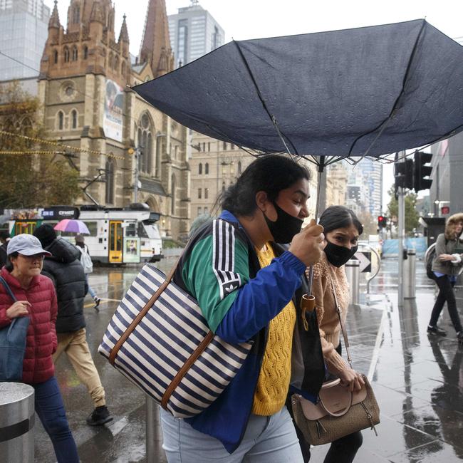
The bulk of Melbourne’s wet weather is expected to hit before sunrise on Tuesday as the cold front crosses the state, with some showers possible during the day.
It will be quite cold behind the change with the temperature falling to 13C in the city, with a “really cold pool of air” expected to bring snow to places like the Grampians.
Ms Scully said the front would bring widespread showers, small hail and isolated thunderstorms across Victoria.
A severe weather warning for damaging winds on Monday evening and Tuesday morning has been issued for the southwest, alpine regions and some parts of the central district, including the Mornington Peninsula and Yarra Glen but not Melbourne.
Winds averaging 60 to 70km/h with peak gusts up to 90km/h have been forecast.
Locations likely to be affected include Hamilton, Warrnambool, Portland, Kyneton, Ballarat and Wonthaggi.
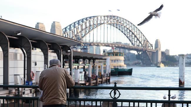
NSW
The cold front will push across NSW during Tuesday, with the temperature in Canberra plummeting to a top of just 8C on Wednesday.
“Things really start to get interesting as a complex area of low pressure starts to develop over southern NSW late Tuesday into Wednesday,” Ms Scully said.
“It then moves off the south coast of NSW where it intensifies during Wednesday, further deepening into Thursday as it lingers off the trough.
“We’re forecasting widespread showers, even a round band extending along the eastern half of NSW, with the potential for very heavy rainfall.”
Sydney is looking at 15mm of rain on Wednesday and up to 25mm with a top of 15C on Thursday.
A severe weather warning for damaging winds has been issued for the Snowy Mountains on Monday evening and into Tuesday.
“Blizzards are possible in the early hours of Tuesday morning,” the weather bureau has warned.
“For areas above 1900m elevation, damaging winds averaging 70 to 80km/h with peak gusts of 125km/h or more are possible late Monday night and into Tuesday morning, easing later that morning.”
The NSW National Parks and Wildlife Service recommends that back country travel be postponed until conditions improve.
Locations that may be affected include Jindabyne, Perisher Valley, Charlotte Pass and Thredbo.
South Australia
A severe weather warning for damaging winds has been issued for Adelaide, the Mount Lofty Ranges, Lower Eyre Peninsula, Kangaroo Island, lower southeast and parts of Eastern Eyre Peninsula, Yorke Peninsula, Murraylands and upper southeast districts on Monday.
A “vigorous cold front” will move across the west and south of the state on Monday, with winds averaging 50 to 60km/h and peak gusts up to 100km/h forecast.
Locations likely to be affected include Port Lincoln, Mount Gambier, Murray Bridge, Kingscote, Naracoorte, Cleve, Minlaton and Victor Harbor.
“Raised dust may be whipped up in those northwesterly winds and on or behind that cold front we’re expecting widespread showers, isolated thunderstorms and small hail,” Ms Scully said.
“Those showery and cold conditions are expected to continue well into the middle of the week with accumulated rainfall totals reaching 30 to 60mm about southern coastal areas and also the Mount Lofty Ranges.”
Ms Scully said even snow was possible on the highest peaks of the Flinders Ranges on Tuesday.
Adelaide is expecting a top of just 13C and up to 20mm of rain on Tuesday.
Western Australia
The nation’s west coast is the only place that won’t experience the impacts of the strong cold front due to a different weather system moving into the area.
Rain, showers and thunderstorms will sweep through during the middle of the week, with up to 50mm possible at Exmouth and in the southwest corner.
“Western Australia has a low pressure system that’s forecast to develop off the west coast during Tuesday and moving closer towards the coast, with a rain ban affecting the area during Wednesday into Thursday,” Ms Scully said.
“There’s the potential for moderate to even heavy rainfall across western parts of WA on Wednesday and moving down into southern parts on Thursday.”
Up to 10mm of rain and a top of 18C has been forecast for Perth on Wednesday.

Aussie champ to test anti-gay laws
After outrage from the family of an Aussie star when the World Surf League confirmed an event in an Abu Dhabi wave pool she’ll hit the event this week as world No.1.

‘I’ll kill them’: Outrage over vile anti-Semitic rant
NSW Health has responded to a video of two people wearing NSW Health uniforms vowing to “kill” Israeli patients seeking care.