Dandenong and Macedon Ranges to be hit by damaging winds again, as CBD building stripped of steel
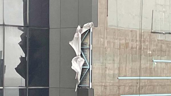
A Melbourne high-rise has been stripped of steel by harsh winds, as an ‘unstable’ cold front bringing damaging winds crosses the state.
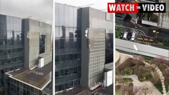
Wild winds have stripped steel panels from a building in Melbourne’s CBD as wild weather continues to lash the state.
Startling vision has shown the terrifying moment the panels were stripped from the Southbank high-rise on Tuesday, flapping in the wind before plummeting hundreds of metres to the street below.
It comes as the weather bureau warns of damaging winds for the Central Highlands and Dandenong Ranges, just a month after the area was rocked by a ferocious front.
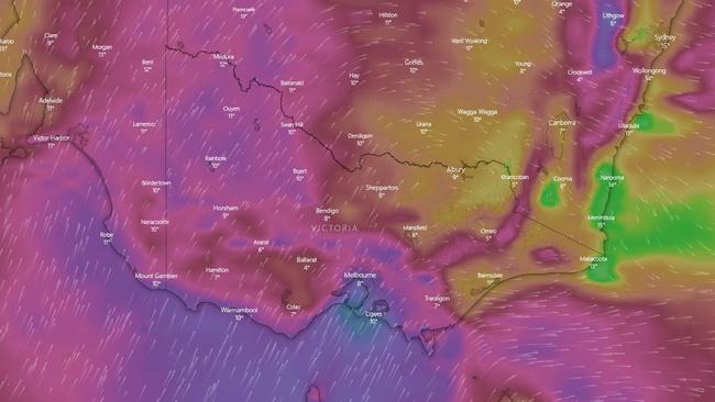
The strong cold front is crossing Victoria on Tuesday, with damaging south-westerly winds – averaging 55 to 60km/h with peak gusts of up to 90km/h.
“Blizzard conditions are possible about alpine peaks,” the bureau said.
The severe weather warning has been issued for coastal and central parts of Victoria, including Melbourne, with locations likely to be impacted including Warrnambool, Portland, the Grampians, Kyneton, the Surf Coast, Wonthaggi, Mt Baw Baw and Falls Creek.
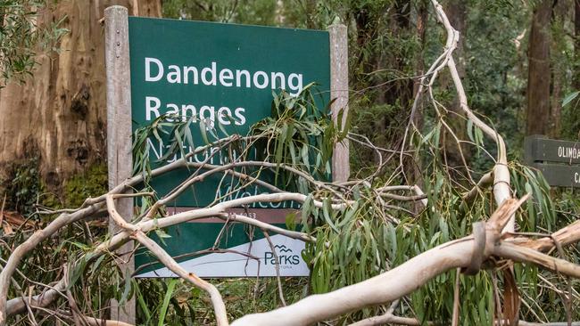
But the State Emergency Service has also issued specific advice for the Central Highlands, around Trentham and Macedon, and the Dandenongs, after the regions were ravaged by storms on June 9 and 10.
The state emergency service has not recorded any significant damage as of Tuesday evening, with minor tree falls in parts of the state.
“Be aware that trees compromised by recent storms make them more likely to fall in high winds,” the warning said.
“The forecast wet and windy weather for Tuesday will add to the already-significant risk of trees falling without warning, due to the existing soil moisture and threat of overhanging trees caused by the recent severe weather event.”
âš ï¸ The Severe Weather Warning for damaging winds on TUESDAY has been UPDATED. The warning area now includes much of coastal #Victoria, including parts of #Melbourne. Find detailed warning information at https://t.co/mInbh8z6Cy#VicWeatherpic.twitter.com/RXBbcNnGEe
— Bureau of Meteorology, Victoria (@BOM_Vic) July 19, 2021
The SES says it is planning for the increase in severe weather conditions and the danger it would bring.
They have urged people to avoid unnecessary road travel, particularly during periods of high winds, and to park their cars undercover and away from trees.
Weather bureau senior meteorologist Chris Arvier said the cold front would bring a “blast of wintry weather”.
He said the front would arrive in Melbourne by 1pm on Tuesday, with the strongest gusts between 4pm and 5pm, before it clears to the east during the evening.
He said there would also be between 5-15mm of rain in the city, along with 15-30cm of snow in the alpine regions.
“As that snow level comes down to about the 600m mark, we could potentially see snow flurries in Mount Macedon and the top of the Dandenong Ranges,” Mr Arvier said.
“We are expecting to see some isolated thunderstorms and small hail, mostly behind the cold front as it moves across the state, bringing in cold and unstable air.
“The temperature is likely to drop dramatically as the cold front moves through about 1pm – we’re looking at the temperature falling to about 8C or 9C shortly after.
“The eastern suburbs look like they will receive the highest rainfall of up to 20mm of rain.”
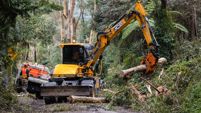
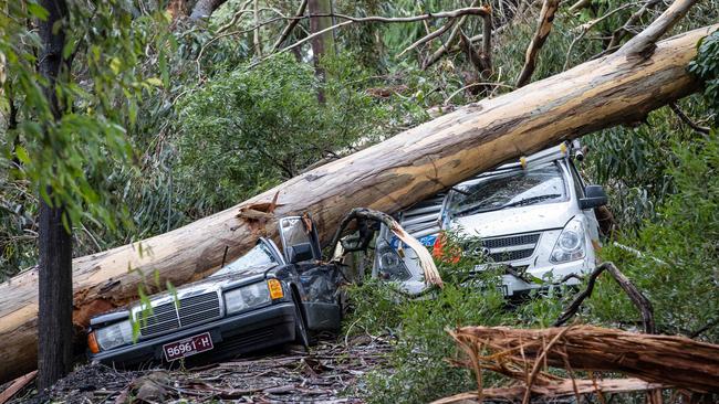
The storms that hit in June caused Trentham, west of Melbourne, to be cut off for days, while thousands of homes went about two weeks without power.
Ferocious winds and massive downpours hit the Dandenong and Macedon Ranges, uprooting trees onto houses, bringing down powerlines and inundating properties with floodwater in Gippsland.
At least 129 homes were deemed uninhabitable from the severe storms. About 135 others were habitable but suffered significant damage, with the damage bill reaching $182m so far.
Two people also lost their lives after becoming trapped in their cars in floodwater.

Aussie champ to test anti-gay laws
After outrage from the family of an Aussie star when the World Surf League confirmed an event in an Abu Dhabi wave pool she’ll hit the event this week as world No.1.

‘I’ll kill them’: Outrage over vile anti-Semitic rant
NSW Health has responded to a video of two people wearing NSW Health uniforms vowing to “kill” Israeli patients seeking care.