By Angus Dalton
The rain soaking Sydney and much of NSW will intensify this weekend into downpours that could exceed 150 millimetres, prompting the NSW State Emergency Service to brace for flash-flooding along the coast.
Since Tuesday, a “blocking high” west of Tasmania has interrupted the eastward flow of weather systems across Australia and delivered to NSW days of predictable showers and temperatures stuck in the high teens.

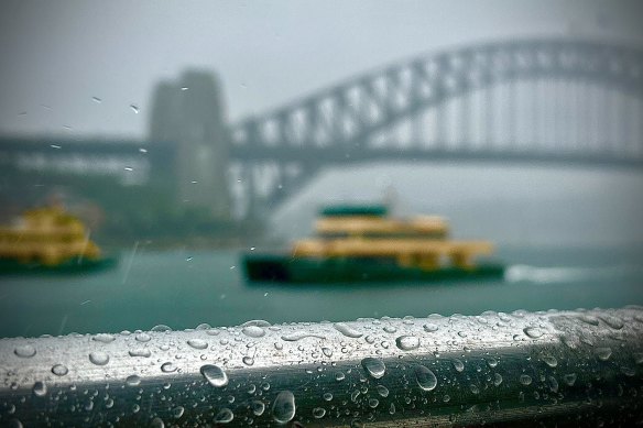
Heavier rain is about to hit Sydney after a week of drizzle.Credit: Tom McKendrick
Spotty, showery weather would continue on the coast on Friday, said the Bureau of Meteorology’s Angus Hines, before heavier downpours strike from Saturday evening.
That’s when an eastward-moving rainband that developed in far west NSW on Thursday will arrive at the coast, turbocharging an already wet weather system.
“By the middle of the day on Saturday it’s starting to affect the Central Tablelands, the mountains, the slopes, the plains, and by Saturday evening, 6pm, or so, we’ll start to see those heavier falls hit the coastline,” Hines said.
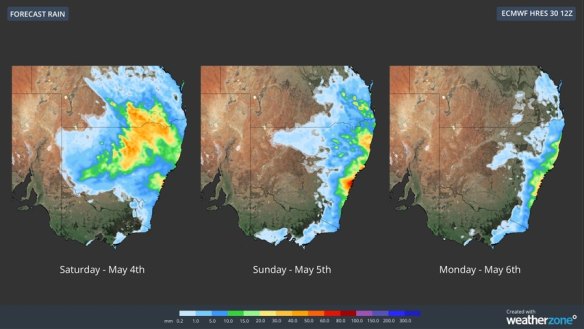
The bureau forecasts heavy rain from the Mid North Coast to Wollongong, with Sydney and the Illawarra copping the harshest downfalls.

The heaviest rain will hit the coast on Sunday.Credit: Weatherzone
“If we do see triple digits – 100, 150 millimetres not out of the question here – that is certainly enough to lead to areas of flooding,” Hines said.
Strong onshore winds could push more rain into already drenched regions on Monday.
Weather systems are normally kept mobile by jet streams – bands of atmospheric wind that snake across the Australian continent about 10 kilometres above the earth’s surface.
But the polar jet stream has moved south towards the Antarctic coastline whereas the subtropical stream has shifted north, leaving a 4000-kilometre gap between them that has allowed the blocking high to settle for days on end.

A rainbow appears in Newport as kookaburras wait out the rain.Credit: Nick Moir
Winds whipping anti-clockwise around the high-pressure system are bringing wet south and south-easterly onshore gusts to the NSW coast, keeping our skies dreary.
The bureau expects the rain to stick around for at least another seven days. Some modelling shows the reformation of another blocking high next week, which could extend the drizzly weather into the middle of the month.
That could make for the longest rain streak in two years in Sydney, since a 17-day run of rainy days in 2022.
May, on average, usually has 8.6 days with rainfall above 1 millimetre and 126.5 millimetres across the whole month.
The rain gauge at Observatory Hill has already recorded 52.8 millimetres within the first few days of the month.
The NSW State Emergency Service is prepared to respond to potential flash floods in Sydney, the Illawarra, Central Coast and the Hunter regions.
“We’re working closely with the Bureau of Meteorology and are monitoring conditions across the state,” SES Assistant Commissioner Allison Flaxman said.
“Isolated rainfall in excess of 100 millimetres in some coastal areas is not out of the question, but we are well positioned to respond to any calls for assistance.”
Get to the heart of what’s happening with climate change and the environment. Sign up for our fortnightly Environment newsletter.