
104km winds lash South Australia after severe weather warning issued
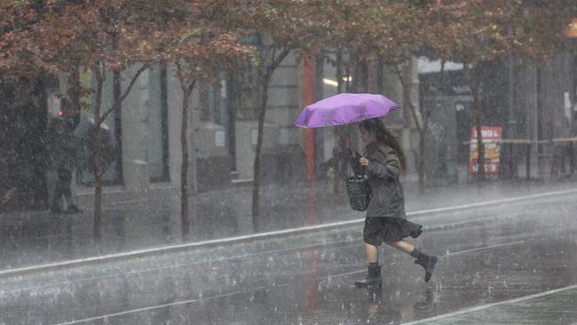
Severe weather conditions have hit parts of the state, with wild damaging winds of over 100km recorded and lashing rain.
SA News
Don't miss out on the headlines from SA News. Followed categories will be added to My News.
Powerful winds have hit parts of South Australia as severe weather conditions intensify with over 100km an hour winds clocked this afternoon.
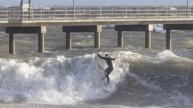
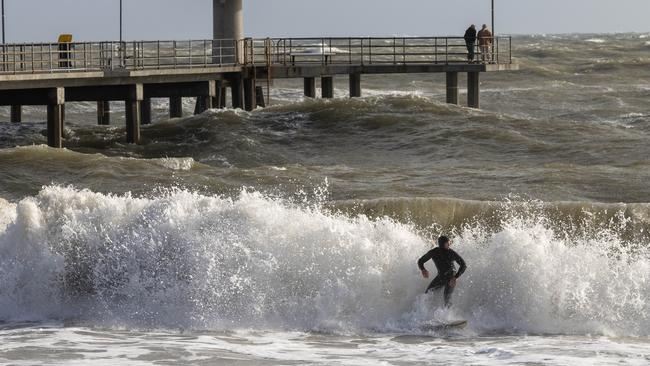
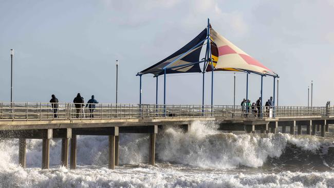
On Saturday, June 7, 2025, South Australia experienced significant wind activity due to a complex low-pressure system over the Southern Ocean. The Bureau of Meteorology issued a severe weather warning for damaging winds across much of the state, including the Adelaide metropolitan area.
This afternoon Hindmarsh Island clocked 104 km/h winds at 3:49pm. Cape Willoughby registered 98 km/h at 1:21 PM.Adelaide Airport had 94 km/h in winds at 1:54 PM.
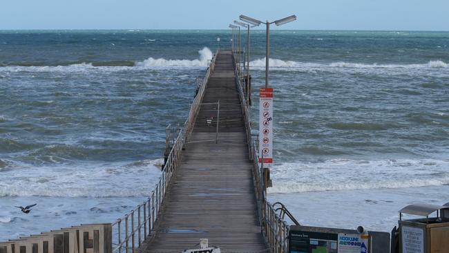
The Bureau of Meteorology issued a fresh “gale winds” weather warning for residents in Adelaide Metropolitan Waters, Lower West Coast, Central Coast, South Central Coast, just before 11.15am on Saturday.
And, Spencer Gulf, Gulf St Vincent, Investigator Strait, Upper South East Coast and Lower South East Coast with the warning expected to stay in place until Sunday at midnight.
Residents in the Far West Coast and Upper West Coast were also warned of “strong winds”.
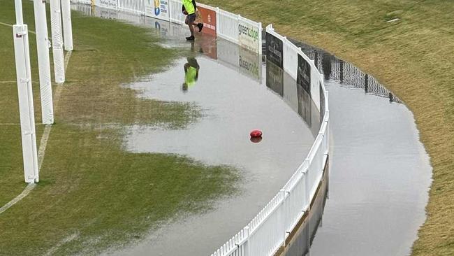
Forecasted “damaging winds” are expected to remain into the afternoon as a “cold front” passes.
“A complex low pressure system located over the Southern Ocean extends a strong cold front over South Australia today,” the BOM said in a statement.

Yesterday, Senior Meteorologist Sarah Scully told The Advertiser the weather would spread from Adelaide to southern parts of the coast and north throughout elevated areas.
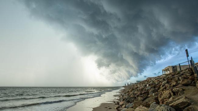
“At the moment it extends across coastal parts of the southeastern part of SA, and also extends into elevated areas like the Mount Lofty and Flinders Ranges, including metropolitan Adelaide,” she said.
“We’ve already seen some strong wind gusts, with Cape Borda, which had a 96 km/h gusts this afternoon, and Stenhouse Bay, which had a 93 km/h gusts.
“It’s very blowy out there and looking at the radar, there’s a bit of a steady stream of showers that are pushing across South Australia and a fairly decent line approaching Adelaide.”
Areas included are Adelaide Metropolitan, Mount Lofty Ranges, Mid-North, Kangaroo Island and parts of Lower Eyre Peninsula, Yorke Peninsula, Flinders, Murraylands, Upper South East, Lower South East, Riverland and North East Pastoral districts.
It comes after wild weather lashed the Fleurieu Peninsula this week, with Sealink ferries cancelling services to and from the mainland.
Heading into next week, Ms Scully said the state could expect similar weather, with conditions easing off on Monday and Tuesday, before picking back up on Wednesday and Thursday.


“It does look like there is potentially another frontal system that might bring another burst of showers on Thursday,” she said.
“The majority of them will be about coastal parts of southeastern South Australia and the elevated parts again.
“And then, this is obviously a bit far out, but it looks like next weekend there will be another low-pressure system bringing some more showers next weekend and cold weather, and gusty winds for Adelaide and the southeast.”
In the mid-north, Ms Scully said showers were expected to creep as far north as Port Augusta and Hawker after Thursday, but said it did not appear to be heavy rainfall.
More Coverage


Originally published as 104km winds lash South Australia after severe weather warning issued
Join the conversation

‘Blood everywhere’: Ukrainian mum fired at, shot in face
Oksana Serhiienko was evacuating her two children from an occupied area when a bullet fired by a Russian soldier struck her in the face.
Read more

SA youth crime exposed: Inside SAPOL’s shocking internal report
A new SA Police report offers a rare glimpse into the youth crime gangs threatening South Australia and how they’ve evolved over time.
Read more