
BOM forecasts low chance of a cyclone forming over the Top End this weekend
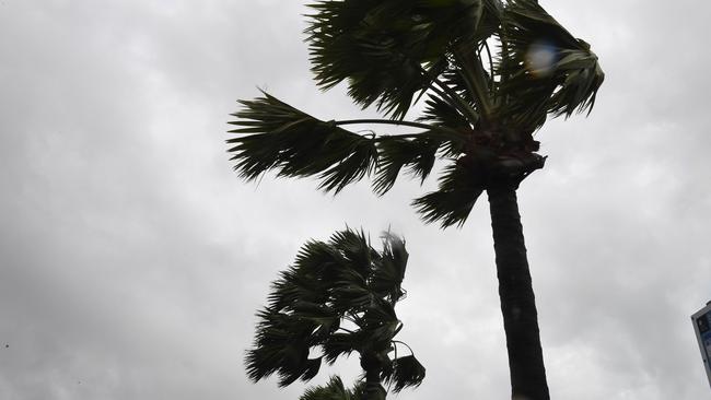
A TROPICAL low expected to form over the eastern Top End and Gulf of Carpentaria today could develop into a tropical cyclone over the weekend, the Bureau of Meteorology has warned.
Northern Territory
Don't miss out on the headlines from Northern Territory. Followed categories will be added to My News.
A TROPICAL low expected to form over the eastern Top End and Gulf of Carpentaria today could develop into a tropical cyclone over the weekend, the Bureau of Meteorology has warned.
A monsoon trough lying over the southern Gulf of Carpentaria is expected to strengthen into a tropical low late today and to continue to move southwest towards the Carpentaria coast over coming days.
BOM has advised that if the low spends a significant period of time over water, there is a chance it could develop into a tropical cyclone in the next few days.
That chance is considered very low for today and tomorrow, increasing to low on Sunday.
BOM meteorologist Chris Kent said the system was expected to bring significant wind and rain to the Top End in coming days, especially to Groote Eylandt and communities along the Gulf of Carpentaria coast which are bracing for 35-50km/h winds and 100-200mm of rain each day.
“As the system moves towards the coast, we can expect heavy rainfall to start falling on Groote Eylandt tomorrow morning, and extend to the Carpentaria District later in the week,” he said.
MORE TOP NEWS
Darwin shooting: Ben Hoffmann’s jurors to tour crime scene in murder trial
Localised flooding causing mayhem on Darwin roads after heavy overnight rain
“We are not expecting the low to become a tropical cyclone if it crosses the coast, however there is a possibility of some gusty winds if it does move ashore.
“As the low moves further inshore and across the base of the Top End … rainfall will continue to move as the system moves.”
He said showers and storms could also “pick up” in the Darwin area next week as the low moved inland.
Today, 127mm of rain was recorded at Royal Darwin Hospital in a 24-hour period.
In the rural area, 104mm was recorded at Noonamah, 73mm at McMinns Lagoon and 30mm at Adelaide River.
Parts of the Stuart Hwy south of Darwin were inundated with rain water, causing significant hazards for motorists this morning.
NT Emergency Service Northern Command Operations regional manager Mark Cunnington said the service was urging Carpentaria District communities to prepare for severe weather and flash-flooding which could potentially leave communities cut off.
$1 FOR ALL YOUR NEWS? HERE’S HOW: Sign up now to our amazing deal of $1 for 28 days
“With the expected inclement weather … there’s an expectation that there’s going to be some strong stream rises around the area, and as a result of that it’s likely that roads are going to be cut and communities will become isolated,” he said.
“So … clean up your yards, make sure anything that can be picked up by high winds is put away or secured, and check your emergency kits and make sure that you have stocks to last you for a few days, if necessary, should you become isolated or surfaces (are) lost as a result of localised flooding.”

Wong dodges media, gives priority to ABC
The mainstream media were left hanging on Sunday when Foreign Minister Penny Wong rocked up to a major media event on the condition she would only speak to one particular outlet.

Top End hotel becomes detention facility
A surge in the capture of illegal fishermen has become something of a windfall for a local Territory Hotel.