
Fewer tropical cyclones expected as El Nino takes effect in the Top End
The El Nino and positive Indian Ocean Dipole events will bring a hotter and drier wet season for Top End residents. Here’s what that means for the upcoming cyclone season.

Cyclones
Don't miss out on the headlines from Cyclones. Followed categories will be added to My News.
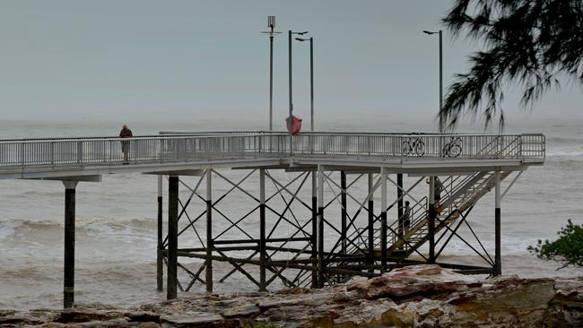
The Top End is expecting fewer cyclones than usual this year, but experts warn residents not to be complacent as severe thunderstorms, flash flooding and damaging winds still pose an ongoing threat throughout the wet season.
The Bureau of Meteorology said hotter and drier conditions resulting from the El Nino and positive Indian Ocean Dipole events mean there will likely be a below average number of tropical cyclones across the country from November to April.
Long term data shows the NT generally gets about three cyclones a year but there is more than a 60 per cent chance there will be fewer this season, according to the Bureau’s long range forecast released this week.
“Even though we do have a hotter and drier outlook with fewer tropical cyclones expected for the Northern Territory, in any wet season we can expect to have severe thunderstorms, localised flooding associated with thunderstorms, and tropical lows,” the Bureau’s NT manager Shenagh Gamble said.
“And in any year we can expect to have at least one tropical cyclone crossing the coast in Australia.”

Ms Gamble said the cyclone season was also expected to begin slightly later than normal, but it did not diminish the potential severity of the season’s storms.
“We typically see the monsoon come in at around Christmas time, and again because of the El Nino phase and the positive IOD it’s likely that the first monsoon will come in a bit later this year,” she said.
“This outlook does not does not forecast the intensity of tropical cyclones.”
The Bureau emphasised how important it was to prepare for local weather hazards ahead of time.
“Around the Top End that is obviously tropical cyclones, but also severe thunderstorms and localised flooding,” Ms Gamble said.
“Severe thunderstorms can happen any day during this build-up and wet season period, so it is really important that you make those preparations now.
“Prepare your emergency kit so that you are safe at home and if you familiarise yourself with the safe steps that you need to take for all of these hazards you will be in the best place during the entire wet season.”
Cyclones form out of tropical low pressure systems and usually affect coastal areas up to 50km inland from the sea.
They are ranked beginning with Category 1, which means gusts up to 125km/h which can damage crops, trees and caravans, and can pull boats from their moorings.
Category 5, the most severe cyclones, involve winds of more than 280km/h and are extremely dangerous causing widespread destruction.
Residents are encouraged to visit securent.nt.gov.au for more details on how to prepare for an emergency.

New alert system to stay prepared
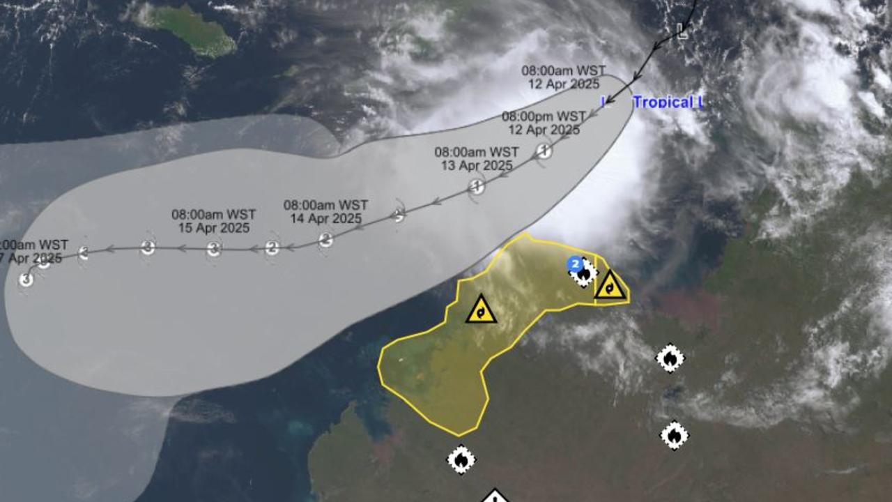
A new cyclone tracking system allows the public to monitor significant tropical lows in real time up to a week in advance, in the hopes of helping the community prepare for severe weather events.
The Bureau of Meteorology’s Tropical Cyclone 7 day Forecast launched last month, providing more detailed information and extra lead time to help emergency services and the Australian community prepare for the impacts of tropical cyclones.
“It shows the likely location of any significant tropical low as well as the chance it will develop into a tropical cyclone, up to seven days in advance,” Tropical Cyclone Team Leader Andrew Burton said.
The service covers all Australian communities that could face tropical storms, including the Top End, mainland coastal waters and land areas, Christmas Island, Cocos Islands, Lord Howe Island and Norfolk Island.
“Improvements to the service will benefit all Australians by providing more lead time to plan for an event,” Mr Burton said.
“Key features include a visual display showing the probability of a tropical cyclone developing for the next seven days, improved risk information, a summary of the potential for tropical cyclone development and forecast descriptions about tropical low and tropical cyclone behaviour.”
The Tropical Cyclone 7 day Forecast can be found at bom.gov.au/cyclone.

Cyclone Errol projected to develop off NT Coast
A tropical low hanging off the Northern Territory coast is expected to intensify into a cyclone as it veers towards Western Australia.
Medals ‘should be given’ to ADF members who came to Darwin’s aid
The 8000 ADF members who responded to Cyclone Tracy should receive a medal for their service, argues a military historian, who has recently published a book which documents the contribution of soldiers, sailors and aviators who responded to one of the nation’s greatest natural disasters.